Manti-La Sal National Forest Plans Prescribed Burns Across South Zone This Spring
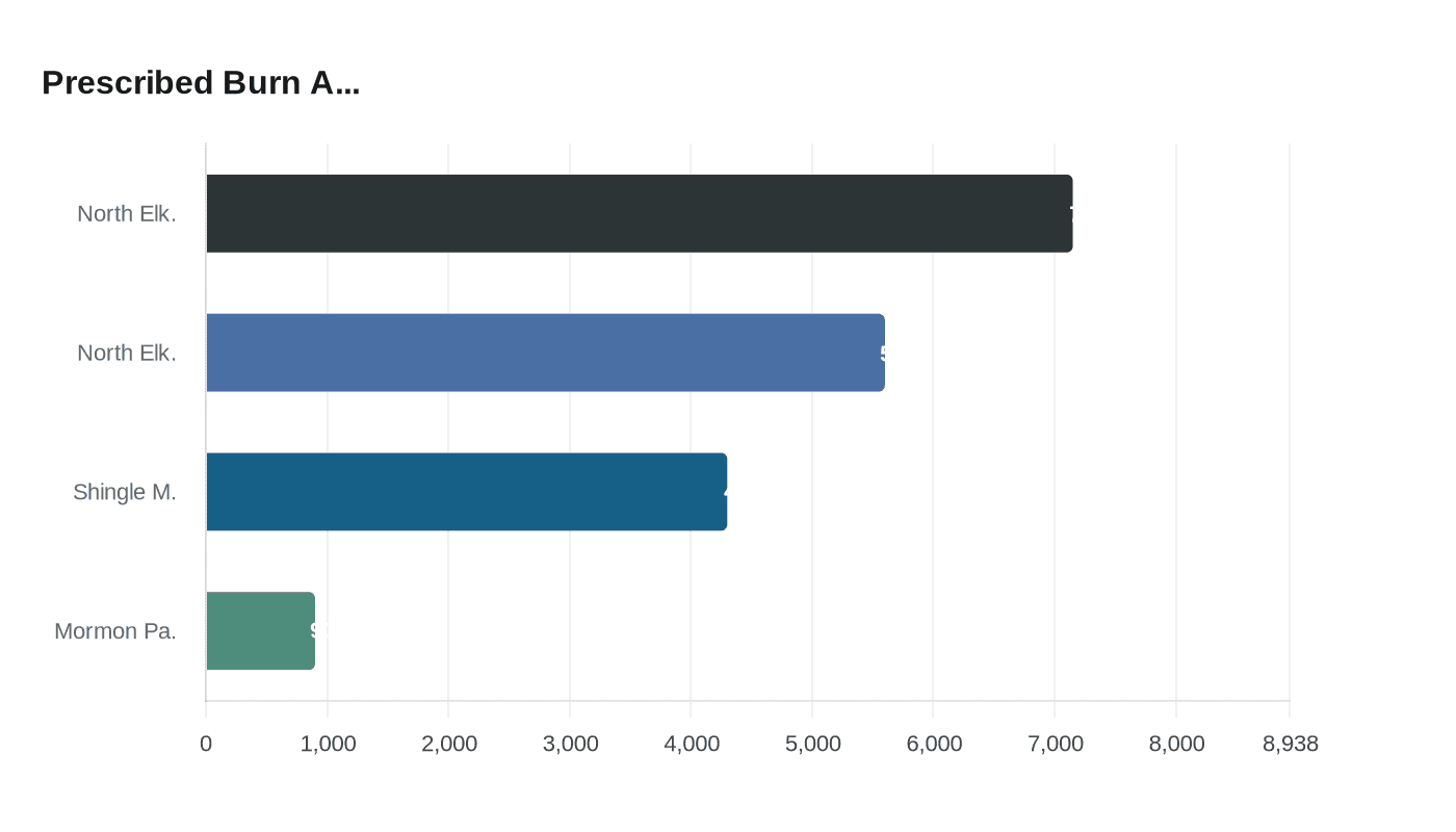
Three prescribed burn projects covering thousands of acres in San Juan County are set to begin in late March, with 7,150 acres still remaining at North Elk Ridge alone.

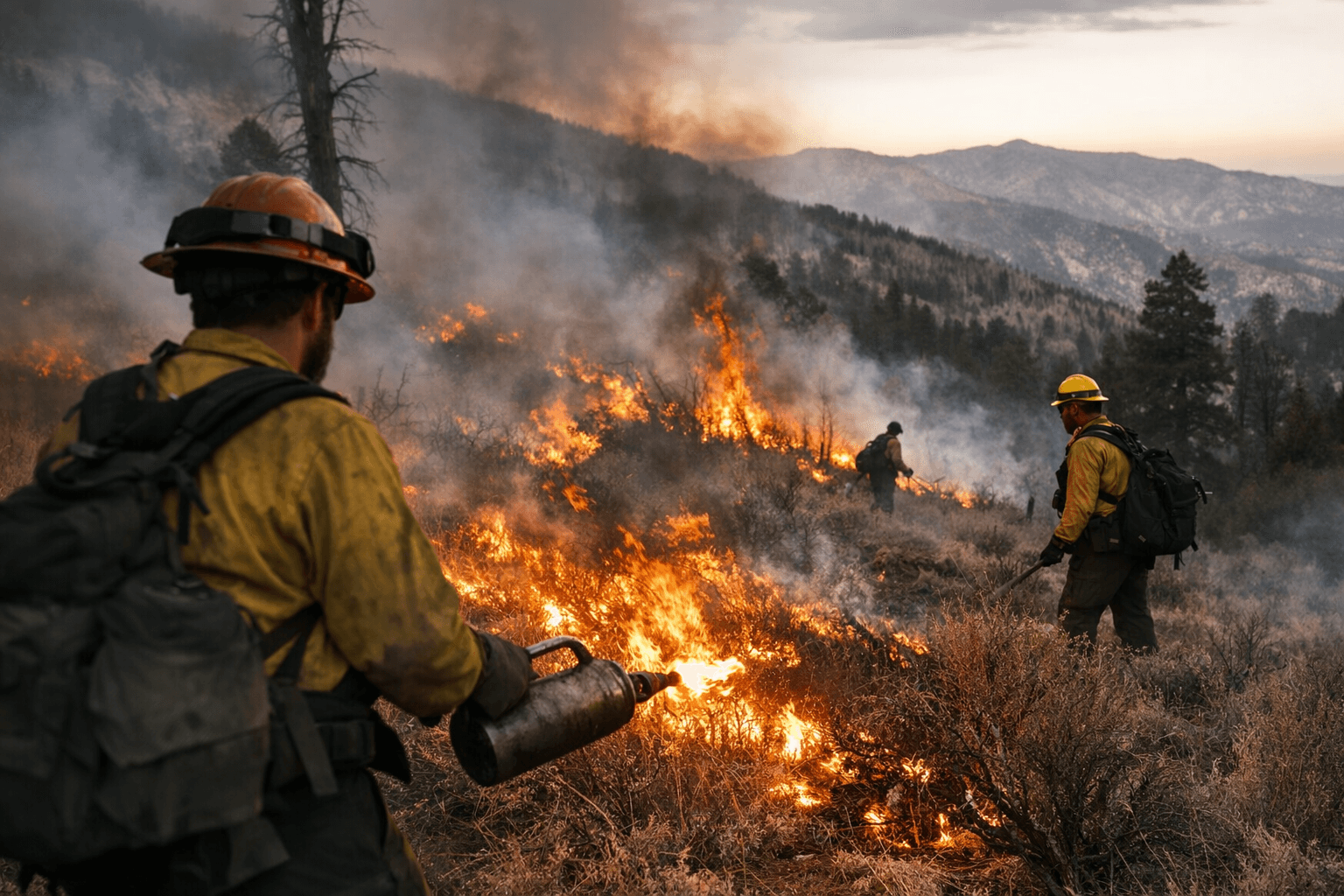
Crews from the Manti-La Sal National Forest are preparing to light prescribed fires across the south zone of the forest in San Juan County, Utah, beginning in late March and running through April, pending required approvals and favorable weather conditions. The U.S. Forest Service announced the planned operations on March 13, with three named treatment units spanning from the outskirts of Monticello to the ridgelines northwest of Blanding.
"We use prescribed fires to help reduce overgrown vegetation to help protect local communities, infrastructure and natural resources from wildfires," the Manti-La Sal National Forest stated in its announcement.
The largest of the three projects is the North Elk Ridge Prescribed Fire, which carries a total project area of approximately 12,750 acres on the Monticello Ranger District. Crews already treated 5,600 of those acres in fall 2025, leaving 7,150 acres remaining for this spring's effort. That remaining ground sits mostly due west of South Cottonwood Road (0106), roughly 17 miles northwest of Blanding, near Forest Service Roads 0095 (Elk Ridge Road) and 0088 (Cause Way Road).
The Shingle Mill Prescribed Fire, positioned just 2 miles west of Monticello, covers approximately 4,300 acres. Crews will concentrate their work in the South Creek Road (0087) area, with operations in proximity to Forest Service Roads 5526 (Harts Draw Loop Road) and 0087 (Shingle Mill Draw Road). A third unit, Mormon Pasture Mountain, is also planned for treatment with 800 to 1,000 acres targeted, located in San Juan County near Blanding and Monticello.
The Forest Service's announcement and its Facebook post identify the Monticello Ranger District as the site of the operations; some outlets republishing the release describe the south zone as encompassing both the Moab and Monticello Ranger Districts.
Anyone traveling through the area this spring should plan for delays. The Forest Service was direct on that point: "Area closures are not anticipated, though delays for firefighter and public safety are expected. We will do our best to accommodate travelers." Watch for warning signs posted along roads adjacent to all treatment units before and during burns.
Smoke will be part of the picture across San Juan County as burns proceed. "When driving, slow down and turn on your headlights when you encounter smoke on the road," the Forest Service advised. Real-time air quality conditions are available through AirNow online or via the mobile app.
No burn date is guaranteed. "We will evaluate weather conditions in the hours before a burn begins. If conditions warrant, scheduled prescribed fire activities may be canceled," the agency noted. County emergency management officials in San Juan County will be notified when burning begins. Updates on active burns will be posted through the Manti-La Sal National Forest's website, its social media channels, and InciWeb, the interagency incident information system used to track ongoing wildland fire operations across the West.
This article was produced by Prism’s automated news system from verified source data, official records, and press releases, then run through automated quality and moderation checks before publishing. The system is built and supervised by the people who set the standards it runs under. Read our full AI policy.
Did this article answer your question?


