Pack Smart, Navigate Wild: Your Complete Guide to Southwest Backcountry Hiking
Surviving the Four Corners backcountry starts with what you leave behind — and knowing exactly what to bring instead.
The red rock canyons of Southwest Colorado and Utah don't forgive sloppy preparation. Whether you're threading through the high basins above Durango, reading canyon walls in the Four Corners region, or navigating the slickrock plateaus of southern Utah, the terrain demands a different kind of readiness than a weekend trail run. This is minimalist backcountry country, where the reward for getting it right is profound solitude and the consequence for getting it wrong can be genuinely dangerous.
This guide pulls together the essential frameworks, from NPS and BLM land management guidance to Leave No Trace principles, to help you move through this landscape with confidence, competence, and minimal impact.
What "Minimalist Backcountry" Actually Means Here
The Four Corners region spans the intersection of Colorado, Utah, New Mexico, and Arizona, and it encompasses some of the most varied backcountry terrain in North America. Within a single multiday trip, you might descend from a 13,000-foot basin into a desert canyon dropping below 4,500 feet. The temperature swings, water availability, and navigation challenges shift dramatically with the elevation. Packing minimalist here doesn't mean packing light for its own sake; it means carrying exactly what the terrain and duration require, nothing more, nothing less. Every ounce of unnecessary weight is a liability when you're scrambling over talus or rationing water between reliable sources.
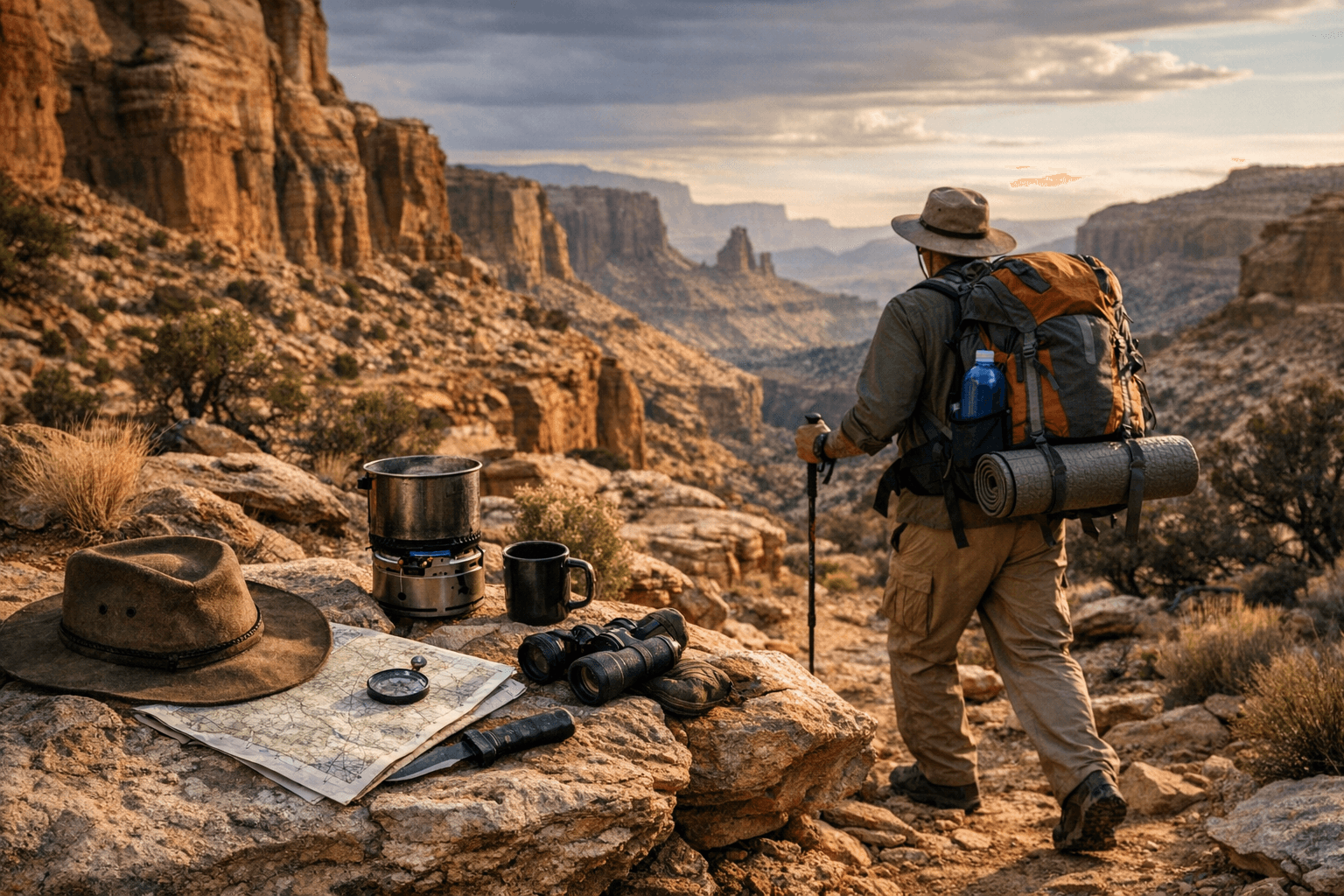
Building Your Pack: The Core Layers
The foundation of any Southwest backcountry kit starts with shelter, sleep, and water. In desert canyon environments managed by the BLM across southern Utah, water sources can be separated by 10 to 20 miles or more, particularly in late summer and fall. Carrying a filter rated for protozoa and bacteria is non-negotiable, and many experienced backcountry hikers in this region supplement with chemical treatment as a backup. A two-liter minimum carry capacity per person is a starting baseline; in exposed canyon country, four liters is often more appropriate between known sources.
Shelter considerations split between the high basin environment and the canyon floor. In Southwest Colorado's high country, afternoon thunderstorms are a near-daily occurrence in July and August, and lightning exposure on open ridgelines is a serious hazard. A freestanding tent with solid rain fly performance matters here. In the lower canyon terrain, the nights are warmer but wind and flash flood risk introduce their own variables; knowing your campsite's drainage context is as important as your gear selection.
For sleep systems, a quilt or sleeping bag rated 10 to 15 degrees below the expected low temperature is the standard framework most experienced desert hikers use. The desert Southwest radiates heat aggressively at night, and lows that surprise first-timers are a genuine pattern.
Navigation in the Four Corners Region
GPS devices are useful, but the Four Corners backcountry rewards map-and-compass fluency in a way that few other regions in the country still do. Cell service is effectively nonexistent across most of the BLM and NPS land in this corridor. Topo maps at the 7.5-minute (1:24,000) scale are the working standard for serious route planning here. Before any multiday trip, tracing your intended route by hand on paper, identifying water sources, bail routes, and elevation profiles, builds the kind of route familiarity that keeps navigational mistakes from compounding.
The canyon country of southern Utah presents a specific navigation challenge that isn't immediately obvious from topo maps: rim-to-floor access points are limited and sometimes require technical skills or specific beta. A canyon that looks passable on a map may have a 200-foot pour-off that turns you around. Consulting NPS ranger stations for current conditions before entering national park or monument units in this region isn't just courteous, it's strategically smart.
For navigation tools, consider carrying:
- A dedicated GPS unit with downloaded offline maps (phone GPS drains battery quickly in cold high-basin conditions)
- 7.5-minute USGS topo maps for every drainage and basin segment of your route
- A baseplate compass with a declination adjustment set for the Southwest (currently around 9 degrees east for the Four Corners area)
- A written route card with waypoints, water sources, and emergency contacts
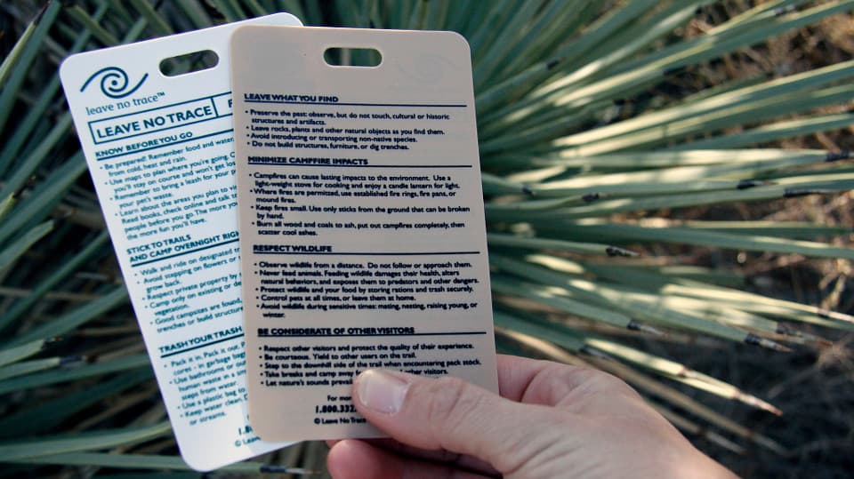
Leave No Trace in the Desert Southwest: Higher Stakes
Leave No Trace principles carry particular weight in the desert Southwest because the ecosystem's recovery timelines are measured in decades, not seasons. Cryptobiotic soil crust, the dark, lumpy biological crust that covers much of the canyon country in Utah and Southwest Colorado, can take 50 to 250 years to recover from a single footstep. NPS and BLM guidance across this region consistently emphasizes staying on established trails or bare rock surfaces when traveling through crust-dominated terrain.
The core LNT principles as they apply specifically here:
- Travel on durable surfaces: Rock, sand, and established trails. Cryptobiotic crust is visibly dark and textured; if you're stepping on something that looks like dark lumpy soil, step back.
- Pack out all waste: Many BLM and NPS units in this corridor require WAG bags (waste alleviation and gelling bags) for human waste disposal. Check the specific land management unit before your trip.
- Minimize campfire impact: Fire bans are common across the Southwest, particularly in drought years, and the high basins of Colorado sit above timberline where wood collection is inappropriate regardless of fire status. A canister stove is the functional and ethical standard.
- Camp at least 200 feet from water sources: Water sources in desert canyon country are magnets for wildlife; camping at distance preserves those sources for animals that have no alternative.
- Leave what you find: Pottery shards, rock art panels, and archaeological features are present throughout the Four Corners region. Federal law under the Archaeological Resources Protection Act makes disturbing these features a serious offense; NPS and BLM both enforce actively in this corridor.
Permits, Land Jurisdiction, and Pre-Trip Planning
The patchwork of land management across the Four Corners region means your route may cross NPS, BLM, and state land within a single day. Permit requirements vary significantly. Some NPS units, including sections of Canyonlands and Bears Ears National Monument managed by the BLM, require backcountry permits that must be secured weeks or months in advance during peak season. Checking current permit requirements through official NPS and BLM portals before finalizing any route is essential, not optional.
Ranger stations associated with the relevant NPS or BLM field offices are among the most underutilized planning resources available. Staff at these offices track current water source conditions, recent wildlife activity including bear and mountain lion reports, and weather pattern anomalies that won't appear in any guidebook.
The Mindset the Terrain Requires
The backcountry of Southwest Colorado and Utah is generous to hikers who arrive humble and prepared, and it is indifferent to those who don't. The Four Corners landscape has been shaped by forces operating on geological timescales, and the canyons, basins, and mesas carry that scale in everything from the width of a slot canyon to the silence of a high basin at dawn. Moving through it well, leaving it intact, and returning with the full weight of that experience is what backcountry travel in this corridor is ultimately about.
This article was produced by Prism’s automated news system from verified source data, official records, and press releases, then run through automated quality and moderation checks before publishing. The system is built and supervised by the people who set the standards it runs under. Read our full AI policy.
Did this article answer your question?


