San Juan National Forest maps phased road, trail openings for spring travel
Dolores and Pagosa gates that protect elk and deer remain closed until May 1; Columbine will open low-elevation roads May 1 while upper-elevation and backcountry routes are commonly held until June 1.
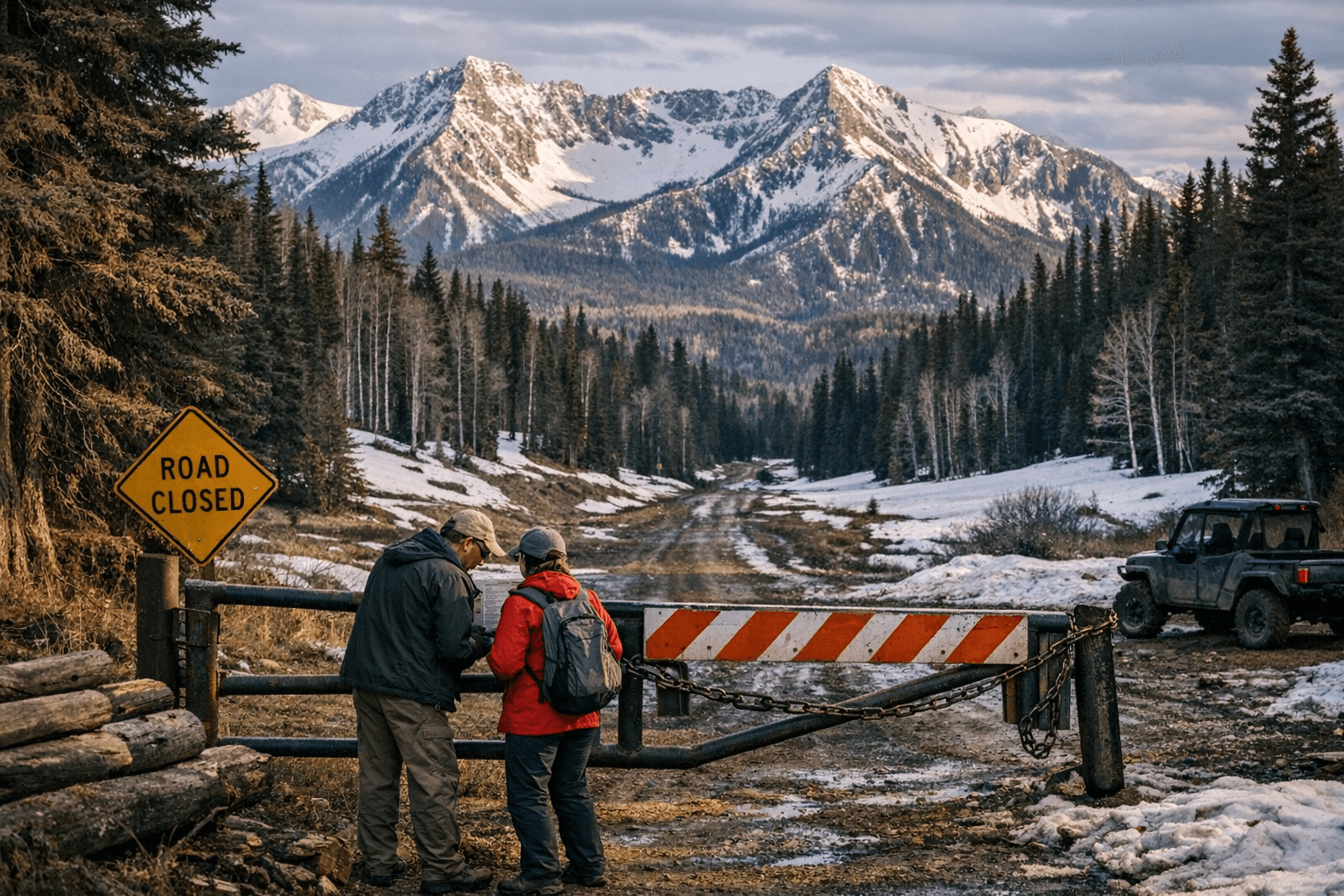
Gates that protect wintering elk and deer on the Dolores and Pagosa Ranger Districts remain closed through May 1, and the Columbine Ranger District will begin opening low-elevation roads on May 1 while keeping upper-elevation and backcountry routes commonly held until June 1 or later. That phased schedule, laid out in the San Juan National Forest release dated April 9, 2026, makes April practical only for valley approaches and some low-elevation recreation; most high-pass driving, technical Alpine Loop runs and many backcountry routes will still be off-limits to motorized use in April.
The Forest Service tied the timing to two operational constraints: lingering high-elevation snowpack and extensive October 10–13, 2025 flood damage. SNOTEL and Western Water Assessment briefings showed Upper Colorado basin snow water equivalent at roughly 22 to 27 percent of median around April 1, 2026, so low elevations are unusually dry while higher ridges still hold snow. The October flood produced measured peaks, including a Pagosa gauge peak near 12.82 feet and a recorded peak flow around 8,570 cubic feet per second in rapid assessments, and left vehicle bridges with severe damage and wilderness bridges on Vallecito Creek and West Fork destroyed.
Federal repair funding and repair windows will shape route availability beyond seasonal gates. The Forest Service says it applied for and was awarded Emergency Relief for Federally Owned Roads funding through the Federal Highway Administration, with work expected to begin in spring 2026 and continue through 2027; some bridge replacements are not expected until at least 2027. Because ERFO projects and reconstruction work will limit or reroute access, the legal Motor Vehicle Use Map remains the definitive guide for where and when motorized travel is allowed on San Juan NF roads and trails.
District-level operations and contacts give practical clarity. Columbine Ranger District, which manages roughly 691,310 acres and is led by District Ranger Nick Glidden, will open low-elevation routes on May 1 as conditions allow. Dolores Ranger District, managed by District Ranger Nicholas Mustoe across about 597,373 acres, and Pagosa Ranger District, led by District Ranger Joshua Peck across about 585,770 acres, are opening roads as conditions allow but retain elk/deer protection closures through May 1. The release lists road-status phone numbers for confirmation: Columbine 970-884-2512, Dolores 970-882-7296 and Pagosa 970-264-2268; Forest Supervisor Steve Hattenbach oversees the forestwide program.
For Jeepers, guided 4x4 operators and mountain bikers the practical split is clear: in April expect short, low-elevation runs, valley trailheads and dry singletrack where snow has melted; beginning May 1 many valley roads and gated access points will come online but high passes such as Engineer and Cinnamon that feed the Alpine Loop are still likely to be unreliable until late May or early June. The Forest Service release explicitly asks users to avoid wet and muddy roads that are easily damaged, to respect seasonal gate closures and to consult MVUM seasons, since motorized access can remain limited by legal MVUM designations and flood-repair activity.
The phased opening reshapes spring trip calendars for Southwest Colorado: low-elevation recreation ramps up across Columbine, Dolores and Pagosa starting May 1, federal ERFO repairs will occupy crews through 2027, and full restoration of some trail bridges will not be complete until at least 2027. For travelers, that means plan for route flexibility, prioritize MVUM-legal corridors and verify road status with the listed district numbers before booking high-pass or backcountry trips.
This article was produced by Prism’s automated news system from verified source data, official records, and press releases, then run through automated quality and moderation checks before publishing. The system is built and supervised by the people who set the standards it runs under. Read our full AI policy.
Did this article answer your question?


