ROV Video Rekindles Debate Over 18-Foot Tuna Near Gulf Rig
An ROV video showing an estimated 18-foot tuna near a Gulf of Mexico rig resurfaced and sparked debate over species ID and size estimates.
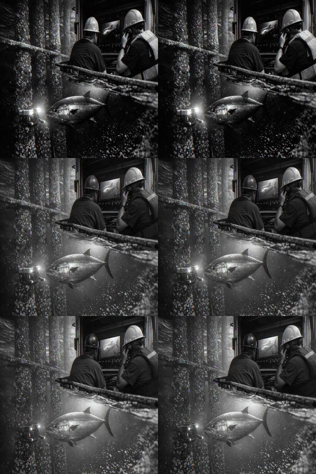
A resurfaced ROV (remote-operated vehicle) clip showing what an operator scaled against a 4-foot rig riser and estimated to be as much as an 18-foot tuna has anglers and offshore researchers trading theories about giant pelagics around deepwater structure. The footage, recorded earlier and circulated by the ROV operator today, pushed size conversations past modern IGFA benchmarks and into hot debate on species identification and measurement accuracy.
The apparent size in the clip far exceeds IGFA all-tackle records for yellowfin at 427 pounds and bigeye at 392 pounds, and it even challenges typical bluefin proportions for an animal of that length. That gap between visual impression and record books is fueling two lines of inquiry in the community: whether the animal is actually an oversized yellowfin or bigeye, an unusually shaped bluefin, or a different species altogether, and whether ROV footage can reliably produce length and weight estimates without standard scaling protocols.
Estimating size from ROV video is tricky. Camera angle, focal length, lens distortion, and unknown camera-to-subject distance can inflate apparent length. The operator’s use of a 4-foot riser as a reference point gives the clip more weight than an unreferenced shot, but riser orientation and perspective still leave room for error. For sport captains and tech-minded observers, the clip is a reminder that lasers or calibrated markers on ROVs, alongside clear notes about camera specs, are invaluable when documenting notable offshore encounters.
Beyond measurement mechanics, the sighting rekindles interest in how deepwater rigs act as congregation points for large pelagics. Anglers have long swapped tall tales about giant tunas patrolling structure, but hard visual evidence is scarce. Resurfaced footage like this prompts practical follow-up: shared verification of rig dimensions used for scaling, copies of raw footage with metadata, and coordinated reporting to fisheries researchers so observations can be cross-checked against tagging and survey data.
For the Gulf fishing community, the clip is both lore and data point. It makes anglers and ROV operators think about better documentation practices and gives biologists a conversation starter on pelagic size ranges near artificial structure. Watch the video, compare measurements carefully, and if you run ROVs or work offshore, consider adding simple scale devices and metadata in future deployments. The debate won’t settle overnight, but it will sharpen how the community records and vets extraordinary offshore sightings.
Know something we missed? Have a correction or additional information?
Submit a Tip

