Blustery weather, chance of snow could disrupt Albany County travel today
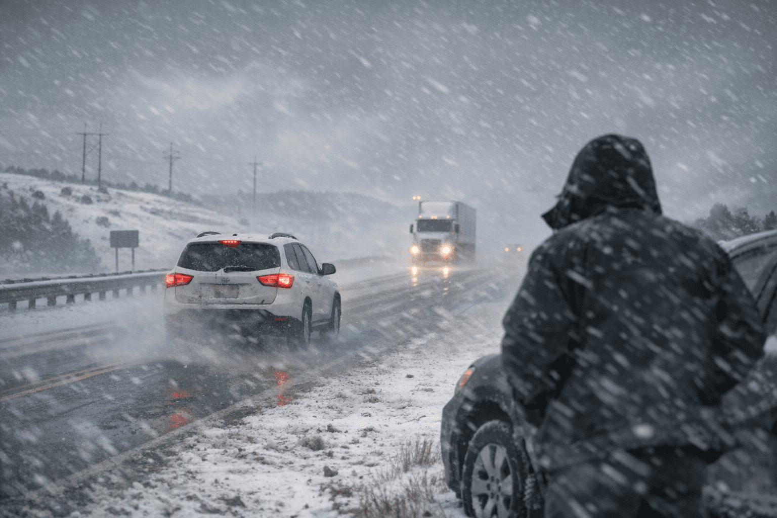
A band of blustery weather is moving through Albany County on December 27, with Laramie forecast to see a high near 41 and wind gusts up to 25 miles per hour and a chance of snow mainly before 11 p.m. The combination of gusty winds and low overnight temperatures could create slick road conditions and complicate local government services and travel for residents.

A weather system bringing gusty winds, clouds and a chance of snow is expected to affect Albany County today, with Laramie forecast to reach a high near 41 degrees and face wind gusts as high as 25 miles per hour. Forecasters expect mostly cloudy conditions overnight with a chance of snow mainly before 11 p.m., and a low near 11 degrees. That pattern mirrors conditions across much of the state where highs range from near 30 to the mid 50s and lows fall from near zero to the mid teens.
For residents and local institutions the immediate concern is how wind driven snow and dropping temperatures will affect roads and municipal services. Gusty conditions statewide include winds as strong as 48 miles per hour in Glenrock, 38 miles per hour in Casper and up to 35 miles per hour overnight in Cheyenne. Those wind speeds can reduce visibility and push loose snow into drifts, increasing the workload for Albany County road crews and for the Wyoming Department of Transportation on state routes.
County officials and emergency services will need to manage routine winter operations, including road treatment and timely public information about conditions. The weather could slow travel for commuters, delivery services and anyone planning to travel to or from Laramie today. Residents should plan for slower trips, allow extra time and be prepared for colder overnight temperatures near 11 degrees which can freeze wet pavement.
The broader statewide forecast shows scattered snow chances in mountain and northwestern areas, with locations such as Jackson seeing up to three inches of snow mainly after mid afternoon and western towns facing early day snow. Southeast communities including Cheyenne are expected to reach the low 50s before cooling later and becoming mostly cloudy and blustery overnight.
Albany County government and regional transportation agencies will be key sources for evolving road condition updates. Monitoring local alerts and allowing additional travel time will reduce risk for drivers as the system moves through and conditions change this evening.
This article was produced by Prism’s automated news system from verified source data, official records, and press releases, then run through automated quality and moderation checks before publishing. The system is built and supervised by the people who set the standards it runs under. Read our full AI policy.
Did this article answer your question?