Snowy Range Scenic Byway Offers Stunning Views With Key Safety Tips
The Snowy Range Scenic Byway, designated the nation's second scenic byway in 1988, climbs to 10,847 feet and is open Memorial Day through mid-November, with key safety rules every driver should know.
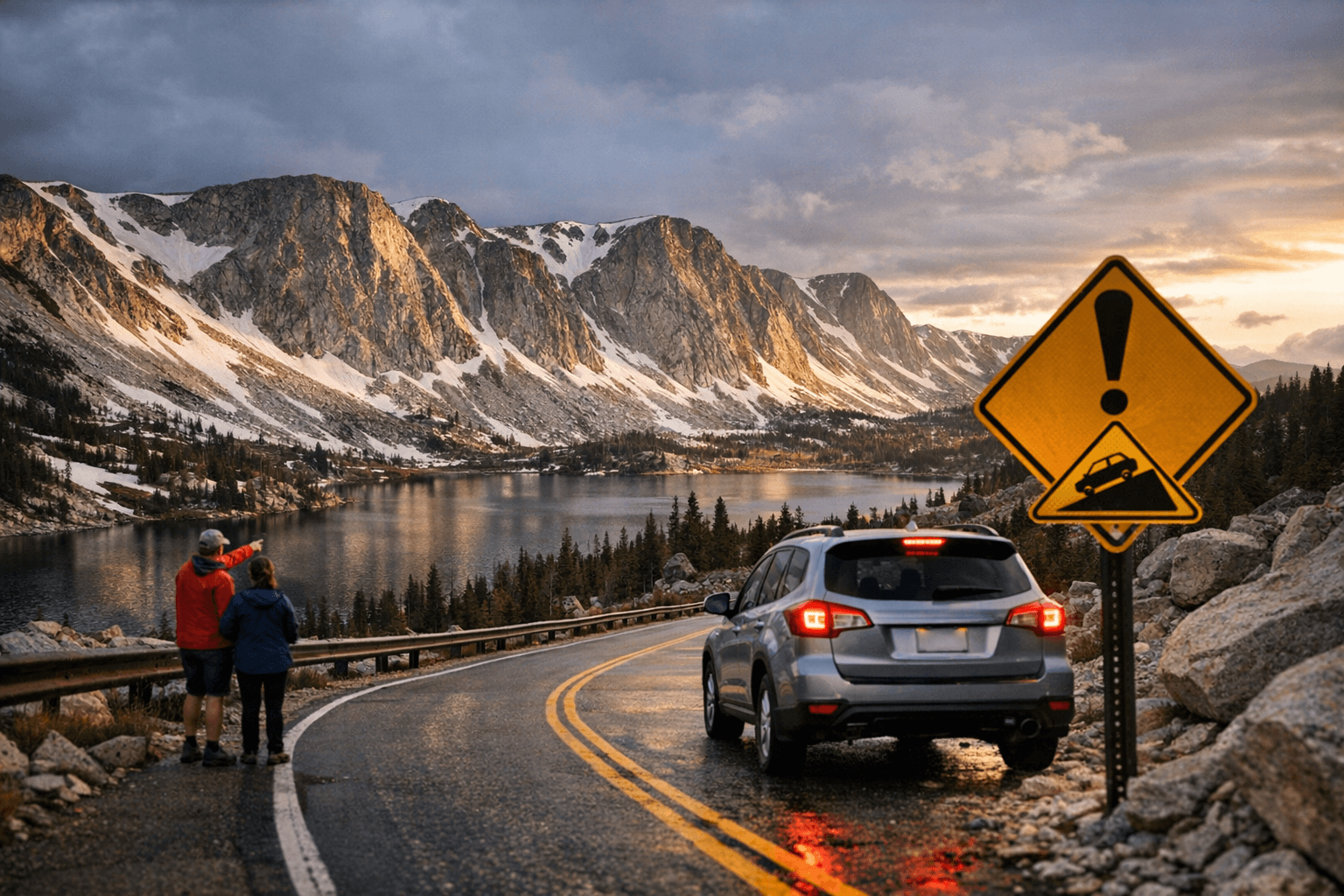
Thirty-one miles west of Laramie, Wyoming Highway 130 crosses into the Medicine Bow National Forest and transforms from a plains highway into one of the most dramatic paved drives in the Rocky Mountain West. The Snowy Range Scenic Byway is a stretch of Wyoming State Highway 130 between Laramie and Saratoga, reachable on its western end from Interstate 80 about 20 miles east of Rawlins, or from its eastern end at the outskirts of Laramie. The closest town to the byway's high alpine section is Centennial, Wyoming, a former mining community that sits just 27 miles west of Laramie, at the foot of the Rocky Mountains.
The road was originally a wagon road built in the 1870s, widened in the 1920s, paved in the 1930s, and designated as the nation's second scenic byway in 1988. The U.S. Forest Service describes it as one of the first scenic byways designated on National Forests, and after years of work it became known as the "Great Skyroad." The byway is the second highest mountain pass in Wyoming.
What to Expect on the Drive
One of the first scenic byways designated on National Forests, this 29-mile stretch of paved road crosses through spectacular alpine habitats, rising from sagebrush and lodgepole pine forests below and offering views of rugged peaks reaching over 12,000 feet in elevation, crystal clear lakes, and gorgeous displays of native wildflowers in the spruce-fir forests and alpine areas of the high country.
The byway rises from 8,000 feet on the valley floor to a height of 10,847 feet above sea level. The scenic byway takes travelers from sagebrush prairies to a high-altitude alpine environment, including all of the major life zones in the Rocky Mountains. Near the summit, the wind-sculpted krummholz spruce-fir trees signal the shift into true alpine tundra. The region near Medicine Bow Peak is home to Rocky Mountain bighorn sheep, yellow-bellied marmots, pikas, and blue grouse, while the many mountain lakes and streams support rainbow trout, brook trout, and Wyoming's only native trout, the cutthroat.
Driving time along the byway from one forest boundary to the other depends on the interests of the visitor; driving straight through during the summer tourist season takes about an hour, while stopping to enjoy the scenery, points of interest, and activities like camping and fishing can extend travel time by several hours or even days.
Wildflowers and Alpine Plants
Few stretches of Wyoming road rival the Snowy Range for summer wildflower displays. Indian Paintbrush, Wyoming's official state flower, blooms in abundance along the lower sections of the highway near the Little Laramie River corridor. Higher up, the spruce-fir and alpine zones host species found nowhere else at these latitudes.
One of the most distinctive alpine plants along the byway is *Polemonium viscosum*, the sky pilot or alpine forget-me-not. This common plant of alpine tundra is normally deep purple, but occasional white forms can be found as well, as documented in photographs by Andrew Kratz of the U.S. Forest Service. The alpine forget-me-not (*Eritrichium nanum*) is a tiny wildflower that occurs throughout much of the Rocky Mountain chain, also photographed by Andrew Kratz of the U.S. Forest Service.
Recreation and Picnic Areas
The byway begins as it enters the Medicine Bow Forest 31 miles west of Laramie and leads westward through the Snowy Range, passing numerous trailheads, campgrounds, and lake turnoffs. Numerous hiking trails, picnic sites, and campgrounds offer recreational options throughout the corridor.
The Mirror Lake Picnic Ground stands out as the most fully developed accessible stop on the byway. The facility was recently reconstructed and paved, and includes single and double picnic sites, a group site, a fishing platform, a toilet, a path along the lake shore, a path to water, and the historic CCC toilet building, with all features accessible to people with disabilities. The facility has four designated accessible parking spots out of thirty available parking spots. Accessible facilities are also available at Barber Lake and Lake Owen, making the byway well-equipped for visitors who require accessible amenities.
Just west of the Greenrock Picnic Area is the turnoff for Brooklyn Lake Road, a side trip that leads to several lakes accessible by automobile, with other lakes reachable via a network of hiking trails. St. Alban's Chapel, a small outdoor Episcopal chapel near Little Brooklyn Lake, is the site of frequent weddings and other ceremonies in the summer months.
Seasonal Opening and Closure: Know Before You Go
The byway's most important practical fact for Albany County drivers is its strict seasonal window. Snow lingers late and returns early at the upper elevations, so the byway is normally open from Memorial Day through October. The byway closes for the season in mid-November, and traditionally reopens with the help of snowplows before Memorial Day weekend.
Opening the road is a significant undertaking. Crews from Laramie and Saratoga, with some help from crews in Casper and Cheyenne, typically start work on the 12-mile high-elevation stretch in mid-May, and multiple rotary plows, snowcats, and other heavy equipment have been used to clear drifts of snow as tall as 15 feet. As of early 2026, WYO Highway 130 remains closed for the season. Check current conditions before heading out, especially in spring and fall.
Key Safety Considerations
Even after the road opens each Memorial Day weekend, conditions on WY-130 can shift rapidly. WYDOT District 1 Area Maintenance Supervisor Eric Anderson has warned that "spring snowstorms can still happen at higher elevations" and "conditions may be impassable overnight." Motorists, including bicyclists and motorcyclists, should stay alert as they travel through the mountain pass. Maintenance crews are typically in the area after opening to make repairs to guardrails and signposts damaged by snow, so drivers should be prepared to slow down for workers.
A critical safety note that many first-time visitors overlook: cell service is essentially non-existent for a lot of the drive, making a satellite communication device strongly advisable, particularly for anyone camping, hiking, backpacking, or climbing along the byway.
Key tips before driving WY-130:
- Check Wyoming 511 (wyoroad.info) or call the ranger districts for current road status before departure, particularly in May, June, and October.
- Pack layers and rain gear regardless of the forecast: summit temperatures can drop sharply even in July.
- Carry extra water and food if you plan to hike from trailheads along the route.
- WYO 130 tops out at 10,800 feet and is one of several high-elevation mountain roads in Wyoming that closes annually in late fall when relatively low traffic and deep snow accumulations render plowing operations impractical; plan accordingly for any late-season visit.
- If visiting Mirror Lake Picnic Ground in a large group, note that total parking is limited to thirty spots, with four reserved for accessible use.
Management and Contacts
The byway is managed by the U.S. Forest Service within Medicine Bow National Forest, split between two ranger districts. For road conditions, permits, and recreation information, contact:
- Laramie Ranger District: (307) 745-2300
- Brush Creek-Hayden Ranger District: (307) 327-5481
The Brush Creek Visitor Information Center, on the western boundary of the forest, is open May through mid-October and offers maps, books, permits, interpretive program schedules, and other information; call the Brush Creek Ranger District at (307) 326-5258 for the current schedule of operations at the visitor center. The Centennial Visitor Center, which is open seasonally, can be reached at (307) 742-9730 for current hours. The U.S. Forest Service's Medicine Bow - Routt National Forests' Forest Safety web page is the primary resource for up-to-date safety guidance, wildlife advisories, and any active alerts or closures before heading into the Snowy Range.
For a drive that climbs through every life zone in the Rockies, past glacial lakes and bighorn sheep habitat, in under an hour of pavement, WY-130 is in a class of its own in southern Wyoming. The window to experience it safely is short; knowing the conditions before you leave Laramie makes all the difference.
This article was produced by Prism’s automated news system from verified source data, official records, and press releases, then run through automated quality and moderation checks before publishing. The system is built and supervised by the people who set the standards it runs under. Read our full AI policy.
Did this article answer your question?