Tornado watch remains in effect for Albany County severe storms
Albany County stayed under a tornado watch until 11 p.m. as storms were set to hit the I-25 corridor first, then sweep east again after dark.
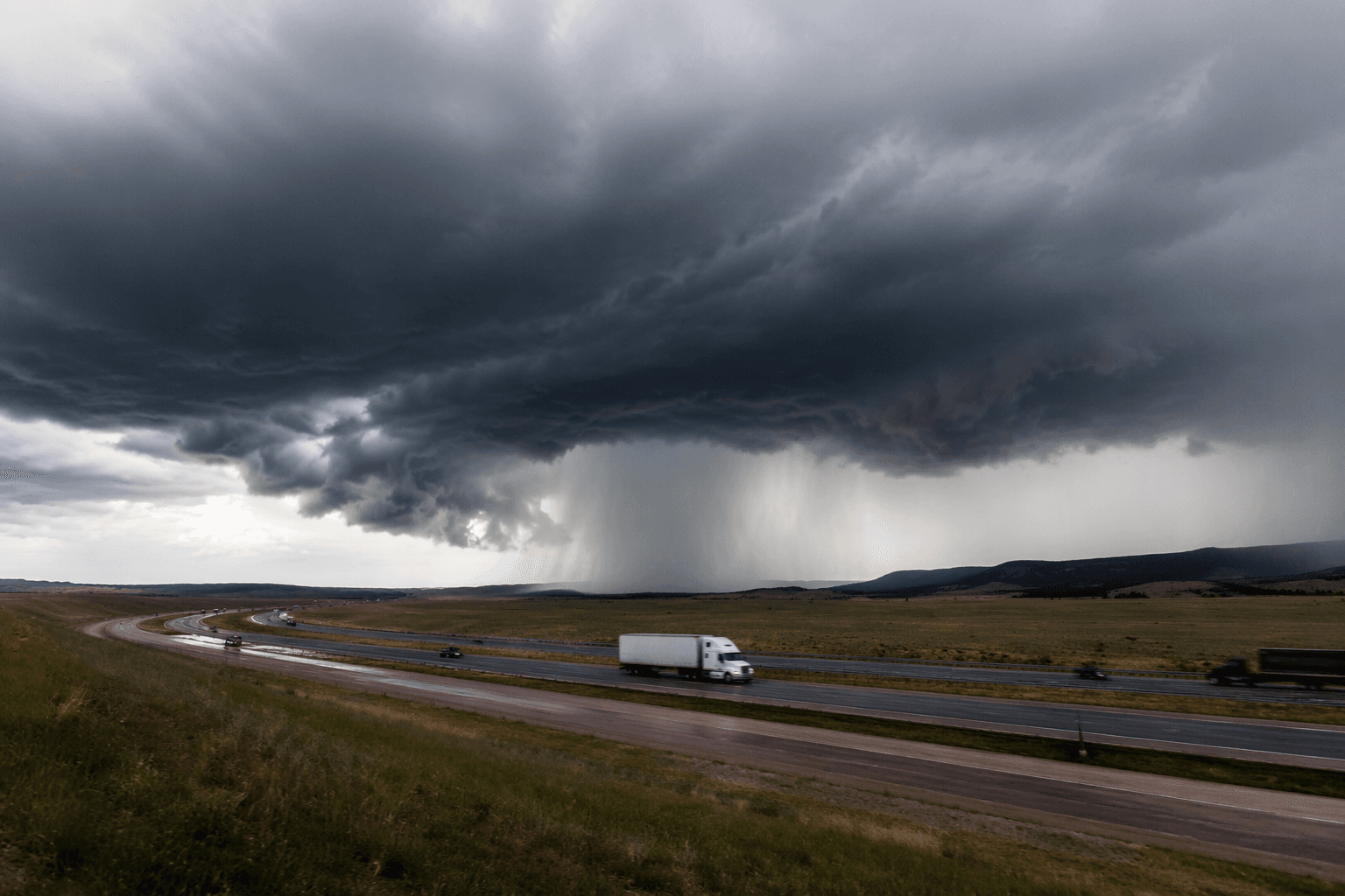
Tornado Watch 389 stayed in effect for Albany County and nearby Laramie and Platte counties until 11 p.m. MDT Wednesday, as forecasters warned that severe thunderstorms could bring large hail, damaging winds, flash flooding and a continuing tornado threat across southeast Wyoming. The first round of storms was expected along the I-25 corridor between 2 and 6 p.m., with another round moving eastward through the evening and nighttime hours.
For Laramie, that meant the afternoon commute, county travel and any outdoor plans were entering the highest-risk window first. The National Weather Service in Cheyenne said severe thunderstorms were expected Wednesday and Thursday, and the Storm Prediction Center said isolated tornadoes could continue for at least a few more hours in an environment still favorable for rotating storms.
Meteorologists described that setup with 2,500 to 3,500 joules per kilogram of mixed-layer CAPE, up to 60 knots of effective bulk shear and 200 to 500 m2/s2 of effective storm-relative helicity near a boundary. The Storm Prediction Center estimated the most probable peak hail size at 2.00 to 3.50 inches and peak wind gusts at 65 to 80 mph, a combination that can damage roofs, break windows and make driving dangerous in a matter of minutes.
Albany County’s risk also came with hard local memory. National Weather Service Cheyenne event summaries include the June 6, 2018 Albany County EF3 tornado, the May 27, 2018 Federal EF2 tornado, the September 10, 2019 Platte-Goshen County tornado, the July 16, 1979 Laramie County F3 tornado and the June 20, 2010 Chugwater tornado. Those storms showed how quickly severe weather can intensify across southeast Wyoming when the atmosphere lines up for supercells.
Wyoming hazard pages also showed a Flash Flood Watch, Red Flag Warning, Fire Weather Watch and Hazardous Weather Outlook active across parts of the state. That combination pointed to a storm day that could shift from hail and wind to flooding and then back to severe weather again by nightfall, leaving little margin for travel, outdoor events or other plans across Albany County.
This article was produced by Prism’s automated news system from verified source data, official records, and press releases, then run through automated quality and moderation checks before publishing. The system is built and supervised by the people who set the standards it runs under. Read our full AI policy.
Did this article answer your question?