Apache-Sitgreaves Prescribed Burns Planned Near Springerville Starting March 18
Prescribed burns covering over 1,100 acres near Pinedale launched March 18, with smoke expected across 10 communities including Pinetop-Lakeside and Snowflake through April 30.

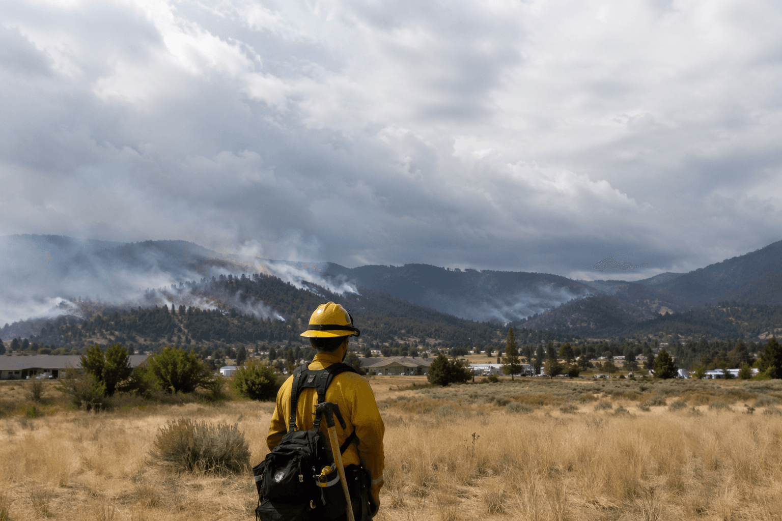
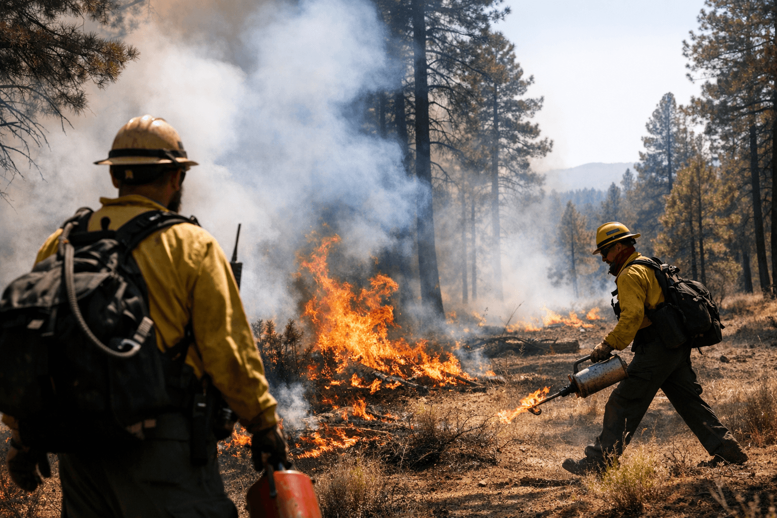
The Apache-Sitgreaves National Forests launched prescribed fire operations on the Lakeside Ranger District beginning March 18, targeting more than 1,100 acres of overgrown vegetation near Pinedale and Highway 260, with work expected to continue through April 30.
Two specific burn units anchor the operation. The Pine Rx covers 552 acres one mile east of Pinedale, south of Highway 260. The Thomas Rx encompasses 591 acres one mile west of Pinedale, a half-mile southwest of Highway 260. Both units are pending all required approvals, and the Forest Service has made clear that weather conditions will determine whether any given day's ignitions proceed.
"We use prescribed fires to help reduce overgrown vegetation to help protect local communities, infrastructure and natural resources from wildfires," the agency stated in its advisory.
The burns carry practical consequences for a broad stretch of east-central Arizona. Smoke may be visible from Pinedale, Linden, Snowflake, Taylor, Vernon, Concho, Pinetop-Lakeside, McNary, and along both Highway 260 and Highway 77. Areas near active burns may close temporarily for public safety, and the Forest Service advises watching for warning signs posted along roads adjacent to prescribed fire zones before and during burns.
Drivers encountering smoke should slow down and turn on headlights. Residents concerned about air quality can check conditions through AirNow online or the AirNow app.
The agency is not locked into the burn schedule regardless of conditions. "We will evaluate weather conditions in the hours before a burn begins. If conditions warrant, scheduled prescribed fire activities may be canceled," the Forest Service stated.
County emergency management officials will be notified when burning begins. Updates will be available through the Apache-Sitgreaves forest website, the forest's social media channels, and InciWeb, the interagency incident information system used to track wildland fire and prescribed burn activity nationwide.
The March 18 operations are distinct from an earlier round of pile burns at the Pinedale Work Center and Lewis Canyon Campground that the Lakeside Ranger District had scheduled for February 17. The Forest Service updated its map page for those pile burns on February 12, and that advisory described work expected to continue throughout the week, weather permitting. The relationship between the February pile burns and the current multi-week prescribed fire campaign has not been formally clarified by the agency.
Springerville sits roughly 30 miles northeast of Pinedale, and the extended burn window through late April means smoke events could recur intermittently across the White Mountains corridor for six weeks. The Forest Service has not released a daily burn schedule, specific ignition times, or the names of personnel overseeing each unit.
This article was produced by Prism’s automated news system from verified source data, official records, and press releases, then run through automated quality and moderation checks before publishing. The system is built and supervised by the people who set the standards it runs under. Read our full AI policy.
Did this article answer your question?