Coronado Trail Scenic Byway climbs from desert to White Mountains
The Coronado Trail turns one U.S. 191 drive into Apache County’s tourism corridor, linking 120 miles of curves, 7,000-foot towns and White Mountains spending.

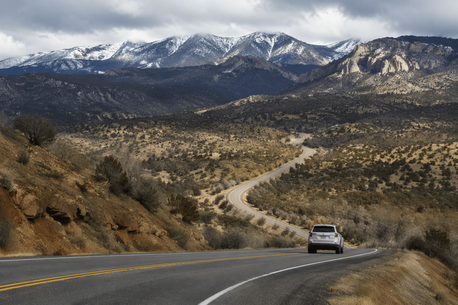
U.S. 191 runs more than 120 miles on the Coronado Trail Scenic Byway, bends through about 460 curves, and climbs from the Clifton-Morenci area into alpine country near Alpine, Eagar and Springerville. For local businesses and seasonal employers, that elevation change is not just scenery. It is the road that moves visitors from the high desert into the White Mountains, where they spend money, stay overnight, and anchor the county’s outdoor economy.
A road that drives visitors into Apache County towns
Springerville and Eagar sit at the center of the route’s economic pull. Springerville was established in 1879, grew around Henry Springer’s trading post, sits at 7,000 feet in Round Valley, and calls itself the “Gateway to the White Mountains.” Its recreation page lists a year-round estimated population of 1,980, a reminder that a relatively small town absorbs a steady stream of travel traffic when the byway is busy. Eagar, also at 7,000 feet, is located at the foot of the White Mountains and is a central point for regional recreation.
The byway channels travelers directly toward the places where Apache County can capture tourism spending. A scenic drive only becomes an economic asset when visitors stop for meals, lodging, fuel and supplies, and the Coronado Trail funnels that activity into Springerville, Eagar, Alpine and the Hannagan Meadow area. Sunrise Park, the largest ski resort in Arizona, sits 25 miles west of Eagar, which gives the route a direct connection to winter recreation traffic as well as summer travel.
Why the route stands out in the mountain economy
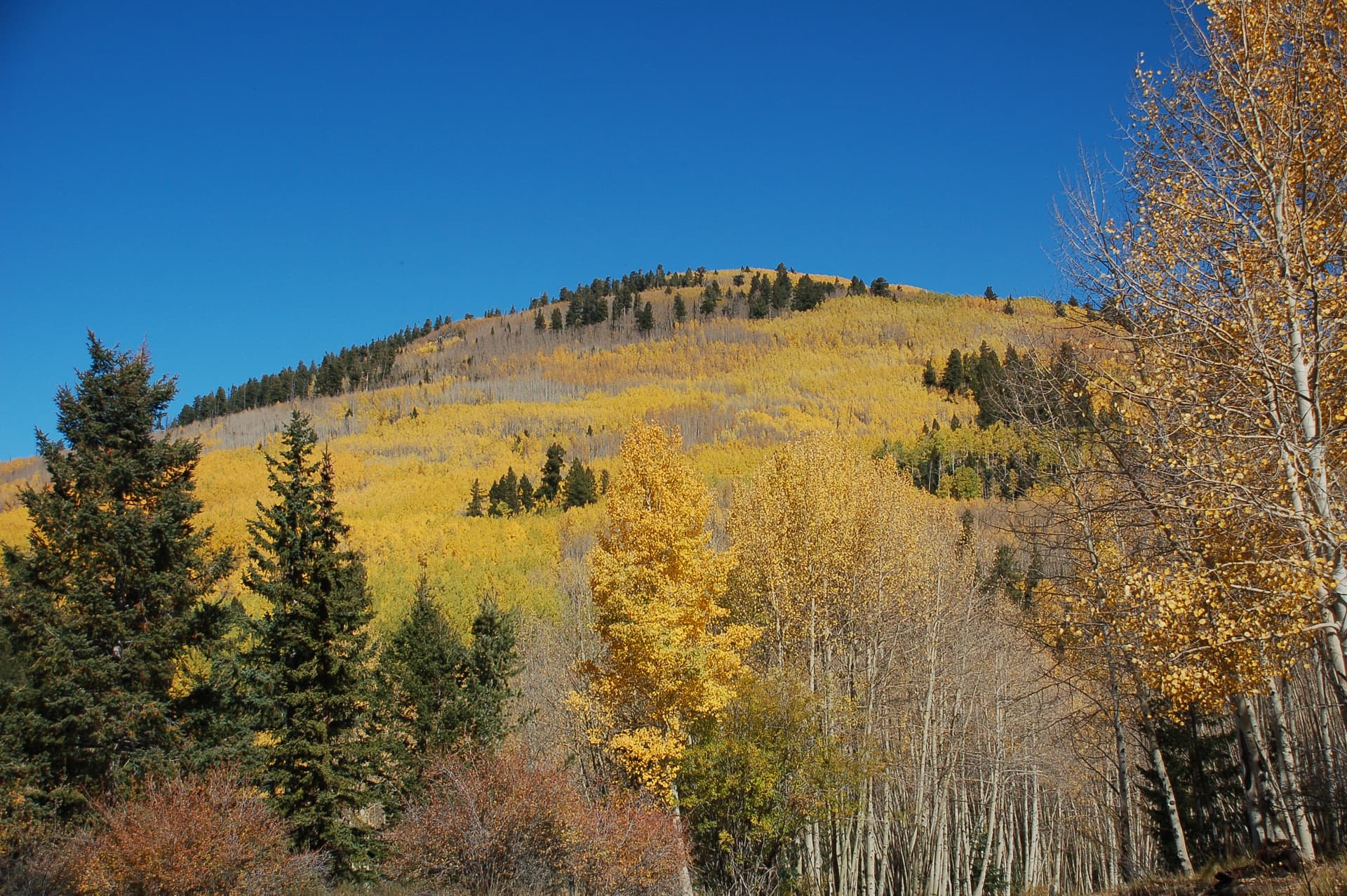
The Coronado Trail compresses several landscapes into one drive. The Apache-Sitgreaves National Forests cover about 2.1 million acres and stretch from roughly 3,500 feet on the Clifton Ranger District to more than 11,000 feet at Mount Baldy Wilderness. The forests also include a large part of the Mogollon Rim and the White Mountains, plus 24 lakes and reservoirs and more than 400 miles of rivers and streams.
A traveler can leave canyon country, cross historic mining landscapes and reach ponderosa forest, mountain meadows and aspen stands in a few hours. The variety supports very different kinds of spending, from short-day sightseeing to longer stays tied to hiking, fishing, camping and ski-season travel. Traffic is relatively light, which keeps the drive from feeling like a commuter route and helps preserve the sense that the county is selling an experience, not just pavement.
History that still shapes the route
The Coronado Trail was dedicated June 19-20, 1926, at Hannagan Meadow as the Coronado Trail and Clifton-to-Springerville Highway. Governor George W.P. Hunt attended the two-day celebration, which drew an estimated 5,000 people. The dedication also included a barbecue of “six fat steers and two bears.”
The byway’s name honors Francisco Vázquez de Coronado, whose 1540 search for the Seven Cities of Cibola cast a long historical shadow across the Southwest. The route is part of Arizona’s historic and scenic road system, which covers roads built between 1912 and 1955 and excludes interstates.
Hannagan Meadow and the thin margin of services
Hannagan Meadow remains one of the route’s most practical waypoints. Hannagan Meadow Lodge has been open since 1926, the same year the road was dedicated. It is still the only place to stay in the middle of the Apache National Forest, which makes it a rare fixed point on a long, curving stretch of highway where services can be sparse.
A road with 460 curves and major elevation swings rewards drivers who slow down, plan ahead and respect changing weather.

Mount Baldy and the cultural landscape around the drive
Mount Baldy stands 11,421 feet high, is culturally significant to White Mountain Apaches and sits on the eastern edge of the Fort Apache Indian Reservation. The White Mountain Apache Tribe identifies Mount Baldy and Fort Apache Historic Park among its cultural and heritage resources.
How to use the route well
A Coronado Trail drive works best when it is treated as a full county experience rather than a pass-through. The strongest stops sit in or near the communities that line the route, especially Springerville, Eagar and Alpine, where visitors can connect to the White Mountains without losing time to unnecessary backtracking.
- Start with daylight if possible, because the curves and elevation changes are part of the journey, not an add-on.
- Use Springerville or Eagar as your planning base, since both towns sit at 7,000 feet and orient visitors to the White Mountain recreation zone.
- Build in time for Hannagan Meadow, where the road’s history and the forest’s remoteness still define the experience.
- Leave room for mountain weather, since the route climbs from lower country into high forest terrain that can feel like several seasons in one trip.
This article was produced by Prism’s automated news system from verified source data, official records, and press releases, then run through automated quality and moderation checks before publishing. The system is built and supervised by the people who set the standards it runs under. Read our full AI policy.
Did this article answer your question?