Greer balances growth and preservation in Apache County mountain town
Greer’s economy runs on forests, water and four-season recreation, but its tiny footprint and wildfire exposure make preservation a daily necessity.
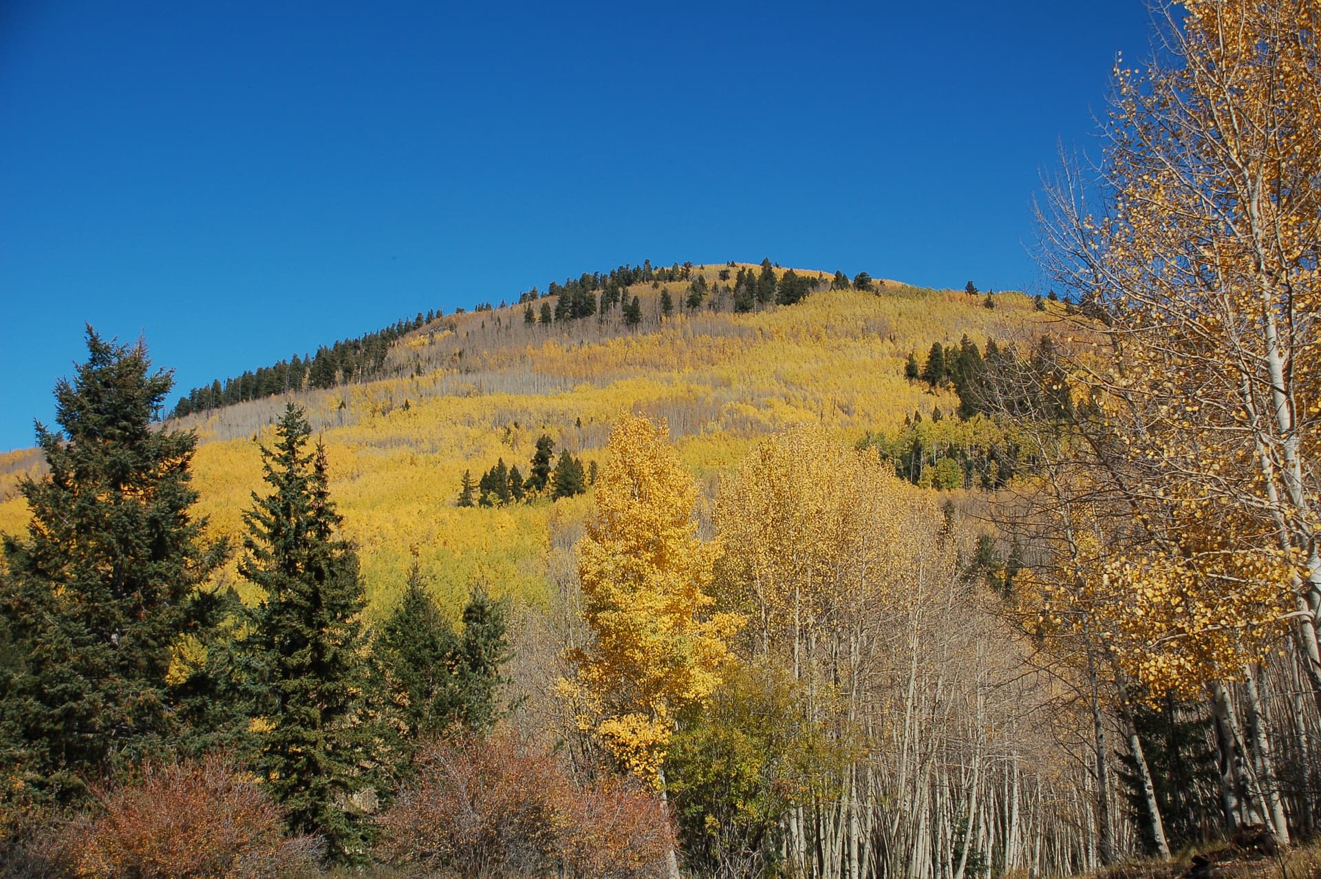
Sitting above 8,000 feet, Greer is Arizona’s highest-elevation town. It depends on the forests, streams and trail access that draw visitors, support cabins and restaurants, and keep a mountain economy moving through every season. With only one road in and out, Greer’s appeal is tied to the same conditions that can strain it: limited access, seasonal swings, wildfire risk and pressure on a very small amount of land.
A mountain community built around land use
Greer is a community made up of permanent residents, part-time residents, vacationers, small businesses and resorts, all sharing a landscape defined by mountain forests, meadow-lands and year-round rivers and streams. One-acre lots, small commercial enterprises and widely dispersed destination resorts keep the town open and rural while still allowing tourism to function.
Development in Greer has been governed by the Greer Phase I ordinances, approved by Apache County on May 15, 1989. Those rules still matter because Greer’s value comes from restraint as much as growth. When a town’s character depends on open space, low-density lots and a fragile high-country setting, each new cabin, lodge addition or commercial project has an outsized effect on traffic, water use, fire exposure and the feel of the place itself.
Why the local economy depends on seasons and access
Greer’s economy works because the outdoors works year-round. In warmer months, hikers and mountain bikers use the White Mountains and the trail network around town. In winter, cross-country skiers and snowshoers take over, turning the same landscape into a cold-weather destination. More than a dozen trails lie close to town, while the White Mountain Trail System offers 200-plus miles of loop trails and reaches to Mount Baldy, which tops out at 11,400 feet.
That recreation base supports the businesses that make Greer a working mountain community rather than a postcard. Cabins, outfitters, restaurants and resorts all depend on a steady flow of people who come for access to the high country, wildlife viewing, fishing and the chance to stay in a place that still feels remote. Hundreds of miles of trails nearby, mountain streams, fall color and the chance to catch Apache Trout in the White Mountains add to that appeal, with Lee Valley Reservoir among the few places this far south where Arctic Grayling can be found.
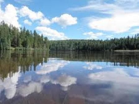
The surrounding public lands deepen that economy. The Apache-Sitgreaves National Forests were formed in 1974 from two forests and now cover 2 million acres, including 450 miles of rivers and streams. Their recreation system includes hiking, biking, camping, horseback riding, backpacking, cross-country skiing, snowshoeing, wildlife viewing, boating and picnicking. For Greer, that forest system keeps local lodging, food service and seasonal jobs viable.
History still visible in the town’s oldest buildings
Greer’s current identity reaches back well before modern recreation. Molly Butler Lodge officially opened in 1910 and remains the oldest continually operating lodge in Arizona. Molly Butler and her family moved into Lee Valley, now Greer, in the late 1880s, and her father built the first valley sawmill there. Greer was shaped by settlement, lumber, hunting, fishing and lodging for travelers long before it became a high-country retreat.
John Wayne, Teddy Roosevelt, Herbert Hoover and Zane Grey were among the notable guests tied to the lodge’s legacy. Greer was an established populated place in the 20th century, and a 1939 Greer Ranger District image points to a long Forest Service presence that still influences land management and recreation across the area.
Why wildfire, water and space shape every decision
Greer’s beauty comes with real exposure. The town’s land area is only 0.5 square miles, according to U.S. Census Bureau data, which means there is very little room for expansion and even less margin for error when land-use decisions are made. On a footprint that small, one-acre lots, dispersed resorts and narrow access roads create a community that feels spacious but is also highly constrained.
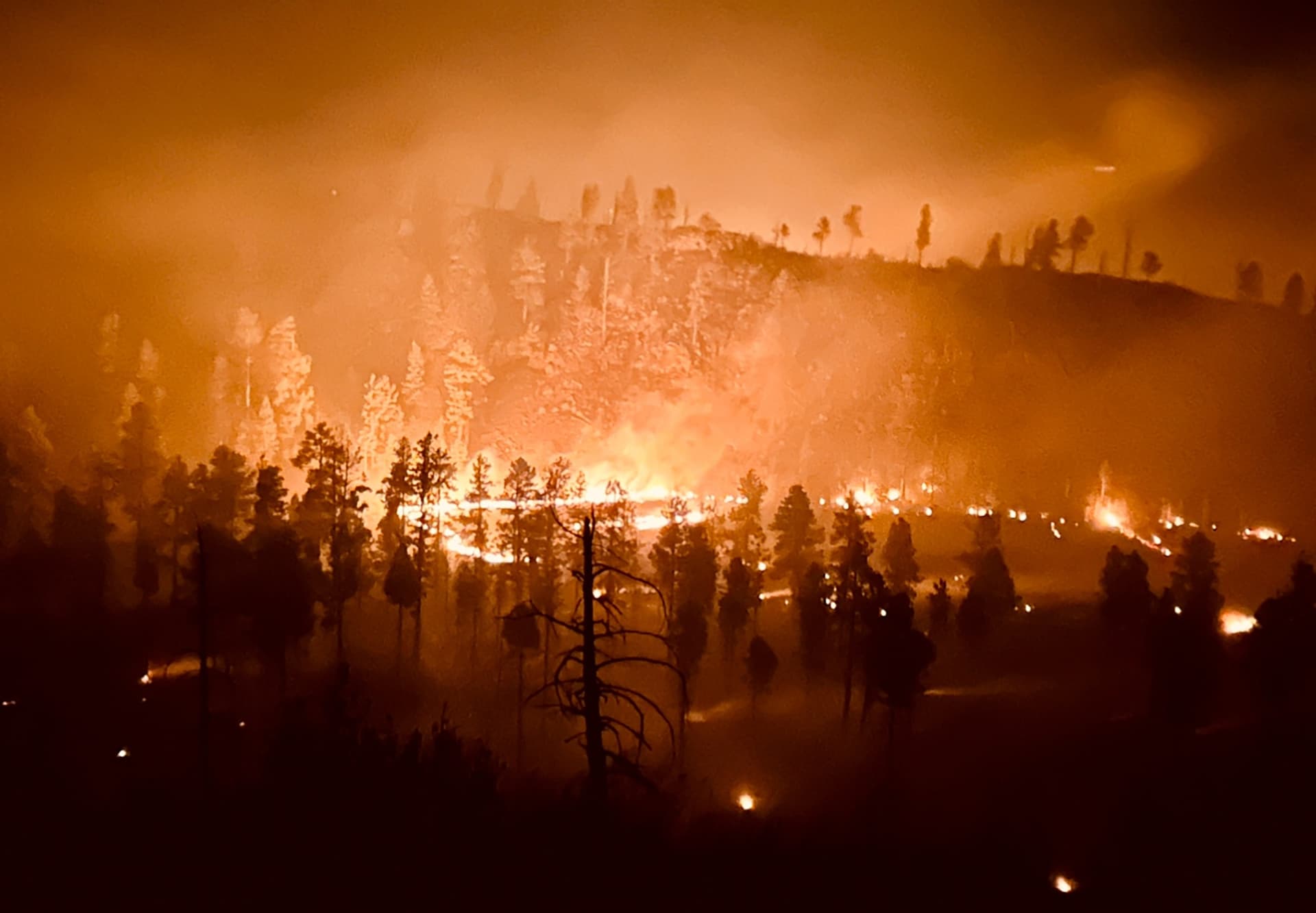
Wildfire has already shown how vulnerable that setup can be. The 2011 Wallow Fire destroyed 22 houses in Greer. That loss still frames how residents and property owners think about fuel conditions, defensible space and the risks tied to living amid dense forest. The same forests and streams that support the local economy also create the threat that one bad fire season can disrupt housing, business income and recreation access at the same time.
Water is part of the equation too. Year-round rivers and streams are central to the town’s identity, from fishing to the scenic setting that drives tourism. In a community where forests, streams and visitor traffic are all tied together, preserving those resources keeps cabins rented, restaurants open and summer and winter visitation steady enough to support year-round jobs.
This article was produced by Prism’s automated news system from verified source data, official records, and press releases, then run through automated quality and moderation checks before publishing. The system is built and supervised by the people who set the standards it runs under. Read our full AI policy.
Did this article answer your question?