Heat burst brings record warmth, overnight wind to Baker City
Baker City woke to limbs down after a heat burst sent winds across town hours after a 89-degree record at the airport.

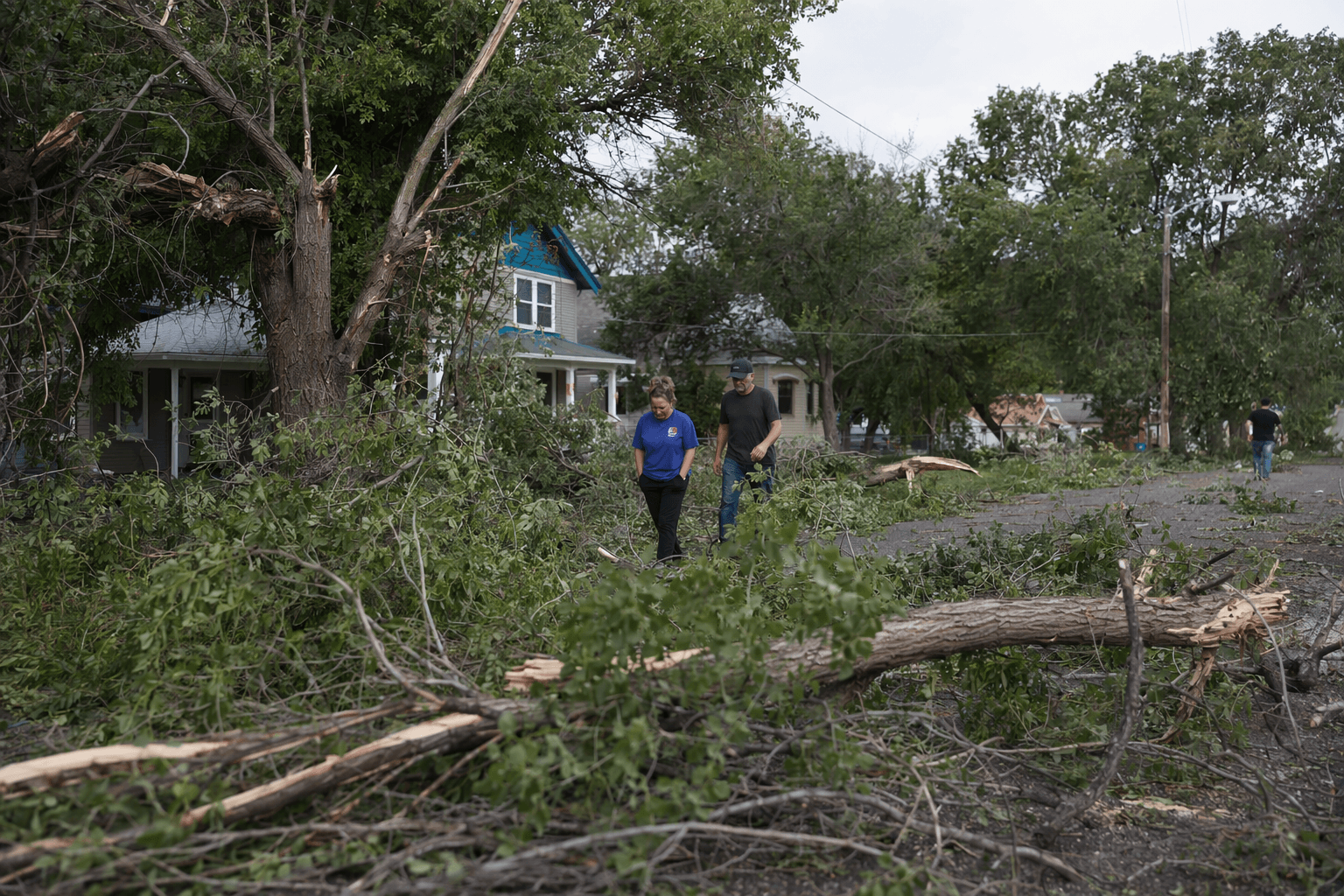
A sudden overnight windstorm left Baker City yards littered with limbs early Wednesday, after an afternoon that had already set a temperature record and set up one of the strangest weather swings of the spring in Baker County.
The Baker City Airport hit 89 degrees on Tuesday, May 12, breaking the May 12 record of 88 set in 1993. By 3 a.m. Wednesday, the temperature had dropped to 54 degrees, then the wind arrived. The rapid shift turned a warm day into a rough night for residents who woke to scattered debris and the kind of gusty conditions that can snap small branches, shake loose yard debris and make a routine morning look more like a cleanup job.
The National Weather Service describes a heat burst as a rare nighttime event marked by gusty winds, a quick rise in surface temperature and a falling dewpoint, usually tied to a dissipating thunderstorm. In Baker City, the event fit that pattern closely enough for the Boise-based National Weather Service office to identify it as a heat burst in later coverage. Warning coordination meteorologist Jay Breidenbach said the phenomenon stood out as a rare and interesting event.
Baker Municipal Airport, the official station at KBKE, sits at 3,360 feet, a detail that helps explain why weather in Baker City can turn sharply from one hour to the next. Forecast pages for Wednesday showed unsettled conditions and gusty winds across Baker County, and a stronger cold front was expected to sweep through later in the day. Regional forecasts also pointed to breezy to gusty conditions and wind gusts that could reach the 40 to 50 mph range in some lower-elevation areas.
For Baker County, the story was not just about a weather oddity. It was about what the oddity did: limbs on the ground, a fast-moving temperature swing and a reminder that a warm spell can end abruptly when unstable air, thunderstorms and a strong front collide over the valley.
Know something we missed? Have a correction or additional information?
Submit a Tip