Massive boulder blocks Highway 245, highlights Dooley Mountain rockfall risks
A 6-foot-tall boulder crashed onto Highway 245 south of Baker City, and crews kept the road open in a reminder of Dooley Mountain’s rockfall risk.

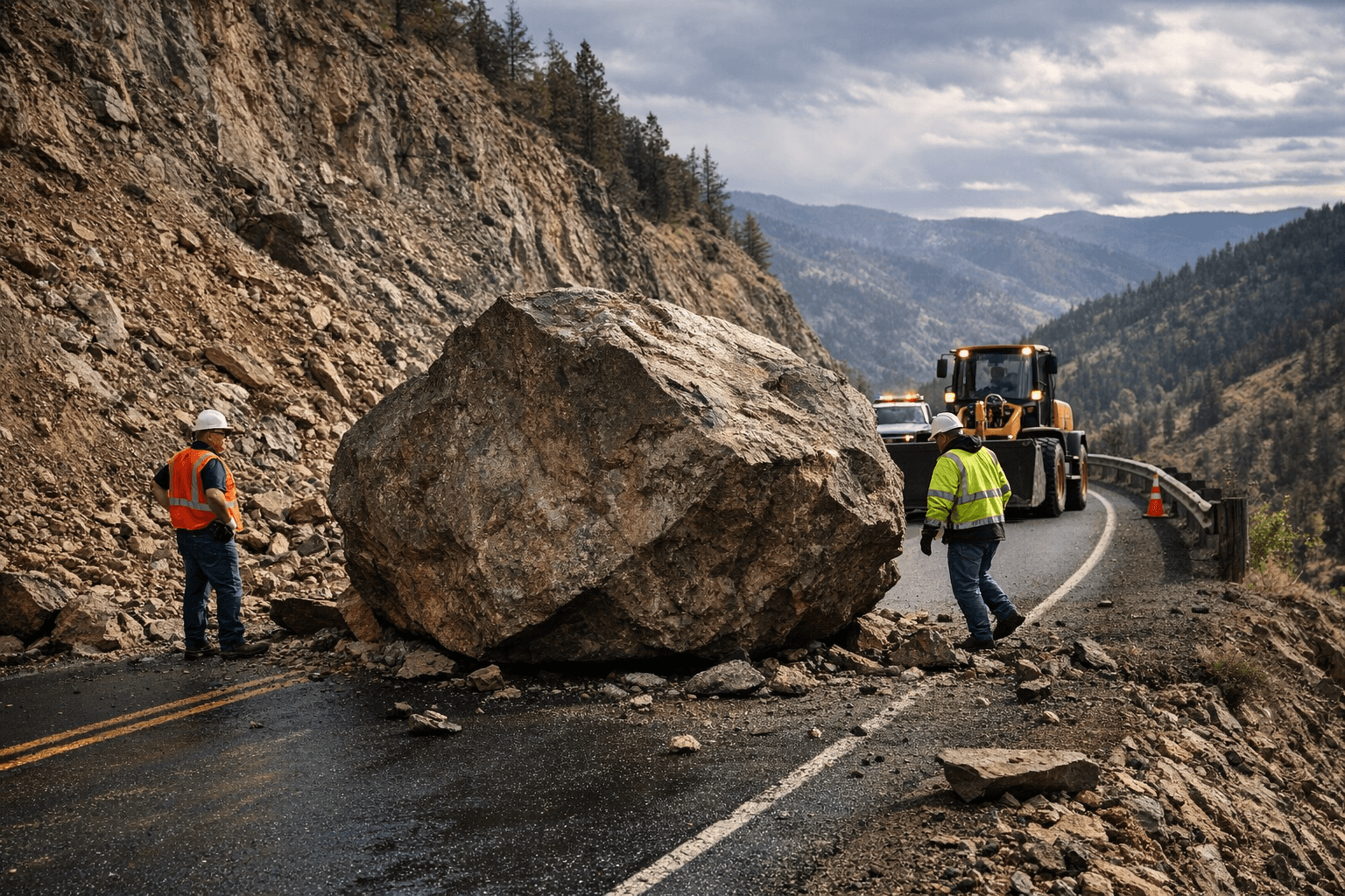
A massive boulder that dropped onto Highway 245 south of Baker City on April 18 turned a routine maintenance call into a sharp reminder of how quickly Dooley Mountain can throw a mountain route out of balance.
Allen Jensen, who manages the Oregon Department of Transportation’s Baker City maintenance station, said the rockfall near Milepost 31, about 6 miles south of Salisbury Junction, was not a surprise in that corridor. The size of the boulder was. Jensen estimated it at about 6 feet tall and 10 feet across, and said it was the largest he had ever seen.
The stone was rhyolite tied to the Dooley Mountain Complex, volcanic rock formed by eruptions roughly 12 million to 16 million years ago. That geology helps explain why this stretch of Highway 245 has a recurring rockfall problem. The same rugged terrain forms part of the divide between the Powder and Burnt rivers, with steep slopes and roadcuts that can shed material without warning.
ODOT brought in a couple of co-workers to help clear the hazard. A front-end loader could not lift the boulder outright, but crews were able to rotate it enough to get it onto the shoulder after a couple of hours of work. No one was hurt, and the highway stayed open while the rock was dealt with.
Jensen said the location made a big difference. If the boulder had come loose a mile or two farther north, near homes along Stices Gulch Road, crews would have faced a more dangerous cleanup. Rolling the rock over the edge there could have threatened a residence or a vehicle below, and Jensen said ODOT would have used a boulder buster to break it into safer pieces.
The Dooley Mountain incident also fits into a much larger transportation problem. ODOT says its unstable slopes inventory includes 4,143 unstable slopes and 1,899 rockfalls along Oregon highways, affecting about 7% of the state highway system, or 495 miles. The agency says it analyzes slopes near highways for hazards and works with Oregon universities on landslide and rockfall detection, monitoring, analysis and mitigation.
A new highway camera and weather station at Dooley Mountain Summit was added to TripCheck in 2025, underscoring how closely ODOT watches this pass. Jensen said the boulder on Highway 245 was even bigger than another large rock that rolled onto Highway 86 between Baker City and Richland in late November 2025, a comparison that shows just how extreme the Dooley Mountain fall was.
This article was produced by Prism’s automated news system from verified source data, official records, and press releases, then run through automated quality and moderation checks before publishing. The system is built and supervised by the people who set the standards it runs under. Read our full AI policy.
Did this article answer your question?


