Snake River-Mormon Basin byway offers scenic Baker County loop drive
The Snake River-Mormon Basin loop turns Baker County’s valleys, mining camps, and backcountry roads into a one-day lesson in how the county was built.
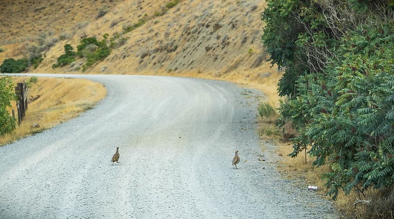
The Snake River-Mormon Basin Back Country Byway is the kind of Baker County drive that reads like a map of how the county came together. The route is officially listed by the Bureau of Land Management and the Federal Highway Administration, and it asks for a high-clearance two-wheel-drive vehicle before the pavement gives way to rougher ground.
What the loop covers
On paper, the byway is one route. In practice, it is a mix of paved, gravel, and narrow dirt roads that loop from Baker City and back again. Outside route guidance describes it as roughly 150 miles; another byway listing puts it at 130 miles and says to allow 2 1/2 hours. That spread matters because the route can feel different depending on which roads, stops, and side segments you choose.
The byway follows OR 7, OR 86, OR 245, and county roads marked with byway signs. Large RVs and vehicles pulling trailers are advised not to attempt the full route, which is the clearest sign that this is not a freeway-style scenic drive. It is a backcountry loop through a county where distance, surface changes, and weather can quickly reshape the day.
Baker City sits at the center of that network. Travel Baker County notes that the city stands at the intersection of three Oregon scenic byways, and the state’s scenic byways program counts 29 scenic byways across Oregon. That gives Baker County an unusually dense byway identity for a small county, with this loop offering the deepest look into the country behind the main streets.
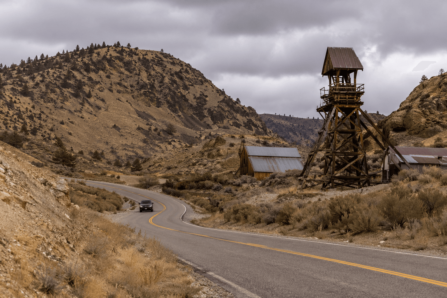
Reading Baker County through the windshield
The byway map ties together a long list of communities and crossroads: Baker City, Medical Springs, Lime, Weatherby, Durkee, Rye Valley, Pleasant Valley, Halfway, Cornucopia, Pine, Jamieson, New Bridge, Encina, Clarksville, Pondosa, Huntington, Weiser, North Powder, Richland, and Brogan. Those names are more than a route aid. They show how Baker County was stitched together by settlement points scattered across valleys, foothills, and travel corridors that once had to work for ranching, mining, and movement through rough country.
That geography still shapes the experience from the windshield. The byway is not a single overlook or a one-stop attraction. It is a corridor of towns, unincorporated places, and crossroads that make clear how Baker County’s communities grew around access, not around neat symmetry on a map. The road tells you where people could live, move, extract ore, and keep going.
Why the landscape looks the way it does
The terrain itself carries the county’s history. A geology reference explains that the modern Grande Ronde, Baker, and Durkee valleys were shaped by uplifting and downdropping along young faults over the last 2 million years. That helps explain why the route can move through broad valley floors and more confined country without ever feeling repetitive.
A BLM and National Park Service-era Oregon backcountry byways brochure adds another layer of context for the drive. Travelers are told to learn road conditions, services, safety considerations, and seasonal restrictions before setting out. The same guidance also tells drivers to respect private property, obtain land status maps before leaving the byway, close gates behind them, and watch for livestock and logging trucks. Those instructions matter here because the route cuts through working landscapes, not just recreation land.
The official materials also connect the byway to wildlife and habitat projects, timber harvests, and reforestation in wooded areas. That is one reason the route feels like a living landscape rather than a museum piece. The road crosses places where land use, conservation, and extraction still share the same geography.
Mining country is still visible
The county’s settlement pattern changed early because of mining. Baker County history begins in 1861, when gold was discovered in Griffin Gulch, and development followed at Auburn. A state geology source places Baker County’s mining history across a long arc, from 1861 to 1959, which shows how deeply extraction shaped the county’s economy and place names.
Historic Baker County settlements identified in local history resources include Auburn, McEwen, Bourne, Whitney, and Granite. Those names matter because they show where people gathered when ore drew them into the mountains and valleys. On this byway, Mormon Basin adds another layer: a geology field-trip publication says it gave access to the historic mining camps of Malheur City and Rye Valley.
Seen from the road, that is the byway’s most important lesson. The route does not just pass through scenic country. It crosses the remains of an economy that pulled towns into being, connected them by rough roads, and then left behind a pattern of place names that still anchors Baker County memory.
How to plan the drive
The byway rewards preparation more than impulse. The BLM’s vehicle guidance is specific: plan for a high-clearance two-wheel-drive vehicle. That matters because the route includes rougher surfaces, and the warning against large RVs and trailer combinations is there for a reason. The safest approach is to treat the loop as a full-day backcountry drive even if one listing says the route can be driven in 2 1/2 hours.
Before leaving pavement, check road conditions and decide whether you want the full loop or just a portion of it. Carry a map that shows land status, because the byway crosses a patchwork of public and private lands. Gates need to be closed, livestock need room, and logging traffic needs space, especially in wooded stretches where active work continues alongside recreation.
The best way to understand Baker County is not to race across it. It is to read the county one valley, one settlement name, and one road surface at a time. The Snake River-Mormon Basin Back Country Byway does that better than almost any other drive in the county, because it shows how geology, mining, and settlement still line up across the landscape.
This article was produced by Prism’s automated news system from verified source data, official records, and press releases, then run through automated quality and moderation checks before publishing. The system is built and supervised by the people who set the standards it runs under. Read our full AI policy.
Did this article answer your question?