Baltimore City braces for severe storms, damaging winds and possible tornadoes
Storms with 70 mph winds and possible tornadoes were expected to hit Baltimore between 4 and 9 p.m., with alerts already active citywide.

Baltimore City spent Sunday under active weather alerts as forecasters warned that the strongest severe-storm threat would arrive between 4 p.m. and 9 p.m., right in the window when commuters, families and evening programs are most exposed. The National Weather Service’s Baltimore/Washington office said scattered severe thunderstorms capable of damaging wind gusts were expected across the Mid-Atlantic vicinity that afternoon and evening, with hail, torrential downpours and even a brief tornado spin-up not ruled out.
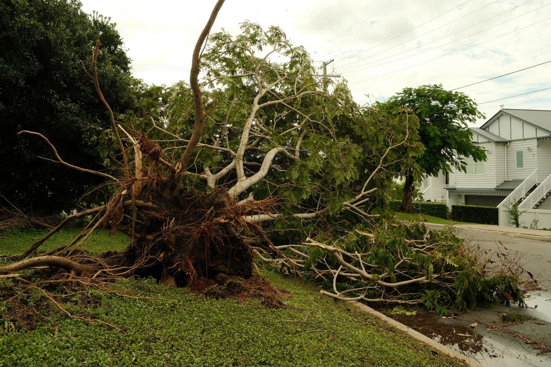
WBAL-TV 11 News said the city’s weather alerts were already active as heat and humidity fueled instability, and its forecast called for heat index values above 100 degrees. That kind of sticky air can help thunderstorms intensify quickly, raising the risk that strong winds or sudden downpours could disrupt traffic, delay pickups and leave neighborhoods dealing with scattered outages and downed limbs.

The city has seen how fast a severe-weather event can escalate. In March, Mayor Brandon Scott announced that Baltimore City would activate its Emergency Operations Center at 1 p.m. on March 16 ahead of severe thunderstorms and potential tornado activity. Gov. Wes Moore also declared a State of Preparedness on March 15, directing the Maryland Department of Emergency Management to coordinate readiness efforts across state government. Those steps reflected the level of concern officials have attached to storms that can turn dangerous in a matter of minutes.
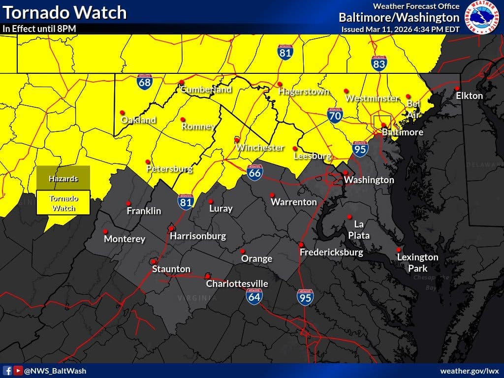
Baltimore’s Office of Emergency Management says its job is to prepare the city for emergencies, teach residents what to do and help when disasters happen. That mission has taken on added urgency after earlier severe-storm episodes this year, when more than 10,300 customers and businesses lost power and Baltimore City and Baltimore County were both placed under a tornado warning during a separate event, according to WBFF. The latest forecast carried the same basic threat pattern: strong wind, sudden visibility drops and the possibility of utility interruptions.
On the water, a Small Craft Advisory remained in effect for the Patapsco River, including Baltimore Harbor, with south winds of 10 to 15 knots and gusts up to 25 knots expected. For anyone moving through the harbor, the Inner Harbor, or roads near the waterfront, the combination of rougher conditions and fast-moving storms could make the evening commute especially difficult before the threat eases later at night.
This article was produced by Prism’s automated news system from verified source data, official records, and press releases, then run through automated quality and moderation checks before publishing. The system is built and supervised by the people who set the standards it runs under. Read our full AI policy.
Did this article answer your question?


