Severe thunderstorm watch in effect for Baltimore City until 8 pm
Baltimore City stayed under a severe thunderstorm watch until 8 p.m., with 60 mph wind gusts, hail and heavy rain threatening commutes, waterfront areas and evening plans.
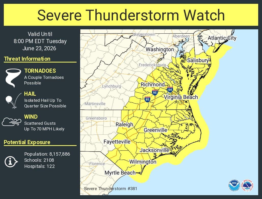
A severe thunderstorm watch put Baltimore City on alert until 8 p.m., with the National Weather Service warning that damaging winds and hail could hit neighborhoods, waterfront corridors and the evening commute. A separate severe thunderstorm warning on June 22 already covered southeastern Baltimore City, where radar picked up 60 mph wind gusts.
The NOAA National Weather Service Baltimore/Washington office said severe thunderstorms remained possible across the Mid-Atlantic through Tuesday, and Baltimore City was included in its hazardous weather outlook along with Baltimore County, Anne Arundel County, Cecil County, Harford County and Howard County. Damaging wind gusts were the primary hazard, but hail, tornadoes and heavy rain were also possible. The outlook also flagged the Patapsco River, Baltimore Harbor and Chesapeake Bay, a sign that the risk reached well beyond city streets and into the waterfront.
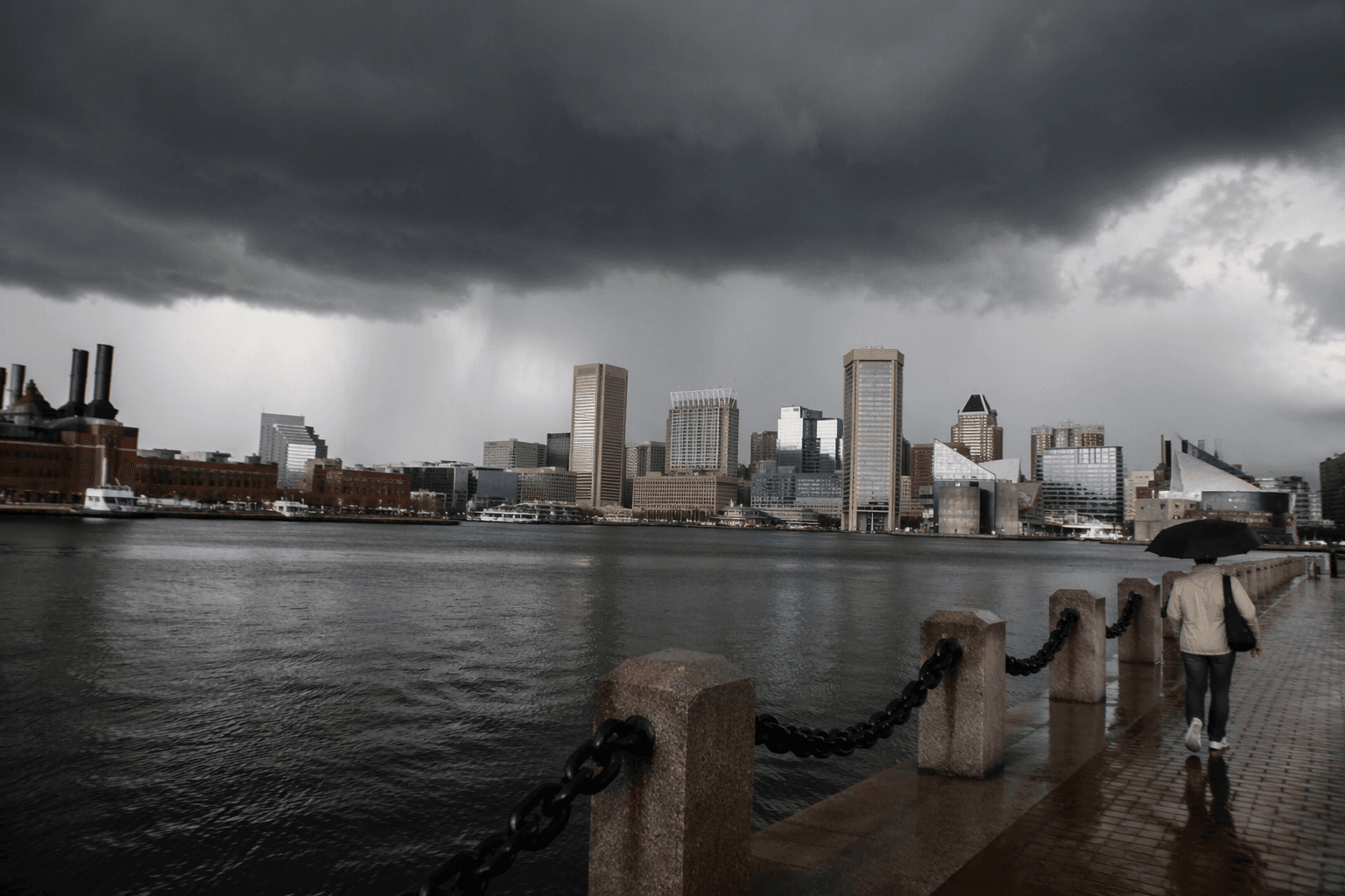
The setup came after Baltimore baked near 91 degrees Monday, and forecasters warned that widespread afternoon thunderstorms could bring heavy rain and gusty winds before conditions improved Tuesday. For people moving around the city, that meant less margin for delay. Sudden downpours and strong gusts can slow traffic, make transit connections tighter and turn short trips into longer, messier commutes, especially when the storm line arrives with little notice.


Baltimore has already seen what those winds can do. On June 6, severe thunderstorms produced 60 to 70 mph gusts and downed trees across the city, and the June 22 warning for southeastern Baltimore City again pointed to the threat of straight-line winds. That recent pattern is why residents, waterfront businesses and anyone headed to an outdoor evening event had reason to watch the sky closely. If storms strengthened again, tree-lined blocks, utility lines and harbor-facing areas would be among the first places to feel the impact.
This article was produced by Prism’s automated news system from verified source data, official records, and press releases, then run through automated quality and moderation checks before publishing. The system is built and supervised by the people who set the standards it runs under. Read our full AI policy.
Know something we missed? Have a correction or additional information?
Submit a Tip