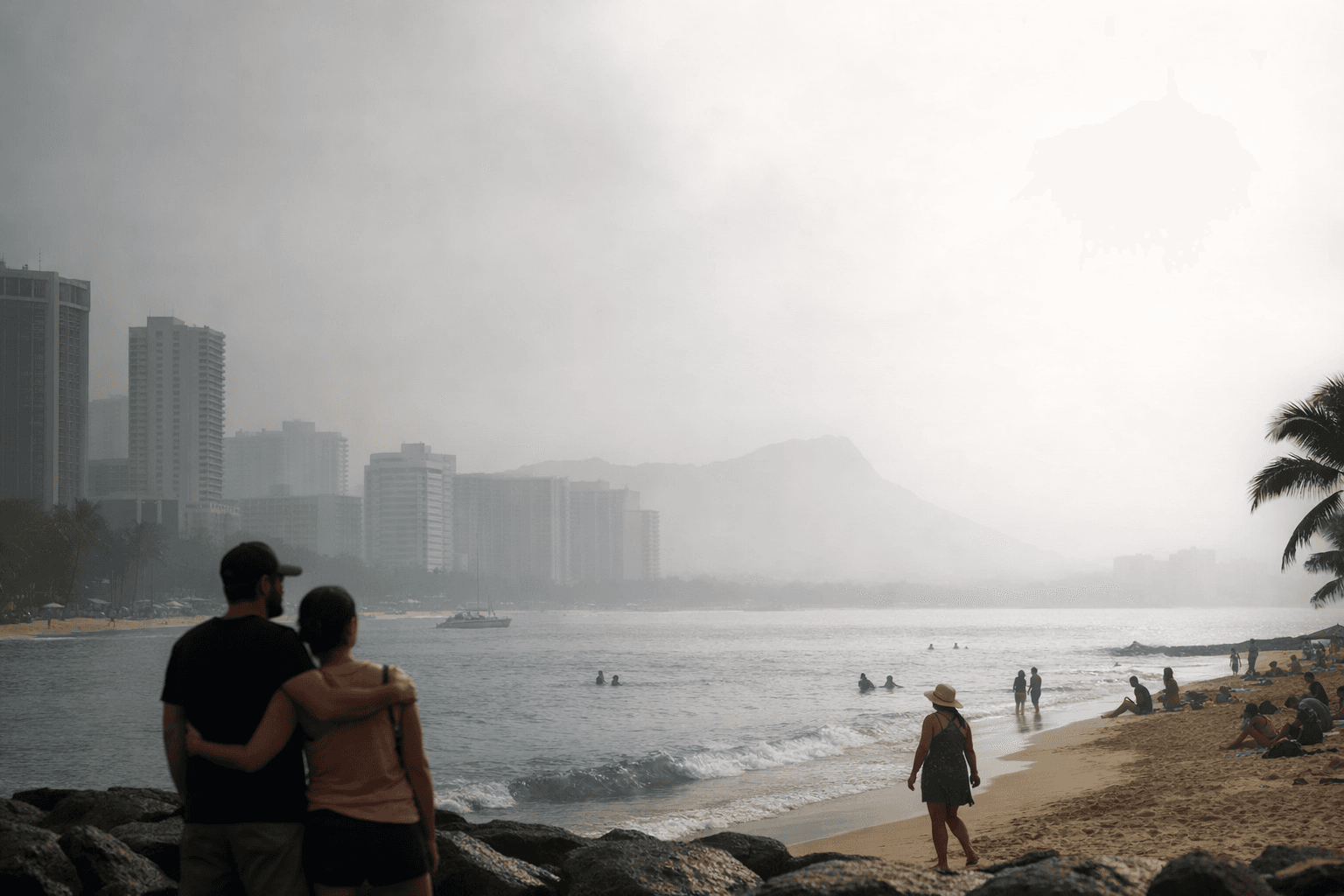
Kona Low Winds Spread Big Island Vog Across Hawaii Statewide
A Kona Low is pushing sulfur dioxide vog from the Big Island statewide, reversing the trade winds that normally confine the worst pollution to Kona and Kaʻū.
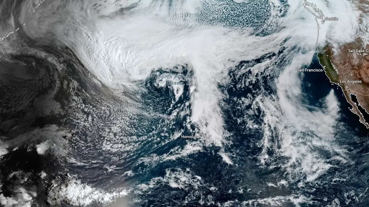
Sulfur dioxide vog from the Big Island is spreading across the Hawaiian Islands today as an active Kona Low upends the wind patterns that typically funnel volcanic haze toward the Kona coast and Kaʻū district, leaving residents statewide bracing for unusual air quality conditions.
Under normal circumstances, the trade winds that characterize Hawaii's weather push vog pollutants southwest from their source, concentrating them along the Kona coast. An eddy west of South Point then advects that haze northward and eastward toward the leeward coast, where afternoon sea breezes push it onshore during peak solar heating. That system works because a persistent North Pacific high pressure center, sitting just northeast of the Hawaiian Islands, maintains a strong inversion that traps most vog pollutants within the subtropical boundary layer close to the Big Island.
A Kona Low dismantles that configuration. As the pressure gradient tightens between the developing low and high pressure to the east, south to southwest winds strengthen, replacing the northeast trades. Scientific research published in the American Meteorological Society in October 2015 found that persistent southerly winds associated with kona lows reduce vog concentrations along the Kona coast specifically, while altering where that pollution ultimately travels. Scientists say the ongoing storm is now pushing vog across the Hawaiian Islands, a starkly different dispersion pattern from what Kona and Kaʻū residents normally absorb alone.
The storm is delivering more than degraded air quality. Snow coated the roads on Mauna Kea on Monday as the Kona Low dumped inches of snow across the volcano's higher elevations. Blizzard conditions remain possible at the Big Island summits through Friday and Saturday, with significant accumulations expected to continue through the weekend. The strengthening pressure gradient is also raising the threat of damaging winds and localized downslope winds capable of downing trees and power lines across affected areas.
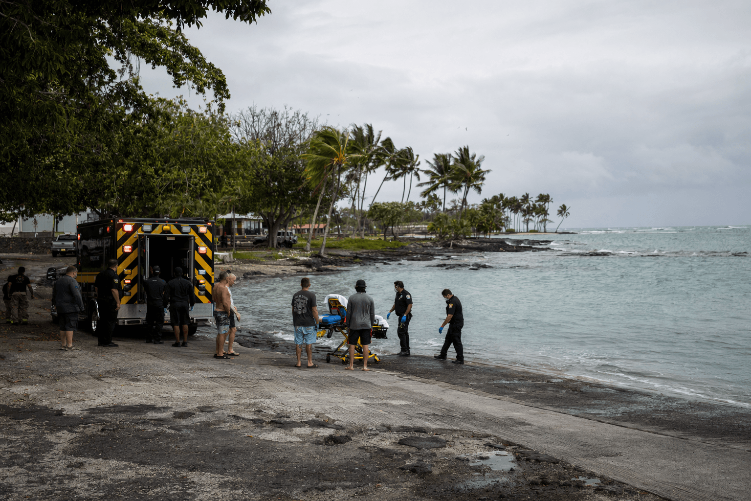
The hazard profile of a major Kona Low is well documented. When a powerful system struck in December 2021, Governor David Ige issued a state of emergency for all of the state's islands on December 6, and the National Weather Service reported the threat of catastrophic flooding as the storm moved slowly from east to west. The following morning, December 7, flooded streets in Honolulu captured the scope of the damage, with heavy rain and high winds having caused widespread flooding and power outages statewide.
Forecasting where vog travels during these events is increasingly possible. The Vog Measurement and Prediction model, known as VMAP, uses qualitative comparisons with sulfur dioxide satellite data from NASA's Ozone Monitoring Instrument aboard the Aura satellite to validate plume positions. That research found the position of the vog plume is well forecast over the island of Hawaii, with higher-concentration areas qualitatively captured in both location and pattern. Current SO2 readings and official air quality advisories from the Hawaii State Department of Health have not yet been included in available reports, and residents with respiratory conditions such as asthma or COPD should monitor the National Weather Service and state health channels for updated guidance as this storm continues to move through the island chain.
Know something we missed? Have a correction or additional information?
Submit a Tip