Saddle Road Lane Closure Set Amid Statewide Flood Watch Wednesday
Saddle Road's six-hour lane closure Wednesday collided with a statewide flood watch, leaving cross-island commuters facing 30-45 extra minutes on alternate Belt Road routes.
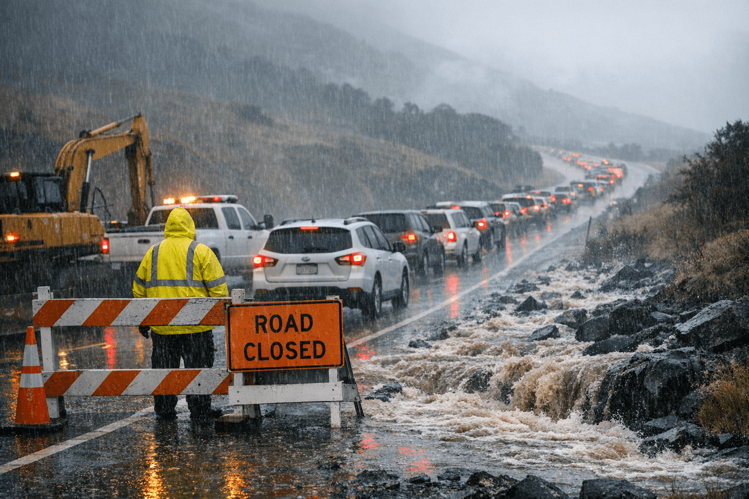
Cross-island commuters faced a compound challenge Wednesday when a scheduled six-hour maintenance closure on Daniel K. Inouye Highway between mile markers 27 and 31 landed on the same day the National Weather Service Honolulu placed all Hawaiian Islands under a statewide Flood Watch through Friday evening.
The Hawaiʻi Department of Transportation posted slow traffic and intermittent stops along the four-mile corridor from 8:30 a.m. to 2:30 p.m. on April 8 for routine roadway upkeep. The affected stretch sits within the historically reconstructed segment near mileposts 28 to 35, the same section dedicated in May 2007 with the late Senator Daniel K. Inouye as keynote speaker.
The timing strained the Hilo-to-Waimea-to-Kona corridor at its most-traveled midday window. Shift workers bound for Kailua-Kona's resort properties, freight haulers, and anyone running an airport connection to Kona International Airport faced a binary choice: absorb intermittent stops at nearly 6,600 feet of elevation or reroute onto one of two Belt Road alternatives that eliminate the savings Saddle Road was rebuilt to provide. The southern Hawaii Belt Road, Route 11, runs approximately 120 miles from Kona to Hilo and takes roughly three hours without stops. The northern option via Route 19 stretches about 145 miles at the same three-hour estimate. Daniel K. Inouye Highway, spanning just 52 miles from Hilo to its Route 190 junction near Waimea, normally saves cross-island travelers 30 to 45 minutes over either alternative.
NWS Honolulu triggered the Flood Watch, in effect from April 8 through Friday, April 10 at 6:00 p.m. HST, after a deep layered trough developed west of the islands and began drawing abundant tropical moisture northward. The watch carries the potential for heavy rain, thunderstorms, and flash flooding across all islands. Wind gusts of 40 to 50 mph, with locally higher speeds near thunderstorms and exposed ridges, are expected Wednesday night through Friday. A separate Winter Storm Watch covers the Big Island's highest summits, including the slopes of Mauna Kea at 13,796 feet and Mauna Loa at 13,680 feet, the twin volcanoes the highway threads between as it crosses the island's saddle.
HDOT noted that all lane closure schedules are weather permitting and may change without further notice, a caveat that carries particular weight on a highway that reaches a maximum elevation of 6,632 feet and records rainfall totals ranging from 10 to 200 inches per year across its 52-mile length. The highway was originally built in 1942 as a one-lane military road by the U.S. Army to connect Pohakuloa Training Area with both coasts. A comprehensive improvement program, culminating in the completion of the east side realignment in September 2017, transformed the route so thoroughly that daily traffic has since risen 250 percent and accidents have fallen 80 percent since 2012. In August 2024, HDOT added no-passing zones at Mile Posts 16.5 to 17.5 and 23.5 to 26.1 as continued safety reinforcement.
PLAN YOUR DRIVE: Wednesday's closure at mile markers 27 to 31 ran 8:30 a.m. to 2:30 p.m., with normal flow expected after 2:30 p.m. weather permitting. With the Flood Watch active through Friday, April 10 at 6:00 p.m. HST, drivers should anticipate fog, reduced visibility, and potential standing water across the saddle segment into the weekend. For mandatory cross-island travel, Route 11 south offers the shorter Belt Road option at roughly 120 miles and three hours; Route 19 north runs 145 miles at comparable time. HDOT publishes weekly lane closure updates on its Hawaii Island roadwork page at the department's official website.
This article was produced by Prism’s automated news system from verified source data, official records, and press releases, then run through automated quality and moderation checks before publishing. The system is built and supervised by the people who set the standards it runs under. Read our full AI policy.
Did this article answer your question?