Volunteers and Researchers Race to Sample Reefs After Kona Low Flooding
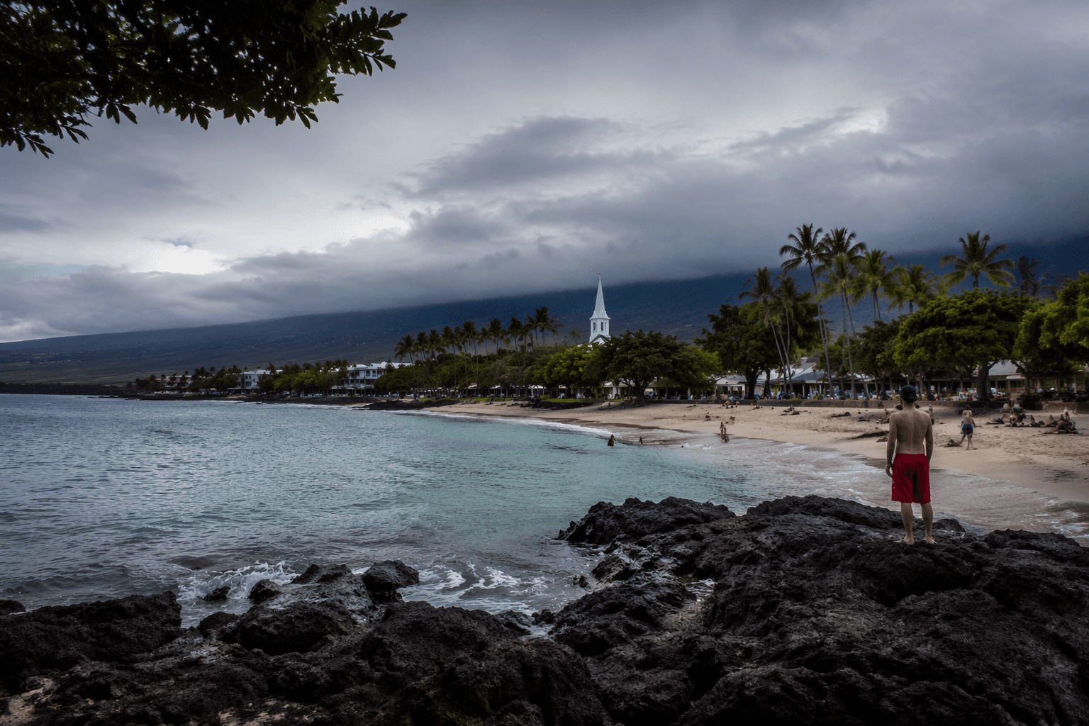
Someone headed miles offshore just to collect a reef water sample. That urgency captures what's at stake for West Hawaiʻi's reefs after the Kona low storms.
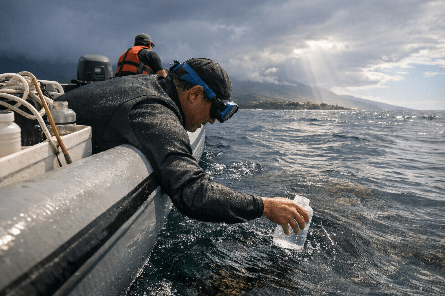
What began as a text chain among three University of Hawaiʻi researchers turned, within days of the March Kona low storms, into hundreds of collected ocean samples spanning the Big Island's coastline and beyond. The speed of the pivot mattered: the chemical signatures of storm runoff on nearshore reefs vanish quickly, and the window to capture them was already closing.
Sara Kahanamoku, Nyssa Silbiger, and Andrea Kealoha launched the push as floodwaters were still receding. Silbiger, an associate professor in the UH Department of Oceanography, described the stakes directly. "The coral reefs are incredibly important to the people here in Hawaiʻi, not just as a beautiful place to snorkel, but because they protect our coastlines. They provide us with food and sustenance, and the water quality has a direct impact on it."
Community volunteers, including divers, fishermen, and coastal residents, were trained on standardized protocols and deployed to river mouths, drainage channels, and coastal estuaries across Hawaiʻi Island, the sites most likely to absorb the heaviest runoff loads. In one moment that illustrated how far the network extended, Silbiger received a GPS pin from a participant miles offshore. "When I showed that to someone, they're like, 'Oh, someone put their GPS point in incorrectly,'" she said. "I was like, 'No, no. That person literally went out to sea and collected those samples and took bottles and brought them back.'"
All samples are being processed at Kealoha's UH lab, where the first analysis focuses on nutrient levels: nitrogen and phosphorus from fertilizers and sewage that can fuel algal blooms across reef systems. "If we see high nutrients, we know that there's probably a lot of stress on the reef," Kealoha said. No results have been released yet.
That data gap carries real weight for the fishing guides, dive operators, and paddle outfitters whose livelihoods track West Hawaiʻi's nearshore reef health. The March storms delivered unusually large freshwater and sediment loads to the coast. Those inputs can smother coral, elevate disease rates, and shift the microbial balance that healthy reefs depend on. Protected bays with less wave energy, the same calm waters that draw snorkelers and support nearshore fisheries, may prove most vulnerable once results come in.
Scientists plan to map which watersheds contributed the heaviest contaminant loads, where those loads persisted longest, and how quickly individual reef sites recovered. That geographic picture will direct resource managers toward the estuaries and upstream land-use practices most in need of intervention: erosion control, cesspool remediation, and stormwater infrastructure. Results will be made publicly available through an app where community volunteers can track findings from the samples they collected.
For the Big Island, where reef health is the economic backbone of West Hawaiʻi's tourism and fishing sectors, the campaign offers something more than raw data. Kahanamoku, Silbiger, and Kealoha built it as a replicable model, a blueprint for the rapid-response reef monitoring that increasingly severe Kona seasons will continue to demand.
This article was produced by Prism’s automated news system from verified source data, official records, and press releases, then run through automated quality and moderation checks before publishing. The system is built and supervised by the people who set the standards it runs under. Read our full AI policy.
Did this article answer your question?