$3.4 Million Boost Advances Leon River and Cowhouse Creek Study
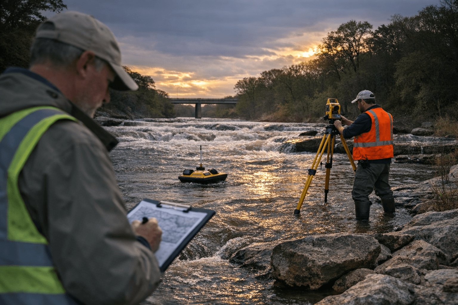
State funding of $3.4 million was announced Dec. 30 to expand a multi-county flood mitigation study for the Leon River and Cowhouse Creek watersheds, moving local planning from a survey to advanced predictive modeling. The investment aims to equip Coryell and Bell counties with long-term mitigation tools including early-warning systems, groundwater analysis, and actionable flood plans that affect infrastructure, public safety, and property management.
At a stakeholders meeting on Dec. 30, officials announced an additional $3.4 million from the Texas General Land Office to advance a regional flood mitigation effort covering Bell and Coryell counties. What began as a local survey has grown into a multi-million-dollar, multi-county study focused on predictive water models for the Leon River and Cowhouse Creek watersheds and related mitigation measures.
The project will develop predictive flood modeling, a coordinated flood mitigation plan, an early warning system, groundwater modeling and aquifer storage recovery. Texas A&M AgriLife and the American Conservation Foundation are leading the technical work with participation from state agencies and local stakeholders. The Bush School of Government and Public Service at Texas A&M will conduct interviews to document how weather and flooding affect local communities; officials asked local leaders and stakeholders to take part in that outreach.
Coryell County Judge Roger Miller called the funding "historic," saying the study lays a foundation to address long-standing flood risks. County officials framed the effort as regional and implementable, intended to move beyond one-off responses toward coordinated strategies that can be used across the watershed.
For residents and local governments, the study carries direct implications for public safety, land-use decisions and infrastructure investment. Predictive modeling and early-warning systems can shorten lead times for evacuations and emergency response, while updated groundwater analysis and aquifer storage recovery work could influence water supply planning and long-term resilience strategies. The mitigation plan under development is likely to inform how counties prioritize projects, pursue federal or state grants, and update floodplain management practices.
Institutionally, the project represents a partnership model that combines state funding with university research and nonprofit involvement, creating technical capacity that local governments alone may lack. That arrangement also raises governance questions residents should watch: how data and model results will be shared, how prioritized mitigation measures will be selected, and how costs and responsibilities will be allocated when projects move from planning to construction.
Officials emphasized that the work is intended to be long-term and community-rooted, offering tools such as early-warning systems and public education. Local leaders, landowners and residents should expect outreach from the Bush School and partner agencies as interviews and modeling progress, and should engage to ensure community experience and local priorities are reflected in final plans.
This article was produced by Prism’s automated news system from verified source data, official records, and press releases, then run through automated quality and moderation checks before publishing. The system is built and supervised by the people who set the standards it runs under. Read our full AI policy.
Did this article answer your question?