Boggy Draw prescribed burn to close trails, roads Sunday
Sunday’s 1,212-acre Boggy Draw burn will close a section of trail system through May 2, with smoke possibly drifting toward Highway 145 and Dolores overnight.
A 1,212-acre prescribed burn in Boggy Draw will put a section of the trail system off-limits starting Sunday, with smoke expected to be visible near Highway 145 and, overnight, in Dolores. For people heading into the hills northwest of town, the work turns a familiar weekend recreation area into an active fire-management zone.
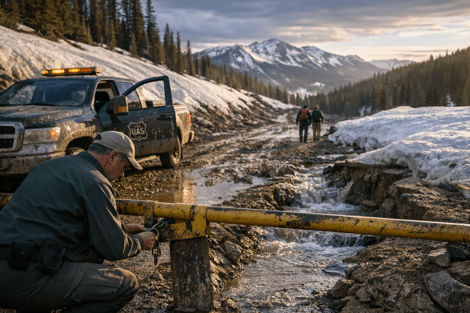
Montezuma County said the Dolores Ranger District is planning to burn Units 25A-C off Forest Service Road 527, or Boggy Loop Road, about 5 miles northeast of Dolores. The operation is expected to use both aerial and hand ignitions, and county officials said the burn should take one to two days if weather and smoke conditions are favorable. Caleb Schutz is listed as the fire management contact.

The U.S. Forest Service says the fire area closure will run from April 19 through May 2, closing a section of the Boggy Draw Trail System during prescribed fire operations. That means riders, hikers, hunters and anyone using forest access points in the Boggy Draw area will need to plan around restricted travel and changing conditions while the burn is underway.
Smoke is the other immediate concern. A Colorado Smoke Outlook warned that smoke from the burn may be visible near Highway 145 and could drain overnight into the canyon and reach Dolores. That is especially relevant for drivers and people with breathing issues, even with a planned fire, because smoke can settle after dark and move farther than expected in low-lying terrain.
Boggy Draw has seen this kind of work before. Prescribed burns there took place in October 2023, April 2024 and May 2025. A 2024 burn covered more than 1,100 acres in three burn units, including Little Bean Canyon, while a 2023 burn covered 1,376 acres and was visible from more than 30 miles away at its peak.
The latest burn also fits a wider regional push. The Bureau of Land Management says about 2,285 acres are anticipated for prescribed burns in Dolores, San Miguel and La Plata counties through May 2026 as southwest Colorado heads into a warmer, drier stretch with low snowpack and elevated fire concern. In Boggy Draw, the short-term disruption is meant to reduce the odds of a more dangerous wildfire later.
Sources:
Know something we missed? Have a correction or additional information?
Submit a Tip