Dolores County addressing office keeps roads, addresses and maps accurate
A wrong rural address can slow 911, deliveries and utility crews in Dolores County. The county’s mapping office keeps road data, new addresses and parcel locations aligned.
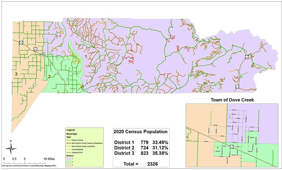
Dolores County’s addressing system is one of those public services most people only notice when something is off. A missing house number, a road that is mislabeled, or a parcel that does not match the map can ripple into 911 response, mail delivery, utility work and even the ability to find a remote ranch or home the first time.
Why the addressing office matters
The Dolores County Addressing and Mapping Office says its work includes the countywide re-addressing project, maintaining Dolores County road data, issuing new addresses and working with the Dolores County Board of County Commissioners and other entities on special projects. In a county where homes can sit far from town centers and access roads can be long, those tasks are not administrative details. They are the framework that lets deputies, fire crews, ambulance services, delivery drivers and utility workers reach the right place without delay.
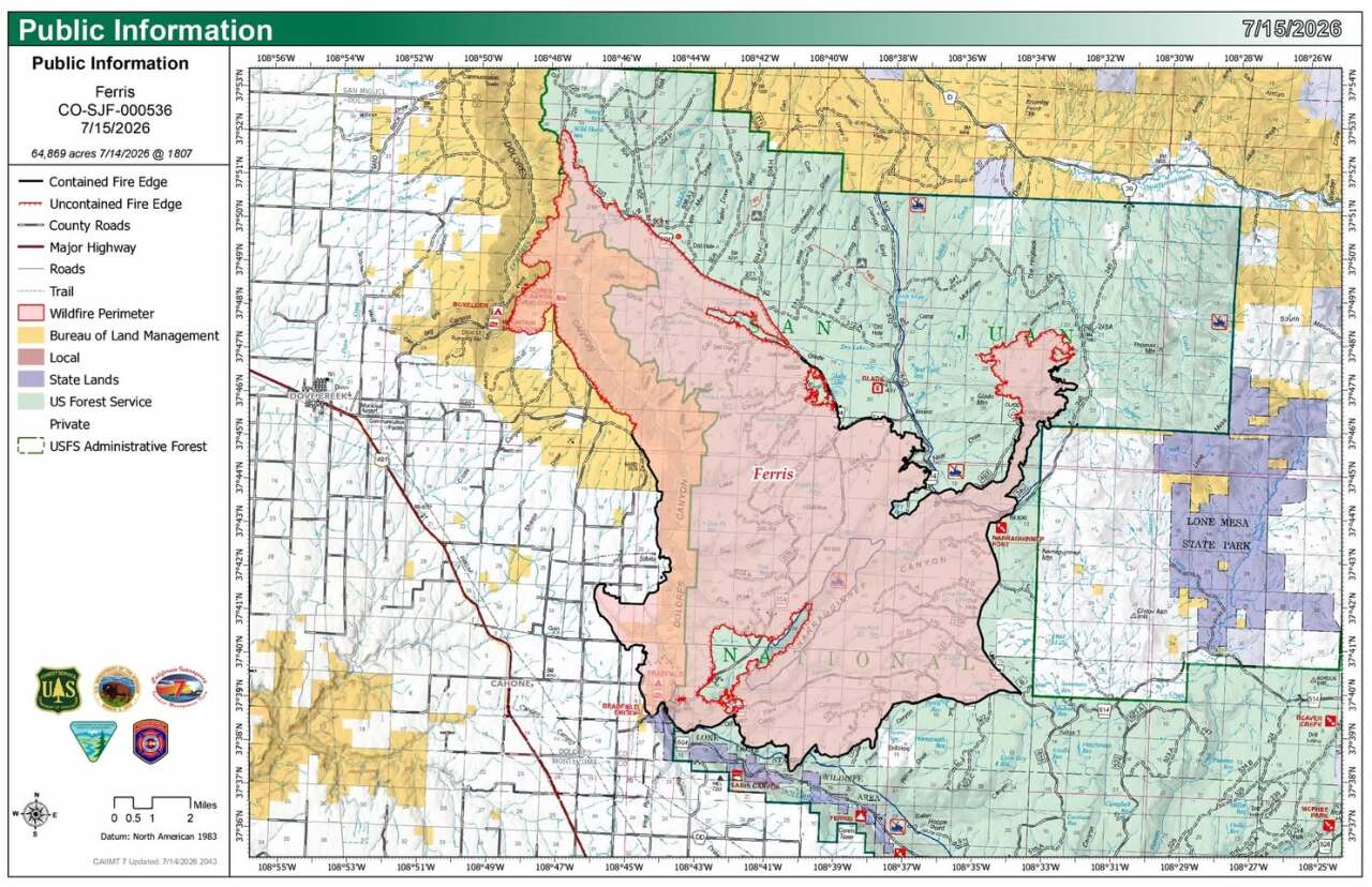
That is especially important in wildfire season and other emergencies, when location data becomes part of the response. Dolores County emergency-management pages have directed residents to evacuation check-in center and evacuation-zone map resources during fire incidents, showing how a clear map system supports public safety when roads, weather and access can change quickly.
What the office actually keeps current
The office is responsible for more than assigning a number to a driveway. Its road-data work helps keep county maps consistent, so that the same location can be found across dispatch systems, county records and planning documents. A countywide re-addressing project also helps resolve places where older directions, private road names or informal descriptions no longer match how emergency services and mail carriers need to find a property.
That matters for rural navigation because an address is an operational tool, not just a label. A correct address can help a sheriff’s deputy reach a home on the first pass, help a package carrier avoid circling back through remote roads, and help county staff identify the right parcel when someone is building, buying, selling or checking access for a property.
When to contact the office
Property owners should reach out if a new build needs an address, if a road or driveway location appears wrong on county records, or if a parcel is difficult to identify on the map. The office is also the place to call when road data or a property access point does not match what residents are seeing on the ground, especially in areas where more than one route might appear to lead to the same place.
- a new address for a home or structure
- confirmation of how a county road is identified
- help checking whether a parcel location matches the county map
- guidance on addressing tied to a project that changes access or uses a new approach road
In practical terms, the office can help when you need:
The county’s role here is to keep the record clean before a small mismatch turns into a bigger problem for emergency response or daily deliveries.
How the county system connects to bigger maps
Dolores County’s addressing work does not sit in isolation. A Colorado public-addresses ArcGIS Hub dataset says public address information depends on an ongoing relationship between counties, municipalities and the State of Colorado to provide accurate updated address information. That means local corrections in Dove Creek can affect how broader state mapping systems read a location.
The federal side matters too. The U.S. Census Bureau’s TIGER/Line materials include a Dolores County, Colorado address-range feature dataset, which shows that county address and road information feeds into national mapping infrastructure. In other words, when a local road is named or an address range is corrected, that work can echo far beyond county lines.
Why parcels and land records depend on clean maps
Accurate addressing also supports land ownership research and property transactions. Acres says its Dolores County plat map includes 3,641 parcel records and 21 sold land records, with a median price per acre of $2,066. Those figures show how much property activity depends on precise parcel boundaries, road references and address data when people are comparing land, checking ownership or sizing up a purchase.
That is why addressing and mapping are tied closely to land use and county administration. Dolores County’s website separates Road and Bridge, Assessor, Public Health, Extension Office and Emergency Management pages, which reflects how location data moves through several county services at once. The address office is part of that ecosystem, not a standalone file cabinet.
How to reach the office
The county lists Amber Fisher as the contact on the Addressing and Mapping page. The office is at the Dolores County Public Service Center, 8477 Road 7.7, PO Box 426, Dove Creek, CO 81324, and the phone number is 970-677-2700.
For broader county business, the contact page lists offices at 409 N. Main Street, Dove Creek, CO 81324, with office hours Monday through Thursday from 7:00 a.m. to 4:30 p.m. That makes it easier for residents to know where to start if a property issue touches more than one office, such as addressing, roads or assessment.
The local payoff of accurate maps
In a rural county, a correct address can determine whether a fire crew finds a home quickly, whether a delivery lands on the right road and whether a parcel can be identified without confusion. Dolores County’s addressing and mapping work keeps those pieces lined up so the county can respond, route and record locations the same way every time.
This article was produced by Prism’s automated news system from verified source data, official records, and press releases, then run through automated quality and moderation checks before publishing. The system is built and supervised by the people who set the standards it runs under. Read our full AI policy.
Did this article answer your question?