Dolores County Offers Boating, Hiking, Archaeology, and Year-Round Adventure
McPhee Reservoir's 50+ miles of shoreline and Boggy Draw's 75-mile trail network make tiny Dolores, Colorado a surprisingly big outdoor destination.
Outside Magazine called the town of Dolores "adventure base camp for the whole family," and the description holds up. Tucked into a scenic valley in Southwest Colorado, this community of about a thousand residents sits at the intersection of the San Juan National Forest, McPhee Reservoir, and the Dolores River corridor. Despite being only three blocks wide, Dolores punches well above its weight as an outdoor destination, offering boating, fishing, whitewater, hiking, mountain biking, archaeology, and cultural tourism within minutes of its front door.
McPhee Reservoir: The Big Water Anchor
With over 50 miles of shoreline, McPhee Reservoir is the largest reservoir on the San Juan National Forest and ranks among Colorado's biggest lakes. That scale translates directly into recreation options: McPhee supports boating, water skiing, sailing, canoeing, kayaking, fishing, paddleboarding, and swimming. Several coves and branches are accessible only by boat, offering a genuine backcountry feel on open water, while developed day-use areas remain reachable by vehicle.
McPhee has two large recreation areas, McPhee and House Creek, both equipped with boat ramps, fish cleaning stations, and campground facilities. Camping is substantial: 71 campsites spread across two loops, with picnic areas and flush toilets. Of those sites, 24 have electric hookups, 12 are walk-in tent sites, and 50 are reservable in advance through the reservation system, with the remainder available first-come, first-served. Groups have a dedicated option as well. The McPhee Group Area offers four group campsites and features volleyball posts, a ball field, and horseshoe pits (bring your own equipment), and the sites all have beautiful views of the San Juan National Forest.
Docs Marina, open from April through October, provides boats, supplies, fishing tackle and rods, depth finders, and BBQ grills. Meal service begins at 11 am and the marina is closed Mondays and Tuesdays, so plan accordingly.
Anglers will find a wide spread of species. From the bank or a boat, the reservoir holds Rainbow Trout, Kokanee Salmon, Bass, and Panfish, with walleye, crappie, northern pike, and perch also present. The reservoir is stocked with both warm and cold-water fish and is open for fishing year-round.
Anyone bringing a motorized or trailered watercraft should note that ANS (Aquatic Nuisance Species) inspection is required, with inspection stations open May through November.
Below the Dam: A Tailwater Fishery Worth Seeking Out
Below McPhee Dam, the Lone Dome Recreation Area offers one of the more specialized fishing experiences in the region. This 12-mile stretch running from McPhee Dam to Bradfield Bridge is designated catch-and-release, with artificial flies and lures only. The season runs April through November. It is a quieter, more technical experience than the reservoir itself, drawing fly anglers who want the solitude of moving water rather than open-lake fishing.
Trails at McPhee: On Foot, on a Bike, and on Horseback
Two trails directly at McPhee stand out for day visitors. The Sage Hen Trail is a 13-mile loop around the northwest sector of the lake, open to hikers, cyclists, and horseback riders. Access is off Road X; look for the second red diamond gate sign on the left past the cattle corral. Next to the boat ramp, the Can Do Trail leads to the 360-degree Ridge Point Overlook, complete with interpretive signs explaining the surrounding landscape. The path continues to the walk-in tent campsites, passing sandstone cliffs along the way. For cyclists, the McPhee/House Creek Bike Route follows the House Creek drainage on a mix of paved and gravel roads.
Boggy Draw: 75 Miles of Trails Outside of Town
Just outside Dolores, the Boggy Draw Trail System offers 75 miles of well-maintained trails weaving through meadows and forests at varying levels of difficulty. The system welcomes hikers, mountain bikers, motorcyclists, horseback riders, and off-road vehicles under 50 inches wide. The Dolores Ranger District maintains both the Boggy Draw Trail and the Boggy Draw OHV Trail, with permitted activities on each including hiking, biking, OHV use, horseback riding, and winter sports.
Those trails are part of a much larger landscape. The Dolores Ranger District manages 597,373 acres of the San Juan National Forest across Dolores, Montezuma, and San Miguel counties, stretching west of the La Plata Mountains and north to Lizard Head Pass. District Ranger Nick Mustoe oversees operations out of the Dolores Public Lands Office, where the district is co-located with the BLM Tres Rios Field Office. The district's recreation site inventory is extensive, covering trails such as Bear Creek, Burnett Creek, Aspen Loop, Big Al, and Burro Bridge, each with its own combination of permitted uses from fishing and hunting to winter sports and outdoor education.
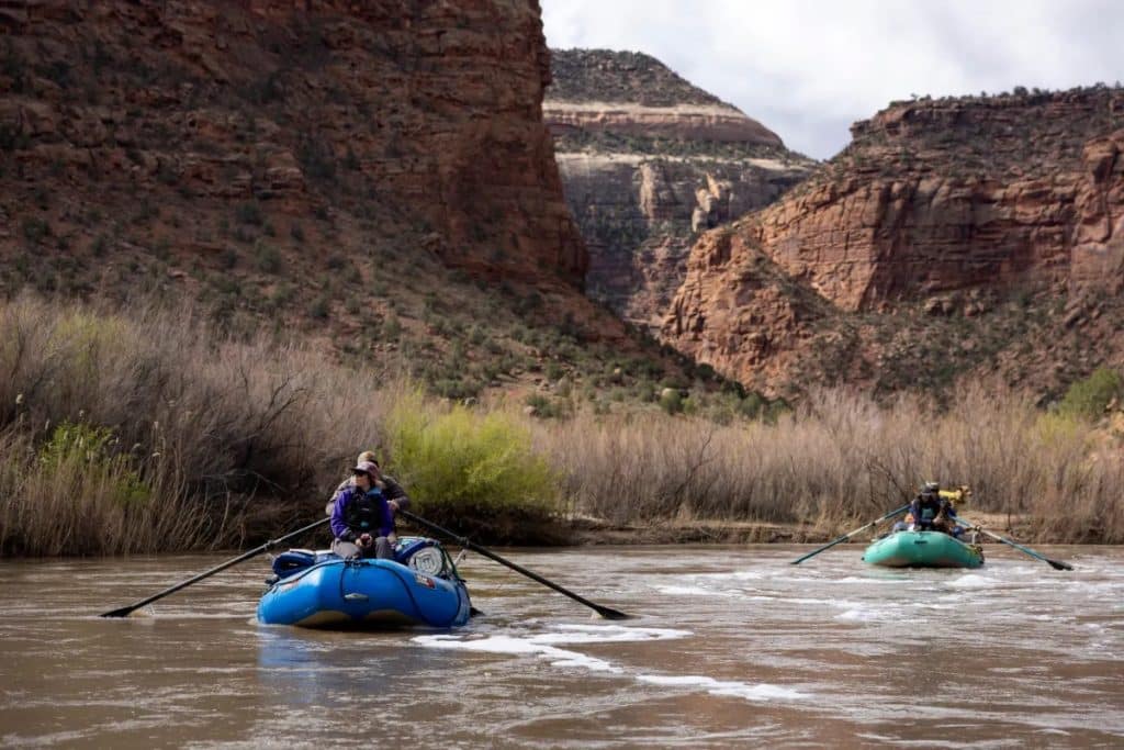
The Dolores River Corridor: Floating, Fishing, and a Locals' Beach
Riverside Park in Dolores serves as both a relaxation spot and the primary put-in point for floating the upper Dolores. The park offers river entry for kayaks, rafts, and inner tubes, and it is a popular lunch and fishing stop as well. A short float from Riverside Park leads roughly 1.5 miles downstream to the Beach, located across from Joe Rowell, or another half-mile further to the mouth of McPhee Reservoir.
The Beach is a locals' institution. It has easy access for swimming and fishing, and boaters and inner tubers frequently use it as the finish point for upper Dolores floats. The site carries no amenities, so bring your own chairs, blankets, and tables. The Dolores River corridor also draws fly anglers, with some of the best fly fishing in Southwest Colorado found along stretches that run directly through town.
Canyons of the Ancients: Archaeology on a Massive Scale
Southeast of town, Canyons of the Ancients National Monument represents one of the densest concentrations of archaeological sites in the country. The monument is home to over 6,000 archaeological sites and encompasses an enormous stretch of terrain, preserving well-preserved remnants of Native American cultures, ruins of homes and shrines, and monuments dating to the era of the ancient Puebloans. Isolated canyons with intact ruins are accessible by trail, and the monument accommodates off-roading, biking, camping, and hiking alongside its archaeological mission.
Nearby cultural draws include Crow Canyon Archaeology Center, Mesa Verde National Park, and Sand Canyon, each offering a different lens on the ancestral Pueblo history of the region. Dolores itself has a Railroad Museum where Pueblo architecture and artifacts are on display, adding a local anchor to what is otherwise a regional archaeology circuit.
The Town Itself
Dolores is genuinely small but well-equipped as a basecamp. Shopping covers a mix of boutiques, galleries, and antique shops with locally made goods and outdoor essentials. Lodging spans riverfront cabins, cozy motels, vacation rentals, and in-town stays. The Dolores River runs along the edge of town, the San Juan National Forest begins at the outskirts, and McPhee is a short drive away.
For a county this small in population, the range of what Dolores County offers is difficult to match in Southwest Colorado: a major reservoir with a full-service marina, a tailwater fly fishery, 75 miles of multiuse trails, a river corridor built for floating, and an archaeological landscape that draws visitors from across the country. Each season brings a different version of the same destination.
Know something we missed? Have a correction or additional information?
Submit a Tip

