Dolores County outdoor trips need road, land access checks before you go
Before you head toward Rico or Dove Creek, check road status, land ownership, and fire restrictions. In Dolores County, a wrong turn can mean a closure, a trespass issue, or a stranded vehicle.
Start with the access question, not the destination
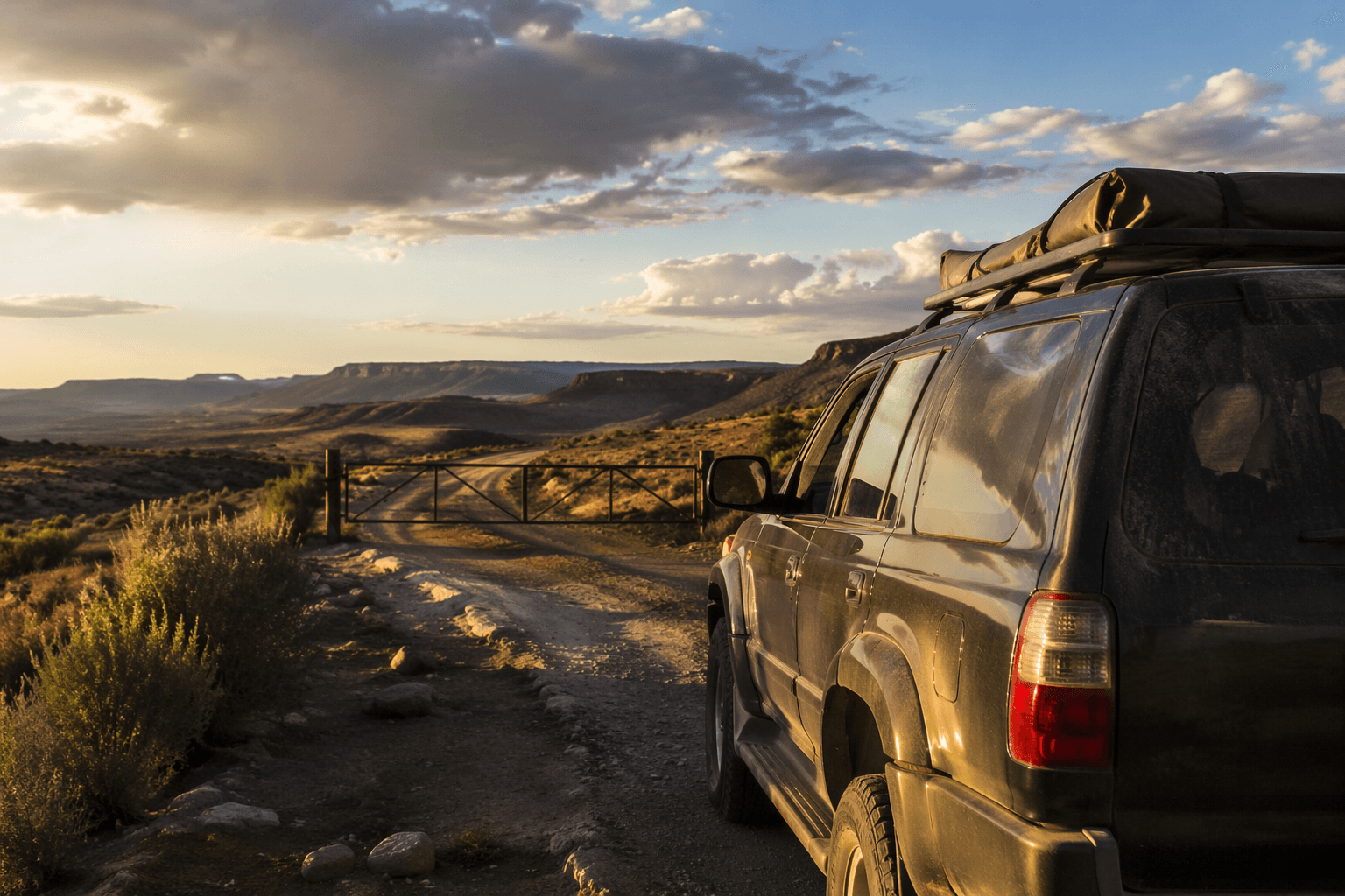
Before you point a truck toward a campsite, trailhead, fishing hole, or hunting area in Dolores County, check what kind of land the route crosses and who manages it. Around Rico and Dove Creek, that question matters as much as the weather, because a road that looks straightforward on a map may cross private land, shift from county to federal ground, or sit under different rules depending on whether it falls under the Bureau of Land Management, the Forest Service, a state agency, or a local jurisdiction.
That patchwork is exactly why last-minute planning pays off here. In this part of southwestern Colorado, public access is a real asset, but it is not a guarantee that every dirt road is open, legal, or passable. The safest assumption is that conditions can change from one weekend to the next, and that a route that worked last weekend may be muddy, blocked, or restricted now.
Know which agency controls the ground
The San Juan National Forest covers about 1.8 million acres in southwestern Colorado, and the Dolores Ranger District alone manages 597,373 acres across Dolores, Montezuma, and San Miguel counties. At the same time, the BLM Tres Rios Field Office oversees more than 600,000 acres of public land and more than 2.6 million acres of federal mineral estate in southwestern Colorado. Its travel-management planning area includes Dolores County.
That split matters on the ground. The Dolores Ranger District is co-located with the Tres Rios Field Office at the Dolores Public Lands Office in Dolores, which tells you something important about this county: land status can be complicated, and the same access question may involve more than one agency. If you need visitor information, permits, passes, or maps, that office is the place to start before heading out.
For practical planning, think in terms of decision points:
- Is the area on Forest Service land, BLM land, private property, or county road?
- Does the route cross more than one type of land?
- Are there posted gates, closures, seasonal restrictions, or fire limits?
- Is your intended parking spot or turnout actually legal access?
Those questions can decide whether a trip is smooth or a dead end.
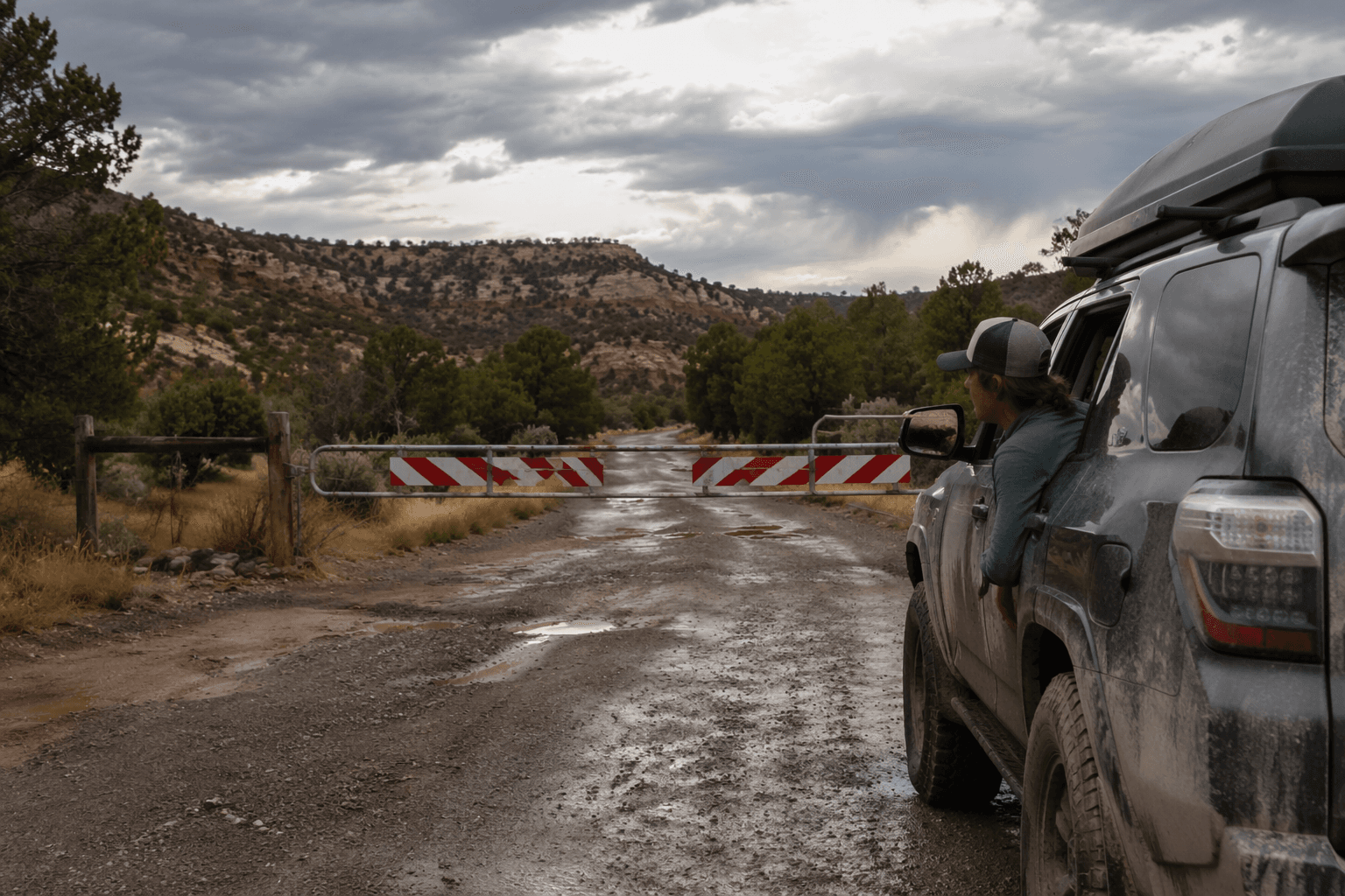
Check road status before you trust the map
The Forest Service says road status tables are updated as districts relay information, but the field can change faster than a website refresh. Any road can be blocked by downed trees or snow at any time, and the agency also warns that the Forest Service and counties do not rescue stranded vehicles. That warning should shape every trip into the backcountry and every drive onto a long dirt route.
Seasonal closures are common for a reason. The Forest Service says many roads close at certain times to protect drivers, wildlife, and road surfaces. Wet, muddy areas after snowmelt are especially vulnerable, and vehicles can cut ruts that last long after the road dries out. In practical terms, low-clearance vehicles and even high-clearance rigs can get into trouble quickly if the route has not been checked that day.
A useful habit is to treat road status as a same-day question, not a weekend-plan question. A route that looked fine on Friday can be impassable by Saturday afternoon if weather turns, traffic churns up soft spots, or maintenance changes access.
Weather and fire rules can change the day’s plan
In Dolores County, weather is not just a comfort issue. Rain, snowmelt, and lingering snow can turn a dry dirt road into a slow, muddy track or a closed route, and higher country around Rico can shift conditions fast. The Forest Service specifically says to always check the weather forecast before setting out, because storms and snow can alter access without much warning.
Fire restrictions are another moving part. San Juan National Forest Stage 1 fire restrictions took effect Friday, May 22, 2026. That matters for anyone planning to camp, cook, or stop near public land during summer travel. Even when roads are open, a fire restriction can change what you can legally do once you get there, so the trip plan needs to cover both access and on-site use.
Dove Creek access is a good example of how local conditions work
Mountain Sheep Point Recreation Site, also known as Dove Creek Pumps, sits about 6 miles east of Dove Creek along gravel and dirt county roads. The BLM says the site is used primarily as a river access point during boatable releases on the Lower Dolores River. That means the road is not just about getting from town to a recreation area, it is tied to river conditions and release schedules that can make the site much busier at certain times.
The local lesson is simple: access near Dove Creek can be use-dependent as well as weather-dependent. If you are headed there for fishing, river access, or a day trip, check whether the road is passable, whether the site is active because of a release, and whether parking or traffic will be heavier than usual. A quiet weekday route can look very different during a release window.
Use official maps before you cross private land by mistake
One of the easiest ways to avoid a bad trip is to verify the route against legal access data before you leave. The BLM provides Public Lands Access Data and a Tres Rios travel-management map to help identify legal public access routes, which is especially useful in a county where roads may cross private and public land in short stretches. Those tools are not just for bureaucratic fine print, they are the difference between a legal access route and a trespass problem.
That is especially important for residents trying to reach campsites, hunting areas, trailheads, or river access points. A road that looks public because it is open, graded, or commonly used may still cross private property or end at a gate. Maps and signs should be checked together, not separately.
What to do before you leave home
The most reliable trips in Dolores County start with a short checklist:
- Check the forecast for the exact area you plan to drive or hike.
- Review current road status, not just a printed map.
- Confirm which agency manages the land and what rules apply there.
- Look for seasonal closures, fire restrictions, and posted access limits.
- Carry enough fuel and water for delays.
- Share your route with someone who can notice if you do not return on time.
- Assume help may be limited if a vehicle gets stuck or disabled.
That last point is not theoretical. The Forest Service has made clear that stranded vehicles are not something the agency or counties will recover for you. In rural country like this, self-sufficiency is part of safe access.
The bottom line for Dolores County
In a county with long dirt roads, public lands, and deep outdoor use, the hard part is not finding a place to go. It is confirming that the route is legal, open, and safe on the day you leave. Around Rico and Dove Creek, land status, weather, road surface, fire rules, and seasonal closures can all change whether you reach your destination at all.
The public lands are still there, but the smart way to use them is to treat access as a daily check, not a standing promise.
This article was produced by Prism’s automated news system from verified source data, official records, and press releases, then run through automated quality and moderation checks before publishing. The system is built and supervised by the people who set the standards it runs under. Read our full AI policy.
Know something we missed? Have a correction or additional information?
Submit a Tip