Dolores County road map explains addresses, rights of way and public access
A Dolores County address can point emergency crews to the right door, but only if you know how mile markers, road numbers and public-access rules work.
Finding a home in Dolores County often depends on reading the county’s map the way emergency crews, delivery drivers and utility workers do. State-highway addresses are tied to the closest mile marker, while county numbers rise from north to south and west to east. That system reaches far beyond a mailbox: it shapes 911 response, package delivery, utility service, county records and the speed with which someone can find a remote house or ranch road.
How to read a Dolores County address
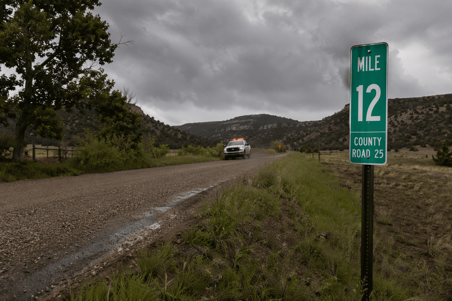
On the county road map, a highway address is anchored to the nearest mile marker, so the number is meant to tell you where a property sits along that corridor. County addresses follow a different pattern, increasing as you move south and east, which gives the numbering system a clear geographic logic even in a place with long distances between homes. In practice, that means a road number or address can tell you more than a posted street sign when a visitor is trying to reach a driveway in the dark or a responder is racing to a medical call.
That matters in a county where homes are spread between Dove Creek, the rural areas outside town and the Rico/Dunton area. The county website describes about 700 people living inside Dove Creek, about 880 outside city limits and about 300 in the Rico/Dunton area, while the 2020 census counted 635 people in Dove Creek. In a county this dispersed, an address has to do the work of a landmark, a map pin and a legal identifier at the same time.
Who manages the system
The Dolores County Addressing and Mapping Office is the department that runs the countywide re-addressing project, maintains county road data and issues new addresses. It also works with the Board of County Commissioners and other entities on special projects, which places the office at the center of both routine address maintenance and larger county planning questions. If a location needs to be matched to official records, this is the office that keeps the numbering system aligned with the county’s road inventory.
That institutional role matters because addresses are not just labels on envelopes. They connect a parcel to county records, school records, utility accounts and emergency dispatch systems, and they help keep new development from drifting out of sync with the road network around it. When a road name changes, a driveway moves or a parcel is split, the addressing system has to keep pace or the result can be confusion for everyone trying to reach the property.
A simple way to think about it is this: the map is the county’s shared language for location. If the number on a house, gate or driveway does not match the county’s current records, the home can become harder to find for first responders, service providers and anyone who relies on an exact location.
Public access is not automatic
The county road map also draws a bright line between a mapped route and a route that is open to the public. It says the map should not be read as limiting the Board of County Commissioners from recognizing public roads, public rights-of-way or public easements, and it sets rights-of-way at generally 60 feet unless the board decides otherwise. Just as important, it tells people to contact local agencies to determine whether a road is open for public use.
That warning matters because a drivable track, a county road number and a public right-of-way are not always the same thing. A route may exist on paper, may be part of a right-of-way, or may appear passable on the ground, yet still raise questions about maintenance, seasonal closure or public access. For residents and visitors alike, the safest assumption is not that a route is open, but that it needs to be checked before someone commits to it.
The county’s boards-and-commissions materials reinforce that road access is a live local issue, not a dry mapping note. Those pages reference road-use planning materials tied to the Dolores Canyon Solar project and a traffic-routing map, showing that the county continues to treat access, travel patterns and public use as active governance concerns. In a county with open country, private parcels and varied terrain, those decisions influence how people reach homes, work sites and recreation areas.
Seasonal roads can change the route
The clearest example on the county road page is the Dolores/Norwood Road, Road 31. The county says it is not maintained from November 15 to May 15, and it tells residents to verify with Dolores County Road & Bridge whether roads are open or closed because of seasonal conditions. That is not a minor detail in a county where winter weather, elevation and distance can all change the safest route in a matter of hours.
Road maintenance rules also help explain why a road number can be more useful than a casual description like “the back road” or “the shortcut.” If Road 31 is not maintained for half the year, then access, turnaround time and even emergency response planning change with the season. A person trying to reach a remote home, a plow crew clearing a route or a dispatcher guiding help to an address all need the official designation, not a guess.
- a house, driveway or parcel has been newly built or altered
- a road name, road number or access point has changed
- a resident cannot match an address to county records
- there is any question about whether a route is public, seasonal or closed
When an address or road status should be checked, the practical trigger is simple:
Why the system matters here more than elsewhere
Dolores County has the kind of geography that makes location systems do real work. The county says it covers about 1,064 square miles, while Census Bureau profile data lists 1,067.2 square miles of land area. Elevation runs from about 5,900 feet in Disappointment Valley to 14,046 feet on Mount Wilson, and the county sits beside La Plata County, Montezuma County, San Juan County in Utah, San Juan County in Colorado and San Miguel County in Colorado.
The population remains small even as it has grown slowly. Census Bureau data shows 2,064 residents in 2010 and 2,326 in 2020, while the county website previously placed the figure at 1,890 in 2005. The county seat is Dove Creek, and the combination of scattered settlement, high country, long road distances and seasonal access rules makes the addressing system a public-safety tool as much as an administrative one.
In Dolores County, an address is not just where the mail goes. It is the framework that helps define who can get there, how fast they can arrive and whether the route is open at all.
This article was produced by Prism’s automated news system from verified source data, official records, and press releases, then run through automated quality and moderation checks before publishing. The system is built and supervised by the people who set the standards it runs under. Read our full AI policy.
Know something we missed? Have a correction or additional information?
Submit a Tip