Dolores County Water Supplies at Risk as Snowpack Hits 38 Percent of Normal
Colorado snowpack crashed to 38% of normal after a March heat dome shattered 1,500+ records, putting McPhee Reservoir inflows and Dove Creek irrigation water at serious risk this summer.
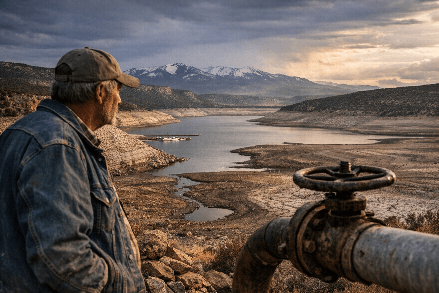
McPhee Reservoir receives every drop of its water from mountain snowpack. As of March 25, that snowpack across Colorado measured just 38 percent of normal, driven down by a heat wave that shattered more than 1,500 temperature records across the U.S. West and accelerated the seasonal melt weeks ahead of schedule.
The timing matters for Dolores County in a specific way: March is when snowpack normally builds toward its late-March to early-April peak before a gradual melt replenishes McPhee through May and June. Instead, an anomalous heat dome arrived before that peak was reached, pushing temperatures in multiple locations past typical April readings. Dr. Zachary Labe, a climate scientist at Climate Central, described the event as "one of the strongest, most unusual heat domes to impact the Lower 48 U.S. in a very, very long time," and emphasized that it arrived unusually early in the season.
The consequences reach directly into McPhee's operations. The reservoir, managed by the Bureau of Reclamation alongside the Dolores Water Conservancy District under general manager Ken Curtis, delivers irrigation water to roughly 28,000 acres of full-service land in Montezuma and Dolores counties, including fields around Dove Creek, and supplies municipal water to Dove Creek, Cortez, and the Ute Mountain Ute community at Towaoc. Annual inflows to McPhee have averaged 327,000 acre-feet over the past 30 years; in the drought year of 2002, that total collapsed to 79,757 acre-feet. With snowpack already at 38 percent of normal before the seasonal peak even arrived, this year's inflow trajectory is tracking far below that long-term average.
Early melt creates a two-stage problem for downstream users. In the short term, unusually warm temperatures can push a brief surge of meltwater into the Dolores River and toward McPhee, temporarily inflating inflow numbers. But that burst depletes the snowpack faster, leaving little reserve for July and August when agricultural demand peaks. For farmers in and around Dove Creek, the practical risk is curtailed allocations by midsummer if April and May precipitation does not rebound substantially.
Elevated wildfire danger compounds the water stress. A depleted snowpack translates to lower soil moisture across Dolores County's forests and rangeland by late May, raising ignition risk during a fire season that already runs longer than it did a generation ago, with consequences for the county road system that serves as supply lines for fire suppression.
Three indicators will define the next 60 to 90 days. Weekly SNOTEL readings for the San Miguel-Dolores-Animas-San Juan basin, which captures snowpack in the mountains feeding McPhee, will show whether melt-out is accelerating or stabilizing. Daily inflow data for McPhee, tracked through the Colorado Division of Water Resources gauge on the Dolores River below the dam, will signal when the snowpack is effectively spent. And Bureau of Reclamation projected release schedules will determine downstream flows on the Dolores River, shaping both whitewater runs below McPhee Dam and the cold-water trout habitat that anchors much of the river corridor's recreation economy.
Whether late-season precipitation closes the gap remains the central uncertainty. Without it, Dolores County enters summer with the thinnest hydrological cushion it has seen in years.
This article was produced by Prism’s automated news system from verified source data, official records, and press releases, then run through automated quality and moderation checks before publishing. The system is built and supervised by the people who set the standards it runs under. Read our full AI policy.
Did this article answer your question?


