Dove Creek guide highlights public lands and nearby Dolores River Overlook
Dove Creek is more than a pass-through, with the Dolores River Overlook just over 10 miles away and public lands defining almost every trip through the county.

Dove Creek as a real basecamp
Dove Creek works best when you think of it as a launch point, not a layover. As the county seat of Dolores County, the town sits at the center of a landscape where public land, long distances and small-town services shape how people move, camp and explore. The Town of Dove Creek says about 60% of the county is public land managed by the Bureau of Land Management and the U.S. Forest Service, which makes the town a practical place to orient before heading out.
That role is rooted in the town’s history. Dove Creek became incorporated on July 10, 1939, and the 2020 census counted 635 residents there, out of 2,326 in Dolores County as a whole. Dolores County itself was created in 1881, Rico was the original county seat, and the seat moved to Dove Creek in 1945. In other words, the town is small, but it carries the county’s civic weight.
A county built around open land
Dolores County is not a compact place, and the terrain tells you why travelers need a basecamp mindset. The Town of Dove Creek describes the county as stretching from Disappointment Valley at 5,900 feet to Mount Wilson at 14,046 feet, across 1,064 square miles of mountains, mesas and narrow valleys. That range of elevations helps explain why a short drive can take you from farm country into high-country views and then back toward canyon country.
Public lands are not a side note here. The Dolores Ranger District of the San Juan National Forest manages 597,373 acres across Dolores, Montezuma and San Miguel counties, while the BLM Tres Rios Field Office oversees more than 600,000 acres of public land and more than 2.6 million acres of federal mineral estate in southwestern Colorado. Together, those numbers show how deeply federal land management is woven into the county’s day-to-day geography and economy.
For locals, that matters because land access affects travel patterns, outdoor use and even where people stop for supplies. For visitors, it means a trip to Dove Creek is not just about getting through town. It is about understanding where the next trail, overlook or camp spot fits into the larger map.
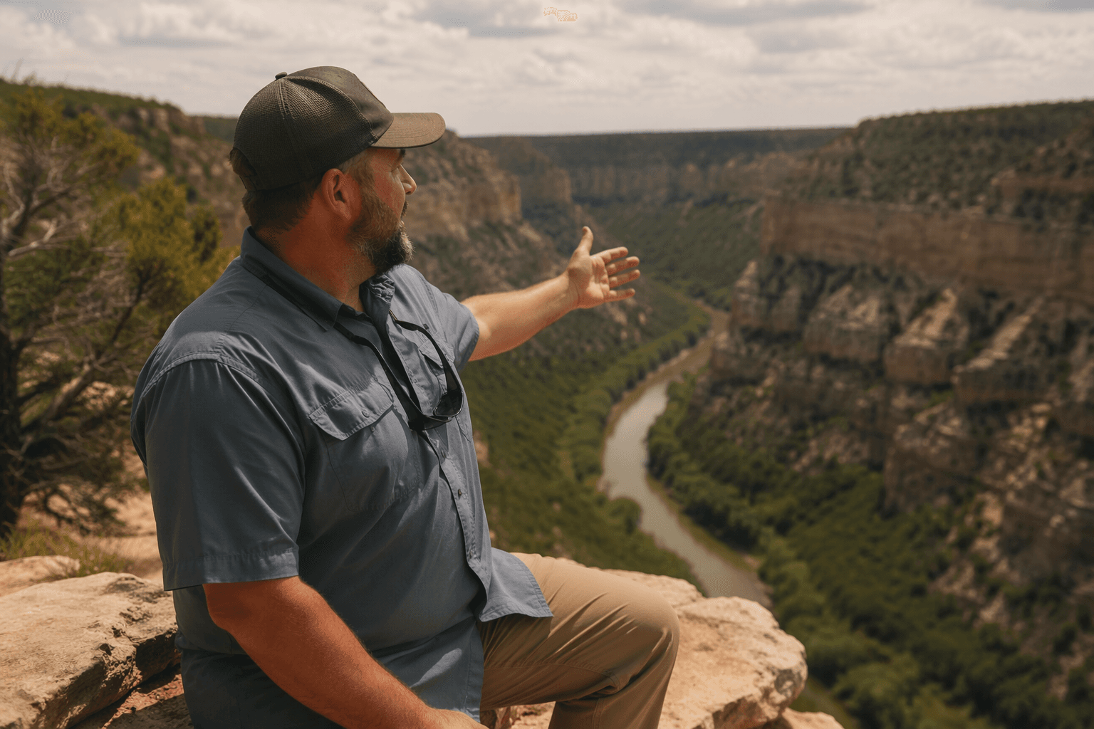
What you can actually do at the Dolores River Overlook
The Dolores River Overlook is the clearest example of why Dove Creek belongs on an itinerary. It sits just over 10 miles from town, close enough for an easy side trip, but far enough to feel like a reward after leaving the highway. BLM describes it as a short walk from the parking area to the end of the ridge, which makes the overlook accessible without requiring a long hike.
The site is also more than a viewpoint. BLM says it has six individual walk-in camp and picnic sites, one walk-in group site and a vault restroom at the parking area. That means it can serve as a scenic stop, a lunch break, a simple overnight base or a small gathering place for people heading into the Dolores River Canyon country.
Because the overlook is a walk-in site, travelers should plan for a little carrying and a little settling in. The parking area and vault restroom are useful for a quick stop, but the setup also encourages visitors to slow down and use the ridge as a place to take in the landscape rather than rush past it. For a county defined by distance, that is a meaningful feature.
How Dove Creek fits into a longer public-lands trip
If the Dolores River Overlook is the near-term destination, Dove Creek is where the rest of the route comes together. The town’s visiting information frames it as the place where county identity, public land and travel logistics meet. That is especially important in a county where the public lands are not just scenic backdrops but the framework for recreation, access and local life.
Canyons of the Ancients National Monument adds another layer to that picture. The monument encompasses more than 174,000 acres of BLM land and was designated on June 9, 2000 to protect cultural and natural resources. The visitor center near Dolores helps anchor that broader regional story, showing how archaeology, tourism and land stewardship are tied together across the county and beyond.
Taken together, the county’s open lands give Dove Creek its practical value. A visitor can stop in town, understand the terrain, and then decide whether the day should go toward the Dolores River Overlook, a longer public-lands drive or a broader regional route through canyon and mesa country. That is the difference between stumbling through Dolores County and using it well.
A town with an agricultural identity and a civic role
Dove Creek is also known for something more local than land access. It is widely identified as the self-proclaimed Pinto Bean Capital of the World, and that agricultural identity still helps shape how the town presents itself to outsiders. The result is a place that is both functional and memorable: a county seat with civic responsibilities, a farming community with a distinct brand, and a stopping point for travelers who need to understand the county before heading deeper into it.
That combination has economic value. A town that makes itself legible to visitors can capture fuel stops, meals and overnight stays that might otherwise disappear to the next county. In a rural place where distances are large and services are limited, simply knowing where the county seat is can change how a trip unfolds.
The bigger lesson is that Dove Creek’s visitor information is not decorative. It reflects the county’s real structure, where public lands, small populations and long travel times are part of everyday life. For Dolores County, that makes the town not just the administrative center, but the most useful starting point for seeing what the county actually is.
This article was produced by Prism’s automated news system from verified source data, official records, and press releases, then run through automated quality and moderation checks before publishing. The system is built and supervised by the people who set the standards it runs under. Read our full AI policy.
Know something we missed? Have a correction or additional information?
Submit a Tip