McPhee Reservoir, Dolores River and Forest Access: Seasonal Safety Guide
McPhee Reservoir, the Dolores River and San Juan National Forest access change with the seasons; check agency pages and gauges before travel or recreation to stay safe.
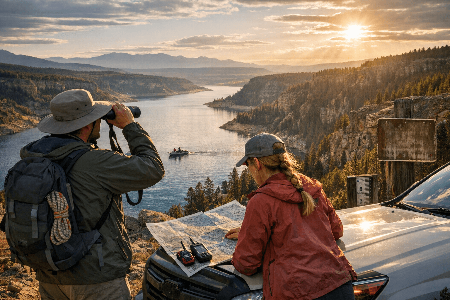
McPhee Reservoir and the Dolores River drive irrigation, livelihoods and recreation across Dolores County, but seasonal changes in reservoir levels, river flows and forest access create real safety and economic impacts for residents. Managed releases from the Dolores Project affect shoreline access, boat ramps and downstream flows; winter and shoulder-season weather often bring lower access and unpredictable currents that require planning.
McPhee Reservoir functions as both a water supply for irrigation and a recreation area for boating and fishing. Reservoir-level changes and scheduled releases can expose mudflats, change shoreline access rules and alter launch conditions at boat ramps. For reservoir conditions and official reservoir-level information, consult Bureau of Reclamation pages for McPhee and contact the agencies that manage the Dolores Project before hauling a boat or planning shoreline activities. Community water managers rely on release timing to service farms and businesses; unexpected changes can affect irrigation schedules and local contractors.
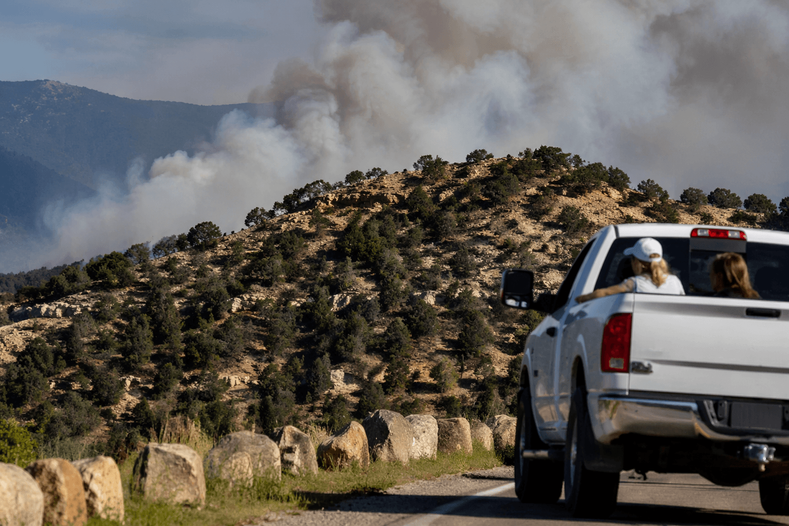
River recreation in the Dolores River canyon requires attention to flow variability. Popular access points used by Dolores County residents and visitors become hazardous at very high flows and can be difficult to reach during winter closures. Variable winter and shoulder-season flows increase the risk for anglers, rafters and anyone crossing unimproved river access roads. Local boating groups and Dolores River advocates provide informal, up-to-date conditions from people on the water, while USGS gauge pages for the local Dolores and San Juan watershed gauges give real-time flow data that should inform trip decisions.
San Juan National Forest access within the Dolores Ranger District is seasonal. Trail systems, dispersed camping areas and unpaved roads are often closed or restricted in winter months, and prescribed-burn program notifications periodically limit access for public safety. Check San Juan National Forest, Dolores Ranger District pages and the Forest Service current conditions maps before traveling on county roads to trailheads, and respect closures to reduce wildfire risk and avoid fines or rescue calls.
Hunting, fishing and use of state trust lands intersect with federal access patterns across Dolores County. Colorado Parks & Wildlife rules, draw-hunt calendars and local CPW offices determine legal seasons and tagging requirements and influence where hunters can camp or access public land after Forest Service closures. Confirm CPW regulations and draw results before planning hunts or fishing trips.
For Dolores County residents and businesses, the combination of water-management timing, river safety and seasonal forest restrictions shapes the recreation economy and daily routines. Verify USFS, USGS and CPW pages and consult local boating groups and agency contacts when planning trips; staying informed reduces risk, supports emergency responders and helps the community adapt to low snowpack years or episodic high flows.
This article was produced by Prism’s automated news system from verified source data, official records, and press releases, then run through automated quality and moderation checks before publishing. The system is built and supervised by the people who set the standards it runs under. Read our full AI policy.
Did this article answer your question?