Prescribed burns near Boggy Draw haze Dolores County skies, cover 1,500 acres
Smoke hung over Dolores County as crews burned more than 1,500 acres near Boggy Draw, with haze likely to settle again in low valleys overnight.
Smoke from prescribed burns near Boggy Draw drifted across Dolores County and much of Southwest Colorado, leaving hazy skies and a smell of smoke that many residents noticed in Dolores, Dove Creek, Mancos, Cortez and along U.S. Highway 491 between Dove Creek and Pleasant View. The smoke was expected to settle hardest in low-lying valleys overnight and into the next morning, making people with asthma, heart or lung conditions, children and older adults the most likely to want to limit strenuous outdoor activity while the haze lingered.
The San Juan National Forest’s Dolores Ranger District treated 1,242 acres on Sunday and planned another 344 acres on Monday, pushing the two-day total past 1,500 acres. Crews used both hand ignition and helicopter support on National Forest land north of Cortez and just outside Dolores, part of a spring effort to lower fuel loads while fire danger remained relatively low.
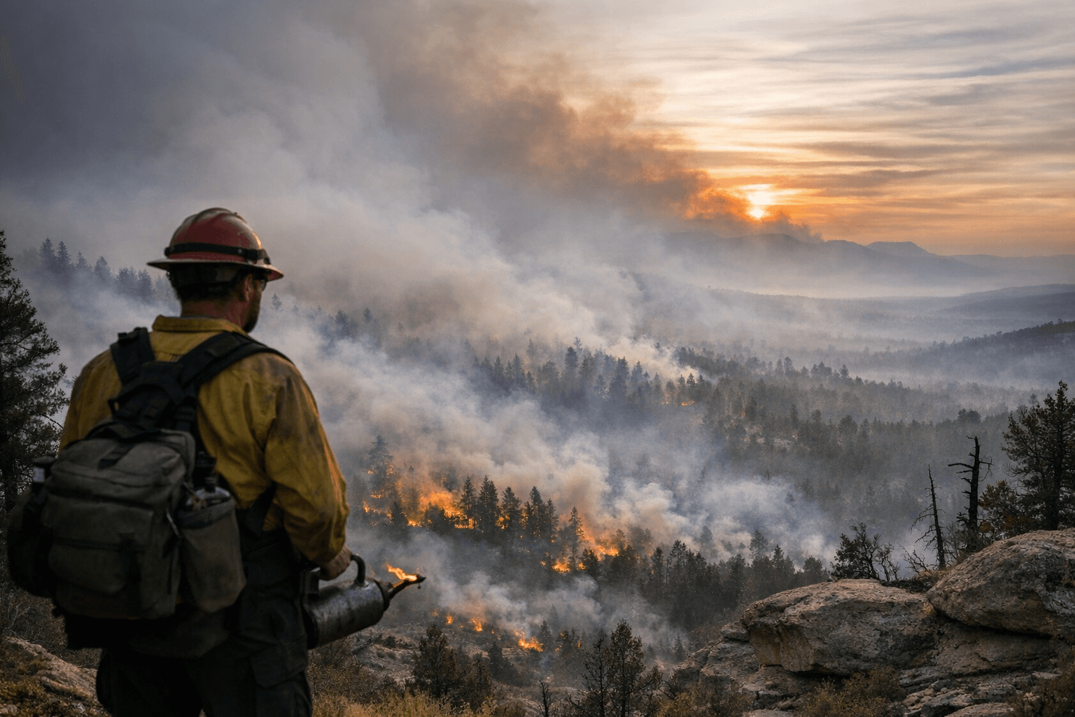
Forest Service spokeswoman Lorenna Williams said aerial ignition helped firefighters apply fire efficiently while staying within the staffing and weather limits needed for safety. She said crews also have to make sure enough resources remain available for wildfire response the same day, which is why prescribed burns depend so heavily on weather windows, smoke dispersal and contingency planning. The smoke was not just a local nuisance; it was a regional air-quality event that could carry toward Durango or sink into the Dolores River Canyon depending on wind and terrain.
The Boggy Draw work is part of a much larger prescribed-fire project covering 4,107 acres, located 4 to 8 miles northeast of Dolores along National Forest System Roads 526 and 527. The Forest Service’s closure for the Boggy Draw Trail System was set to run from April 19 through May 2, cutting off public access in the burn area while operations continue. Smaller units will be burned as conditions allow, and the agency has said future ignitions could include ground crews and possibly drones as well as hand and aerial ignition.
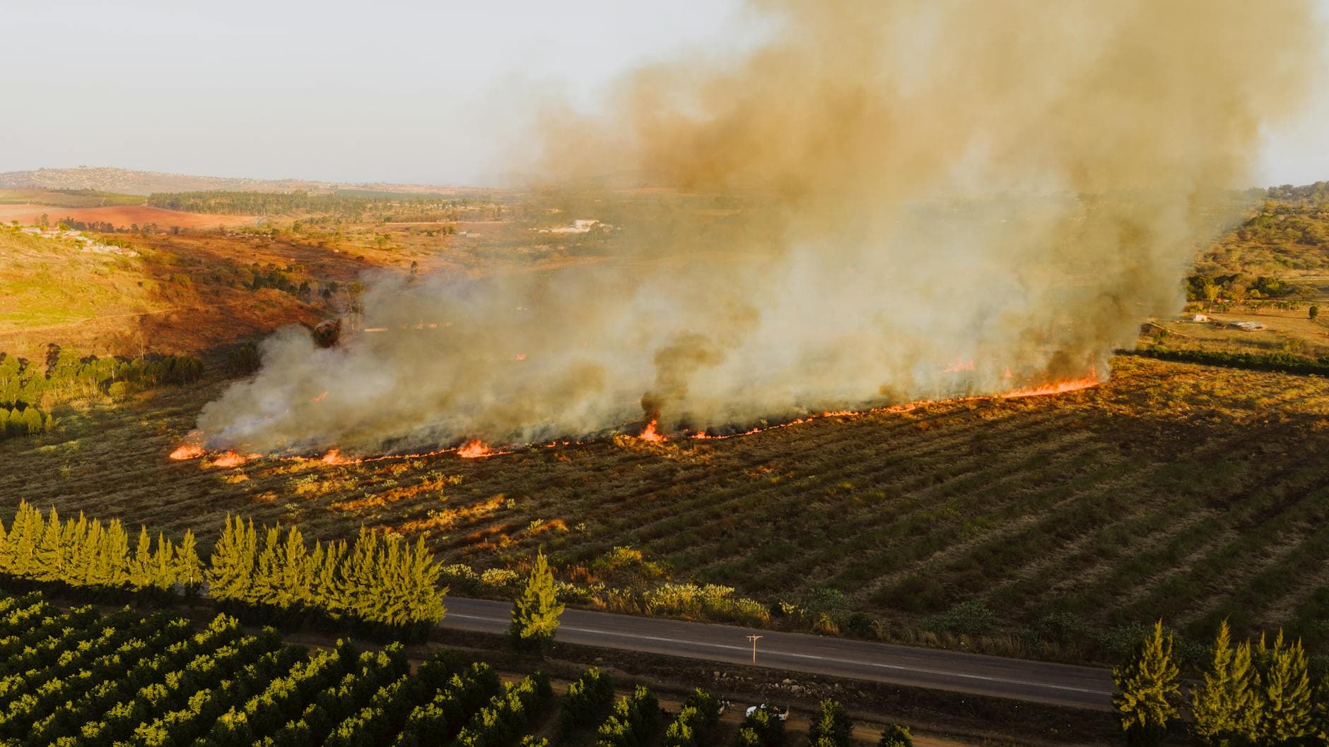
Montezuma County also said crews planned to burn Units 25A-C, about 1,212 acres, over one to two days if weather and smoke conditions cooperate. The Boggy Draw work follows a 255-acre Sauls Creek burn east of Bayfield, part of the same regional push to reduce hazardous fuels before they turn future wildfires into something larger, hotter and harder to control. A previous Boggy Draw burn covered more than 1,100 acres in three units, including Little Bean Canyon, showing that this is becoming a recurring spring tool for forest managers across the county.
This article was produced by Prism’s automated news system from verified source data, official records, and press releases, then run through automated quality and moderation checks before publishing. The system is built and supervised by the people who set the standards it runs under. Read our full AI policy.
Did this article answer your question?


