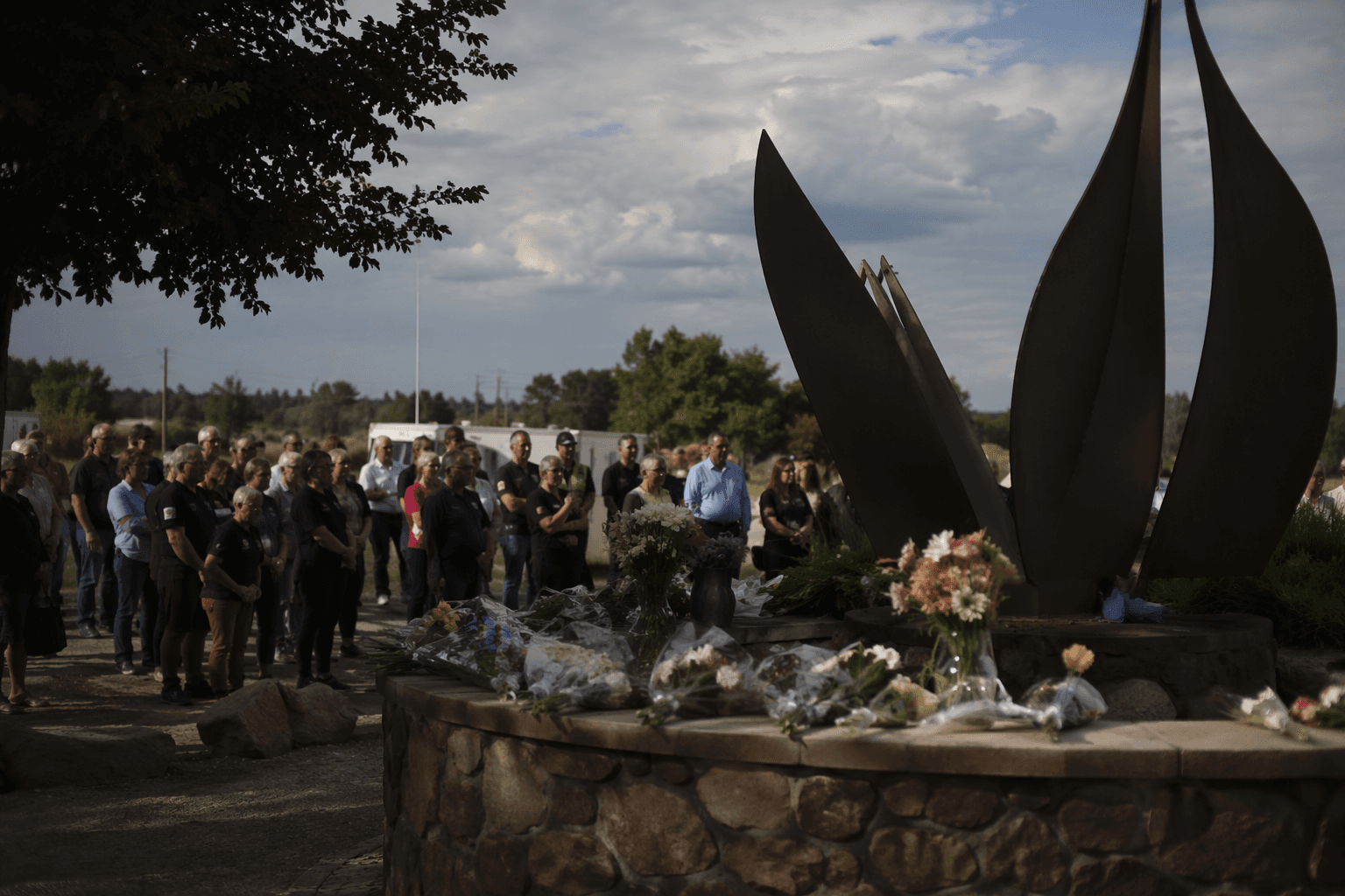
Douglas County marks seven years since devastating 2019 tornado
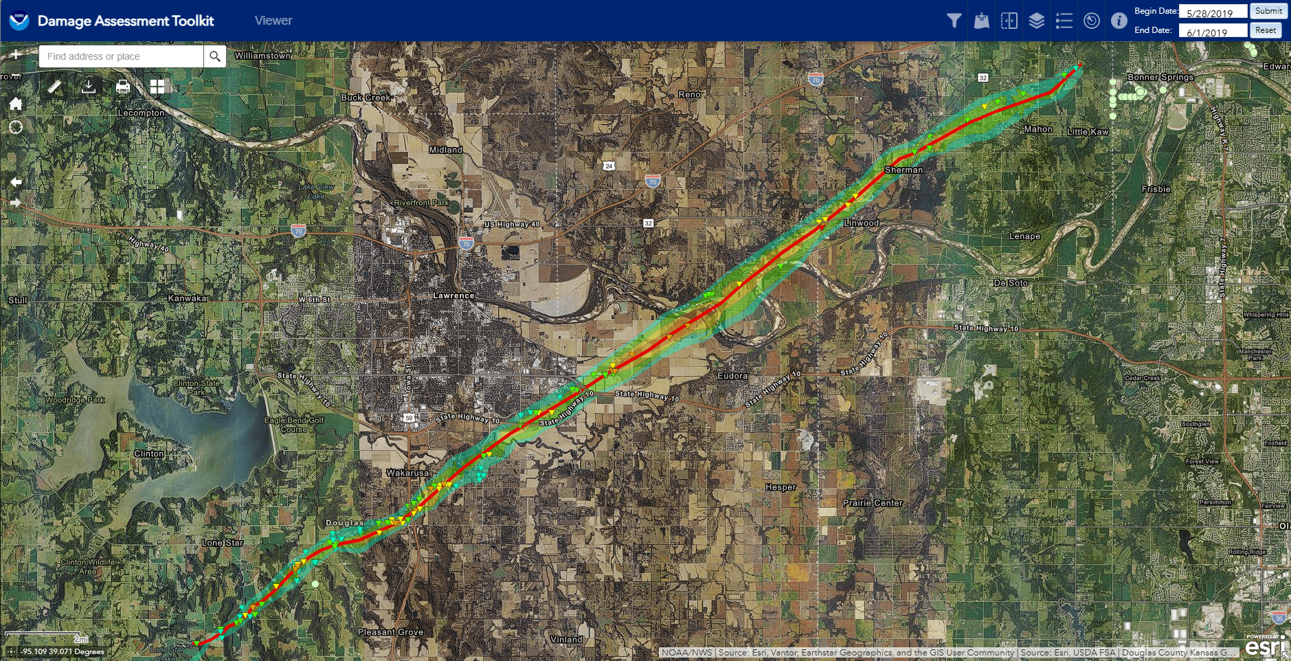
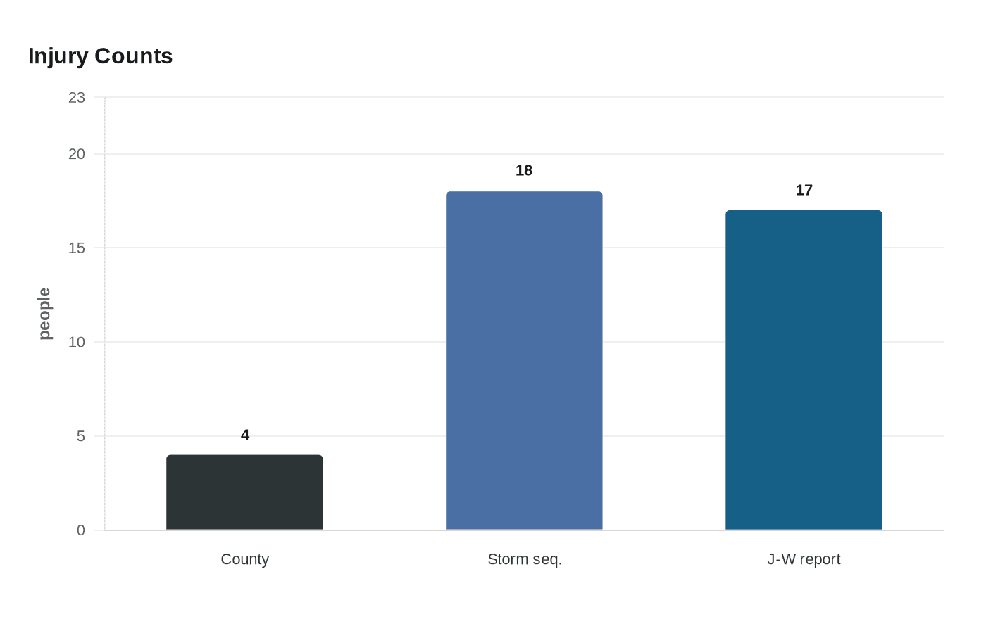
Seven years later, Douglas County is still measuring the 2019 tornado by its 16.66-mile path from Lone Star to Eudora, four county injuries and the damage left behind.
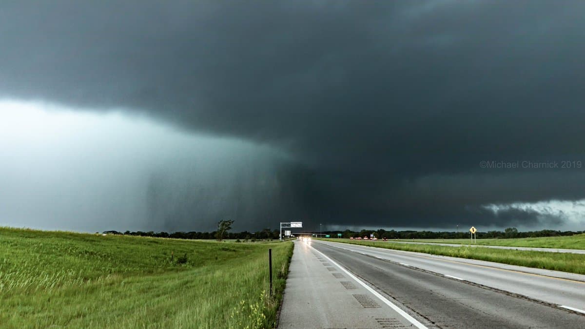
Douglas County is marking seven years since the tornado that carved a 16.66-mile path from Lone Star to Eudora and left four people injured in the county. The storm remains a blunt measure of local preparedness: roofs were ripped apart, farms and businesses were hit, and the event still defines how residents remember severe weather in Douglas County.
NOAA’s Storm Events Database lists the Douglas County tornado as an EF-3 that began at 5:05 p.m. CST on May 28, 2019, and ended at 5:32 p.m. near Eudora. The track was 1,200 yards wide at its widest point. The National Weather Service later described the stronger parent tornado as an EF-4 that developed south of Clinton Lake in southwestern Douglas County, crossed southeastern Lawrence, moved into Leavenworth County and through Linwood, and produced peak winds of 170 mph along a 31.82-mile path.
The broader storm sequence injured 18 people and caused no fatalities, but the damage was severe enough to reset the county’s tornado history. Local reporting at the time said Douglas County had not seen an F-4 tornado since 1952 and had not recorded an F-3 since 1981. Journal-World reported that the mile-wide tornado injured 17 people and damaged more than 60 homes, underscoring how quickly a fast-moving storm can overwhelm neighborhoods from the southwest edge of Lawrence to communities farther east.
The storm also hit places residents knew well. Pendleton’s Country Market in Douglas County was damaged, along with Free State Growers near Linwood. Debris was later found miles away at Kansas City International Airport, a reminder of how far tornado-force winds can carry destruction across the Kansas City metropolitan area and beyond.
In the days after the tornado, a University of Kansas engineering team organized a rapid-response damage survey and completed 271 door-to-door assessments within three days, part of research supported by the National Science Foundation’s Structural Extreme Events Reconnaissance Network, or StEER. Seven years later, those numbers still matter because they show both the scale of the 2019 disaster and the standard Douglas County has to meet when the next warning comes.
This article was produced by Prism’s automated news system from verified source data, official records, and press releases, then run through automated quality and moderation checks before publishing. The system is built and supervised by the people who set the standards it runs under. Read our full AI policy.
Did this article answer your question?