Statewide Search and Rescue Teams Conduct Drone Training in Douglas County
Douglas County Search and Rescue hosted hands-on UAV training with Douglas County, Castle Rock and Arapahoe teams after a drone led by Darren Keralla located a lost 10-year-old and enabled a supply drop.

Douglas County Search and Rescue (DCSAR) hosted hands-on drone training in Douglas County after Darren Keralla’s UAV located a lost 10-year-old on an ATV in early December, enabling a supply drop and ATV extraction that rescuers say helped stabilize the child. DCSAR posted, “Today DCSAR hosted a UAV (drone) search training with multiple law enforcement agency UAV teams (Douglas County, Castle Rock and Arapahoe).”
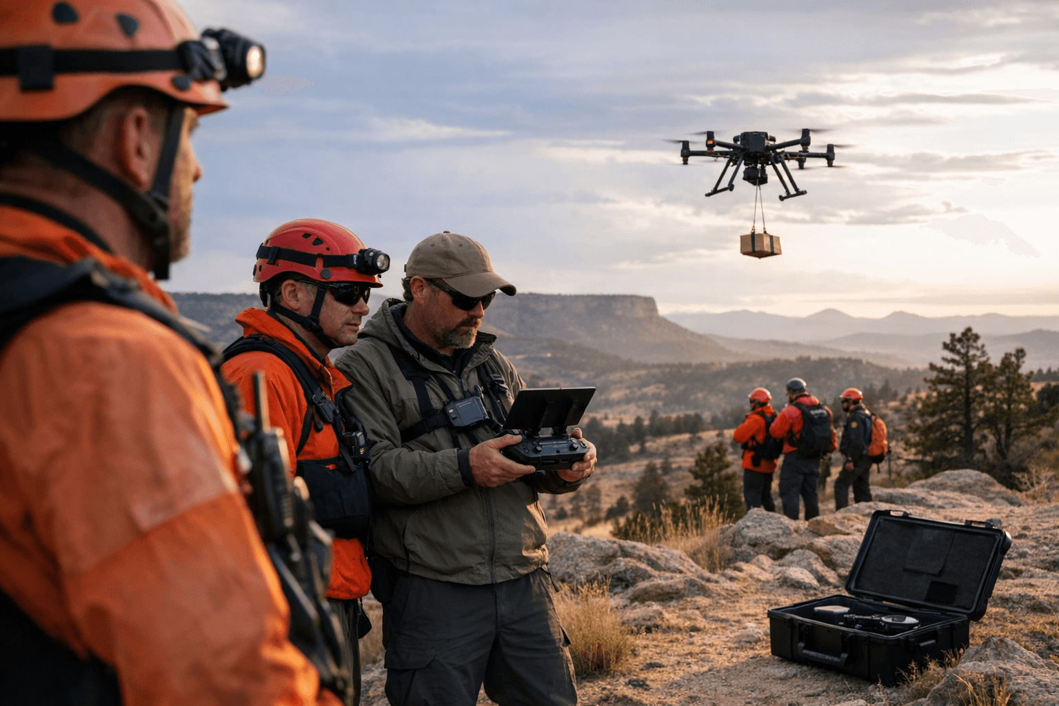
Personnel from across Colorado gathered for practical field exercises that tested coordination as much as piloting. In one AerospaceAmerica-described scenario Keralla controlled a test drone with a computer tablet and was given 40 minutes to find cones while avoiding simulated helicopter medevac traffic, managing “distraction” tasks and listening to mock ground-team radio traffic. The exercise emphasized mission-level positioning and situational awareness rather than basic stick-and-roll flying.
DCSAR’s volunteer structure underpins that operational work. CastlepinesConnection reports DCSAR operates under the Douglas County Sheriff’s Office with about 50 trained volunteers; members receive no monetary compensation and “must provide their own equipment, gear, and gas to and from all missions.” Roman Bukary, DCSAR public information officer, said, “For training alone, an average member donates 250 hours per year, plus response to missions, adding up to over 1,000 person-hours, plus miles and miles of driving.” The unit runs training from September through May with each member scheduled for four monthly sessions - two classroom and two field - and maintains specialty sub-teams including UAV/drone, K9, ATV and technical rope rescue.
The training focused on tools and tactics now entering routine use on Douglas County missions. Route Fifty and related reporting note thermal FLIR imaging was part of recent operations that helped locate lost hikers in Pike National Forest “in just a few hours,” and AerospaceAmerica described tablet-based flight software in the cones exercise. The Mountain Rescue Association account of the early-December ATV rescue laid out the sequence: teams had 911 coordinates, a drone flew the coordinates and immediately spotted the boy, operators used a speaker system to ask him to give a thumbs up if uninjured, and the drone returned to drop a bag with a hat, blanket, food and water before rescuers arrived on ATVs. “The drone played a critical role, but it’s just another tool in SAR,” Darren Keralla said. “It was a team effort.”
Those operational gains intersect with public health and equity concerns for Douglas County. DCSAR training includes medical training and CPR, and the ability to verify condition remotely and deliver basic supplies can shorten the time to care in remote terrain; at the same time the volunteer model requires members to buy and fuel their own vehicles and equipment, a structural issue that affects recruitment and sustained access to costly capabilities like FLIR payloads and drop systems.
As DCSAR expands - CastlepinesConnection reports the team will soon add more than a dozen new fielded members and cited a 13-member 2022 class completing an eight-month course and Mountain Rescue accreditation - leaders say drones are shaping future practice. Bukary put it plainly: “Before we’re out there we can search massive areas of terrain,” and “It is ... where search and rescue, especially in the wilderness, is headed.”
This article was produced by Prism’s automated news system from verified source data, official records, and press releases, then run through automated quality and moderation checks before publishing. The system is built and supervised by the people who set the standards it runs under. Read our full AI policy.
Did this article answer your question?