NOAA confirms EF0 tornado touched down in North Lawrence
A two-minute EF0 tornado cut from Walnut and North Seventh to Maple and Mechanic, uprooting trees and breaking branches in North Lawrence.
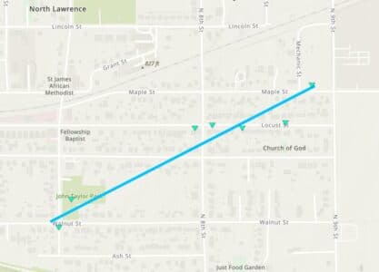
A brief EF0 tornado carved a narrow damage path through North Lawrence, snapping large branches and uprooting trees as it moved from Walnut Street and North Seventh Street to Maple Street and Mechanic Street. NOAA estimated peak winds at 80 mph, enough to leave concentrated damage even though the twister was on the ground for only two minutes.
The tornado touched down at 12:24 a.m. Tuesday, June 9, 2026, and lifted at 12:26 a.m. The short lifespan is part of what made the storm easy to underestimate in the moment, but the damage left behind showed how even the weakest category on the Enhanced Fujita scale can still hit a dense neighborhood with mature trees and overhead infrastructure.
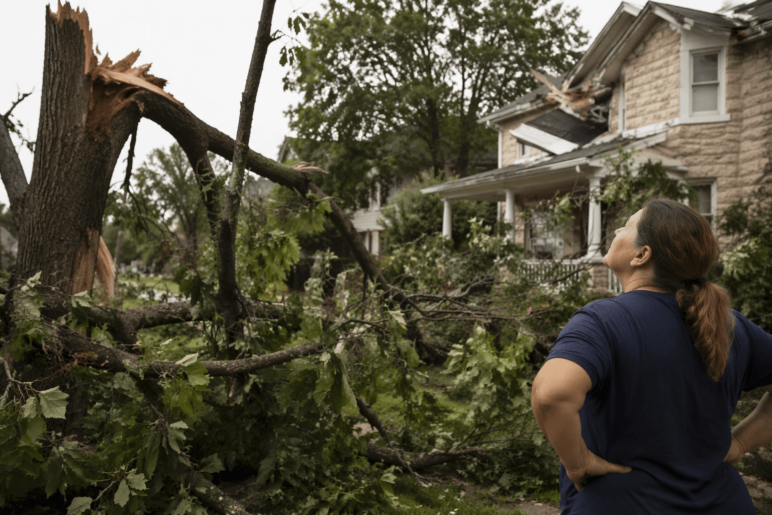
That matters for North Lawrence residents still sorting through the aftermath. Broken limbs, uprooted trees and any hidden damage to roofs, fences, gutters and utility service should be checked quickly, especially in blocks where branches fell near homes, vehicles or power lines. The storm’s path suggests the hardest-hit area was fairly tight, but the impacts were real enough to warrant a formal federal assessment and a clear map of where the tornado traveled.
The tornado came amid a broader round of severe weather that hit Douglas County and the Lawrence area late Monday night into early Tuesday morning. Heavy rain, strong winds, downed power lines and multiple water rescues were reported, and some places received upward of 3 inches of rain. County officials also urged residents not to rely only on outdoor sirens, stressing the need for more than one way to receive severe-weather warnings.
NOAA’s damage assessment data are part of the National Weather Service survey process and are quality-controlled, but they remain preliminary as the post-storm record is assembled. Even so, the North Lawrence touchdown now joins the documented severe-weather history of the Lawrence area, where the National Weather Service Topeka archive includes events such as a March 12, 2006 microburst damage report in Lawrence. That record reinforces a plain lesson for this part of Kansas: brief storms can still produce measurable damage, and overnight warnings matter when the sky turns violent.
This article was produced by Prism’s automated news system from verified source data, official records, and press releases, then run through automated quality and moderation checks before publishing. The system is built and supervised by the people who set the standards it runs under. Read our full AI policy.
Know something we missed? Have a correction or additional information?
Submit a Tip