Forsyth County tests smartphone tool to set safer curve speeds
Forsyth County is testing a smartphone tool that could update curve warnings faster, helping drivers see safer advisory speeds on winding roads before trouble starts.
Safer speeds on Forsyth’s curves
A curve warning sign can do more than remind a driver to slow down. In Forsyth County, engineers are testing a smartphone tool that could update advisory speeds faster, giving motorists clearer guidance on winding roads before a dangerous bend turns into a crash.
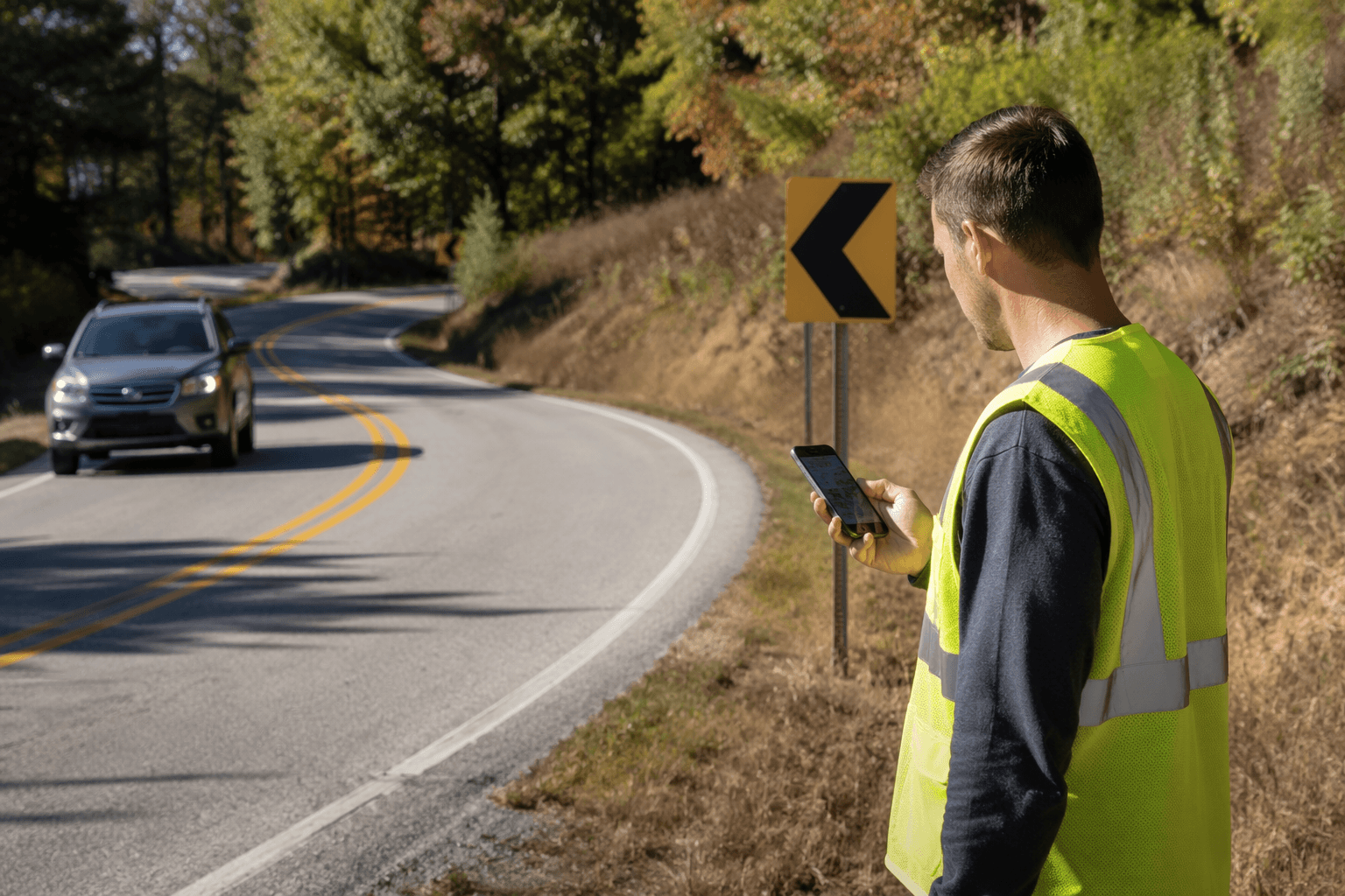
The idea is aimed at a practical road-safety problem that county crews have dealt with for years: figuring out what speed is safe for a horizontal curve, then getting that information into the field without a long delay. If the new method holds up, it could help sign crews check curve conditions more efficiently, confirm signs sooner, and make the county’s roadside warnings more consistent from one bend to the next.
From dashboard tools to phone sensors
The project has deep roots in the way Forsyth County used to handle curve studies. When Tim Allen joined Forsyth County Engineering in 1995, the county had more than 100 miles of rural roadways without posted speed limits, and many of those stretches lacked curve warning signs altogether. To calculate safe advisory speeds, Allen spent months driving winding roads with a ball bank indicator mounted on his dashboard, a time-intensive process that depended on in-person field work.
That background explains why the county is interested in a faster method now. The traditional approach required specialized equipment and separate engineering analysis before crews could place or confirm signs. The new approach, developed with Georgia Institute of Technology and Kennesaw State University, uses sensors already built into smartphones, including GPS and an inertial measurement unit, to gather data in the field.
Denise Freund, Forsyth County’s deputy director of engineering, says the county wants citizens to drive on safe roads and sees better infrastructure management as a way to improve day-to-day operations. For county staff, the promise is not just technical convenience. It is a chance to move curve safety from a manual, stop-and-start process into one that can be handled more quickly by the crews already working on the roads.
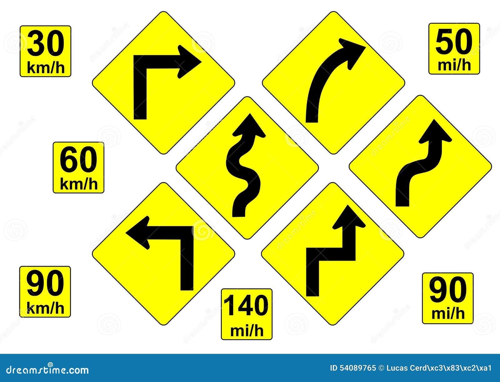
Why curve warnings matter
The stakes are clear because curve crashes remain a persistent safety problem. The Federal Highway Administration has said a disproportionate number of serious crashes occur on horizontal curves, even though curves account for only a small share of roadway mileage. That makes advisory speeds one of the most important signs a driver sees on a rural or winding road.
In practice, the warning has to be right. If the advisory speed is too high, drivers may enter a bend too fast. If it is too low, the sign loses credibility and can be ignored. Forsyth’s effort is aimed at making those numbers more accurate and easier to update, which matters on roads where sight lines, curvature, and traffic conditions can vary sharply from one section to another.
The county’s roads and bridges division gives the scale of the challenge. Forsyth County Engineering oversees design, construction and maintenance of county roads, bridges, drainage systems and traffic signals, and the roads and bridges division maintains about 1,200 miles of asphalt roads and 30 miles of gravel roads. In a county that large and still growing, a faster curve-safety workflow can affect a lot of daily driving.
How the smartphone method works
Georgia Tech researchers describe the system as a smartphone-based curve advisory speed assessment framework that leans on built-in GPS and inertial sensors. Instead of relying only on a one-off field study, the tool is designed to collect and compare multiple runs of sensor data, which can be crowdsourced into a broader network-level picture of curve conditions.
A Georgia Tech project poster says the application can batch-process multiple curves and pull out the data that matters most for sign design, including curve geometry, ball bank indicator readings, speed limit and GPS location. From there, the system can generate MUTCD-compliant curve signs in tabular form, which is the sort of output crews can turn into action more quickly.
That approach has already shown promise in a preliminary case study on five curves on Georgia State Route 17. Researchers said the smartphone-based method was feasible for computing curve characteristics, an important step because it suggested the low-cost device approach could stand in for more cumbersome fieldwork in at least some real-world conditions.
A later report expanded the scale dramatically. The enhanced curve-finder and sign-design algorithm processed nearly 18,000 miles of Georgia state-maintained routes, identified 13,262 curves and designed 29,093 signs. That kind of output suggests the method is not just for one isolated project site. It could become a network-level tool for spotting where curve warnings need attention across a much larger road system.
What Forsyth expects next
Forsyth County sees the work as more than a university experiment. If the tool proves reliable, county leaders believe it could be useful across Georgia and eventually nationwide, because the basic problem is not unique to one county. Wherever roads bend and visibility changes, drivers need signs that reflect the actual curve ahead.
Tim Allen said the technology could also change the way work gets done inside the county. Instead of waiting for an engineer to finish a separate study and return the results, sign crews could do more of the work themselves in the field. That would shorten the path from observation to sign placement, which is exactly where public-safety projects often slow down.
For Forsyth motorists, the practical result would be straightforward: safer advisory speeds on dangerous curves, more consistent warning signs, and a faster response when a road segment needs attention. For county engineers, it would mean a road-safety task that is quicker, cheaper and easier to scale as Forsyth’s network of roads continues to carry more traffic every year.
In a place where rural roads, busy connectors and long stretches of curved pavement all meet, that kind of upgrade could make the difference between a sign that is merely present and a sign that genuinely helps prevent the next crash.
This article was produced by Prism’s automated news system from verified source data, official records, and press releases, then run through automated quality and moderation checks before publishing. The system is built and supervised by the people who set the standards it runs under. Read our full AI policy.
Did this article answer your question?