Forecast warned of heavy rain, mountain snow and travel impacts for Fresno County
The National Weather Service forecast for the Fresno area on Dec. 26, 2025 warned of continued unsettled weather, with an 80% chance of showers and potential thunderstorms through the weekend. The forecast highlighted primary risks from heavy rain, Sierra snowfall above about 5,000 feet, and possible school and traffic disruptions, while noting low probability threats of damaging winds and a tornado.
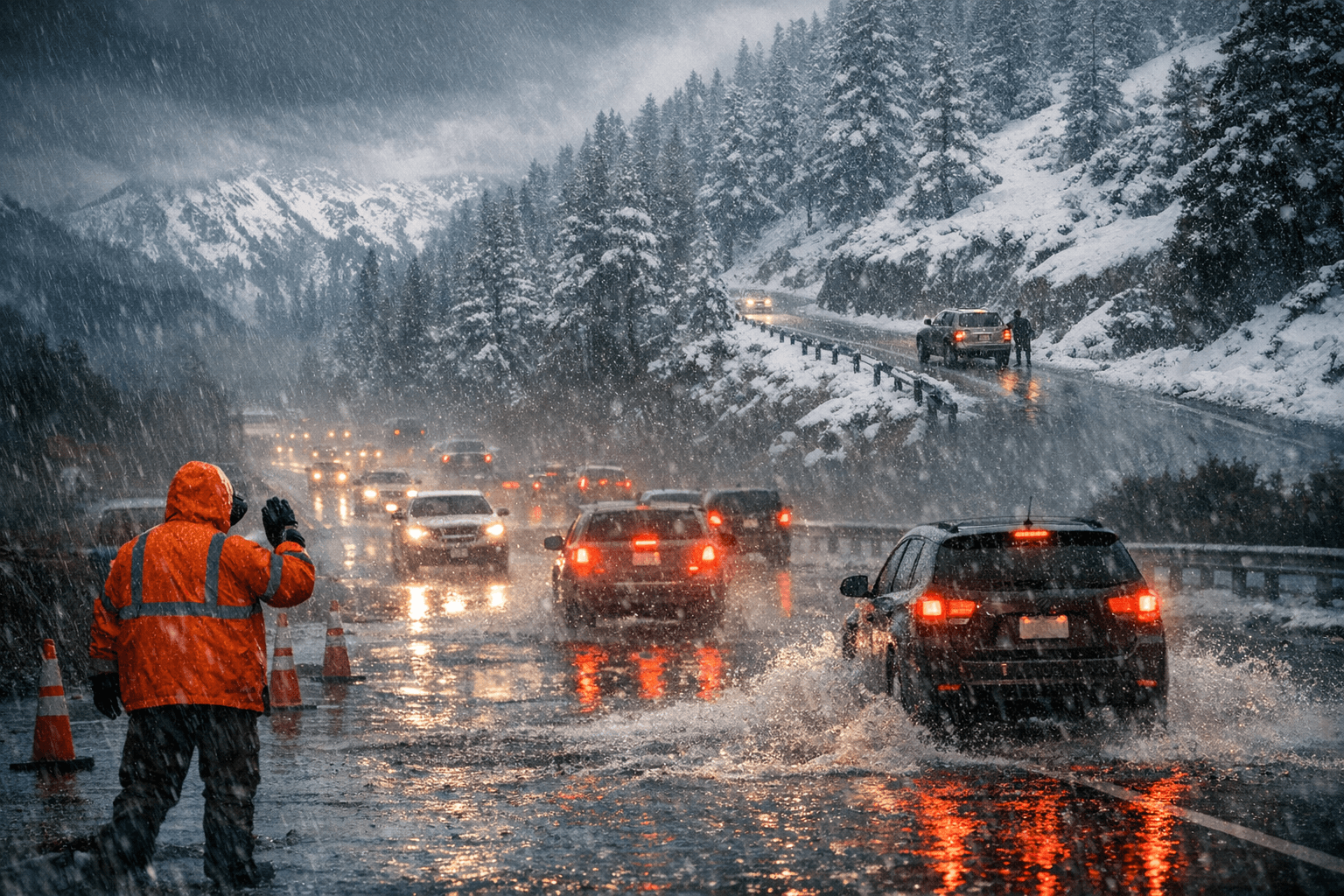
The National Weather Service forecast for the Fresno area issued on Dec. 26, 2025 called for continued unsettled conditions across Fresno County, with an 80% chance of showers and potential thunderstorms through the weekend. Forecasters emphasized the primary risks as heavy rainfall in the valley and significant mountain snowfall at elevations above about 5,000 feet, conditions that could bring localized flooding and travel disruptions.
The forecast identified school and traffic impacts among the most immediate concerns for residents. Heavy valley rain can reduce visibility on major commuting routes and increase morning and evening congestion, while mountain snow can slow or close routes used by truckers and recreational travelers heading into the Sierra. The forecast specifically advised motorists and residents to expect continued heavy mountain snowfall and valley rainfall with potential for localized flooding and travel disruptions.
In addition to the core threats, the forecast office included two low probability hazards. Forecasters placed the chance of damaging winds at less than 5% and the chance of a tornado at under 2%. Both threats were described as atypical for the event but were included to reflect the full risk envelope the forecast team assessed.
For Fresno County, the combination of high probability rain and mountain snow has practical implications for public services and the local economy. School districts and public transit providers were placed on alert for possible schedule changes, and freight and agricultural transport that rely on valley highways may face delays. Residents with travel plans into the higher Sierra should anticipate heavier snowfall at elevations above about 5,000 feet and plan accordingly.
The National Weather Service in Hanford was identified as the source for updated watches and warnings. Residents and businesses seeking the latest guidance were directed to monitor NWS Hanford for any new advisories, as conditions can change rapidly during an unsettled weather pattern.
This article was produced by Prism’s automated news system from verified source data, official records, and press releases, then run through automated quality and moderation checks before publishing. The system is built and supervised by the people who set the standards it runs under. Read our full AI policy.
Did this article answer your question?


