Strong Winter Storm Threatens Central Valley, Sierra, Burn Scar Flooding
A strong winter storm began Dec. 23 bringing heavy rainfall to the Central Valley, significant Sierra snow and strong westside wind gusts. The National Weather Service in Hanford warned Dec. 22 that the system could produce flooding from Dec. 23 through Dec. 26 and elevated mudflow risk on recently burned slopes.
The National Weather Service in Hanford issued an advisory Dec. 22 outlining a major winter storm that began impacting Fresno County and surrounding areas on Dec. 23. The forecast called for heavy rains across the Central Valley from Wednesday through Friday, large Sierra snow totals with snow levels dropping to around 6,000 feet, and westside hill wind gusts reaching about 40 miles per hour. Officials highlighted an increased risk of flooding from Dec. 23 through Dec. 26 and identified burn scar areas as particularly vulnerable.
Local emergency management agencies face multiple concurrent threats. Heavy rainfall over hardened, recently burned soils raises the likelihood of rapid runoff, debris flows and mudflows in the French, Basin, Garnet and Borel burn scar areas. That risk elevates the need for timely evacuation decisions, road closure orders and public messaging to protect residents in at risk neighborhoods and travel corridors. Wind gusts on the westside hills increase the chance of downed trees and localized power interruptions, creating additional strain on response efforts.
The Sierra storm impacts carry regional consequences for mountain communities and for highway travel over passes that typically see rapid deterioration in conditions when snow levels fall. Snow accumulation at 6,000 feet and below can prompt chain requirements and temporary closures on routes used by commuters and commercial traffic. In the Central Valley, persistent heavy rainfall will test urban and rural drainage systems and could cause localized flooding of low lying roads and properties.
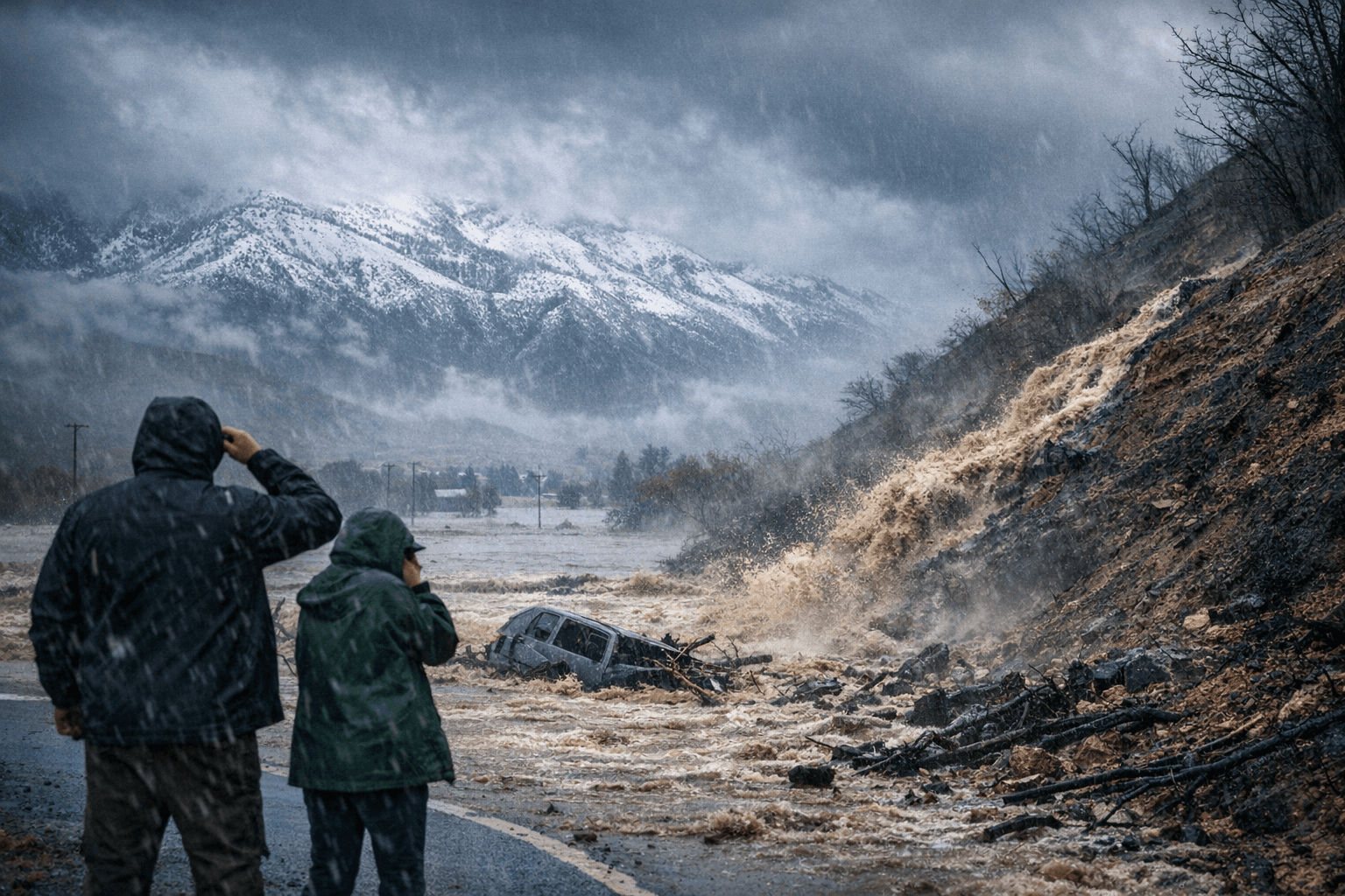
For Fresno County residents the immediate priorities are situational awareness and preparedness. Monitor local emergency alerts, avoid travel through affected mountain passes and burn scar zones if authorities issue restrictions, and have a plan for rapid evacuation if mudflows or flash flooding threaten your area. The forecast places a premium on coordination among the National Weather Service, county emergency services, road management agencies and fire authorities to assess conditions and issue protective measures.
This storm underscores the intersection of climate variability and local vulnerability, as intense rain on scarred landscapes produces outsized hazards. How quickly institutions mobilize warnings, closures and evacuations over the next several days will determine the level of community disruption and risk to life and property.
This article was produced by Prism’s automated news system from verified source data, official records, and press releases, then run through automated quality and moderation checks before publishing. The system is built and supervised by the people who set the standards it runs under. Read our full AI policy.
Did this article answer your question?


