Small craft advisories warn boaters across Grand Traverse Bay and Lake Michigan
Rough water stretched from Grand Traverse Bay to Lake Michigan, with advisories in place and conditions expected to ease by 4 p.m. EDT.
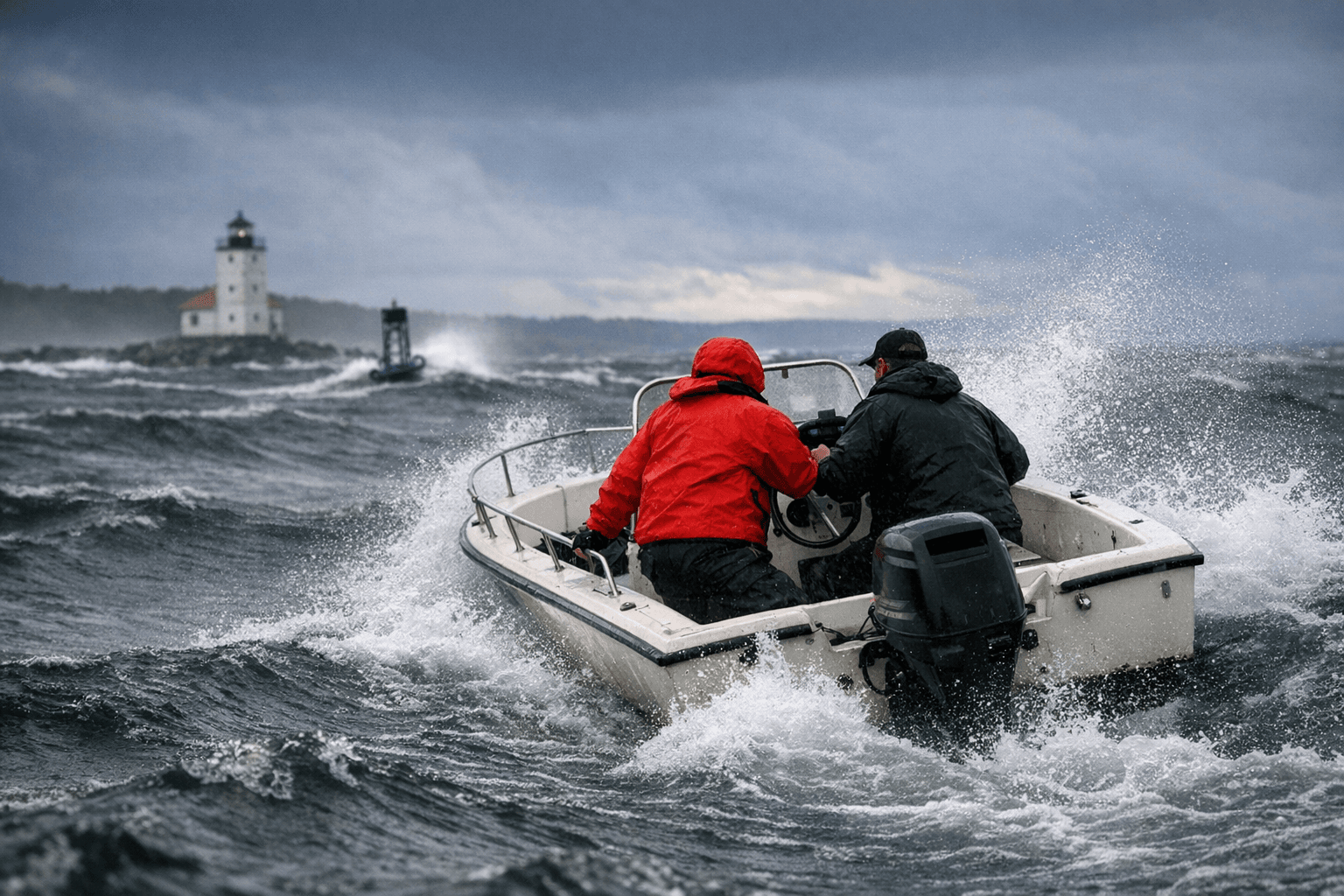
Small boats, kayaks and fishing runs across Grand Traverse Bay faced hazardous water, with advisories signaling that open-water trips and quick launches could turn risky fast. The roughest conditions were expected to ease by 4 p.m. EDT, but boaters on both the bay and nearby Lake Michigan shoreline still had reason to stay close to shore or wait it out.
The National Weather Service in Grand Rapids kept a Small Craft Advisory in effect until 4 p.m. EDT for coastal waters from Whitehall to Pentwater and Pentwater to Manistee, a reminder that the same weather pattern affecting the west side of the state was also raising concern farther north. In Grand Traverse Bay, the National Weather Service in Gaylord issued a Small Craft Advisory for waters south of a line from Grand Traverse Light to Norwood, MI, from 11 a.m. CDT April 6 through 7 a.m. CDT April 7.
For anyone looking at a shoreline forecast in Traverse City and assuming the bay was calm everywhere else, NOAA’s marine guidance offered a warning of its own: nearshore forecasts cover waters within five nautical miles of shore, and point forecasts may miss hazards across a larger area. That gap matters on Grand Traverse Bay, where wind and wave conditions can shift quickly between a harbor mouth, a public launch and open water beyond the pierheads.
The same rapid changes are part of what makes Sleeping Bear Dunes National Lakeshore such a dangerous stretch of Lake Michigan shoreline. The park warns that lake-borne weather can change quickly, and some beaches carry deadly rip-current risk, adding another layer of danger for beachgoers and boaters trying to read the water from land.
NOAA’s buoy station 45183, the Sleeping Bear Dunes buoy at 44.982 N, 85.831 W, helps track those shifts offshore. When winds build and waves stack up around that part of the lake, small craft are the first to feel it, and the safest course is to wait for the advisory to expire before heading back out.
This article was produced by Prism’s automated news system from verified source data, official records, and press releases, then run through automated quality and moderation checks before publishing. The system is built and supervised by the people who set the standards it runs under. Read our full AI policy.
Did this article answer your question?


