FEMA flood maps could put 455 Harris County industrial sites at higher risk
FEMA’s draft Harris County flood maps could reclassify 455 industrial sites, including clusters near Pasadena and the Ship Channel, before insurance and cleanup risks reach nearby neighborhoods.
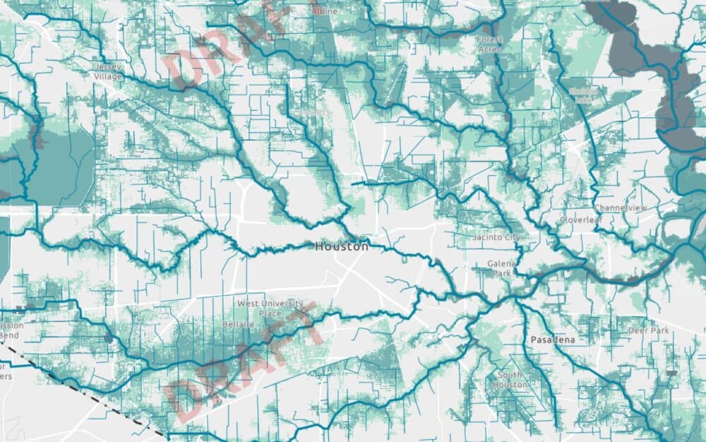
At the Harris County Flood Control District’s MAAPNext mapping effort, draft FEMA flood maps could push 455 industrial sites into higher-risk zones, a shift that would ripple into Pasadena apartment complexes, Ship Channel neighborhoods and the cost of insuring, operating and cleaning up the next flood.
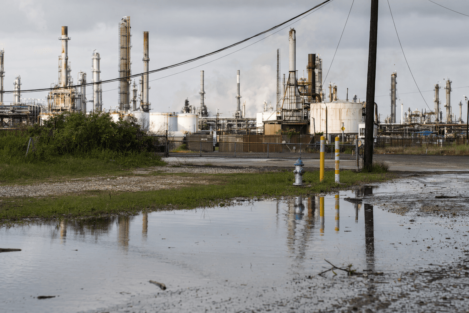
The change matters because many of those facilities sit next to homes, schools and apartments, not far from tank farms, chemical processors, gas manufacturers and fertilizer operations. In Pasadena, where residential blocks run up against heavy industry, a stronger flood designation would raise the stakes for residents already living with the daily threat of flooding and pollution. If floodwaters reach sites that store or handle hazardous substances, the concern is not just structural damage. It is contamination carried into nearby streets, drainage channels and bayous.
Harris County officials say the update is the first countywide flood map revision since 2007. The current effective maps date to June 2007 and grew out of the Tropical Storm Allison Recovery Project, launched after Tropical Storm Allison in 2001. MAAPNext uses newer rainfall data, including Atlas 14, which county officials say gives a more realistic picture of flood exposure than the older federal maps that guided insurance and development decisions for years.
The county says the draft maps do not immediately change flood insurance or regulations. FEMA’s National Flood Insurance Program materials say appeals to proposed flood hazard information are handled during a 90-day statutory appeal period, and county officials have said new insurance requirements could still be two to three years away because the maps must be finalized first. Even so, once adopted, some properties could move into the 100-year floodplain or the floodway, FEMA’s highest-risk zone, where permitting, redevelopment and plant operations face much tighter scrutiny.
The Houston Chronicle analysis says the county has the nation’s largest concentration of active toxic industrial facilities at elevated flood risk, and some of the affected sites are on the EPA’s Toxic Release Inventory or are permitted to store chemicals. That makes the map update more than a planning exercise. It will influence property values, emergency planning and how local governments weigh land use around industrial corridors that already border neighborhoods.
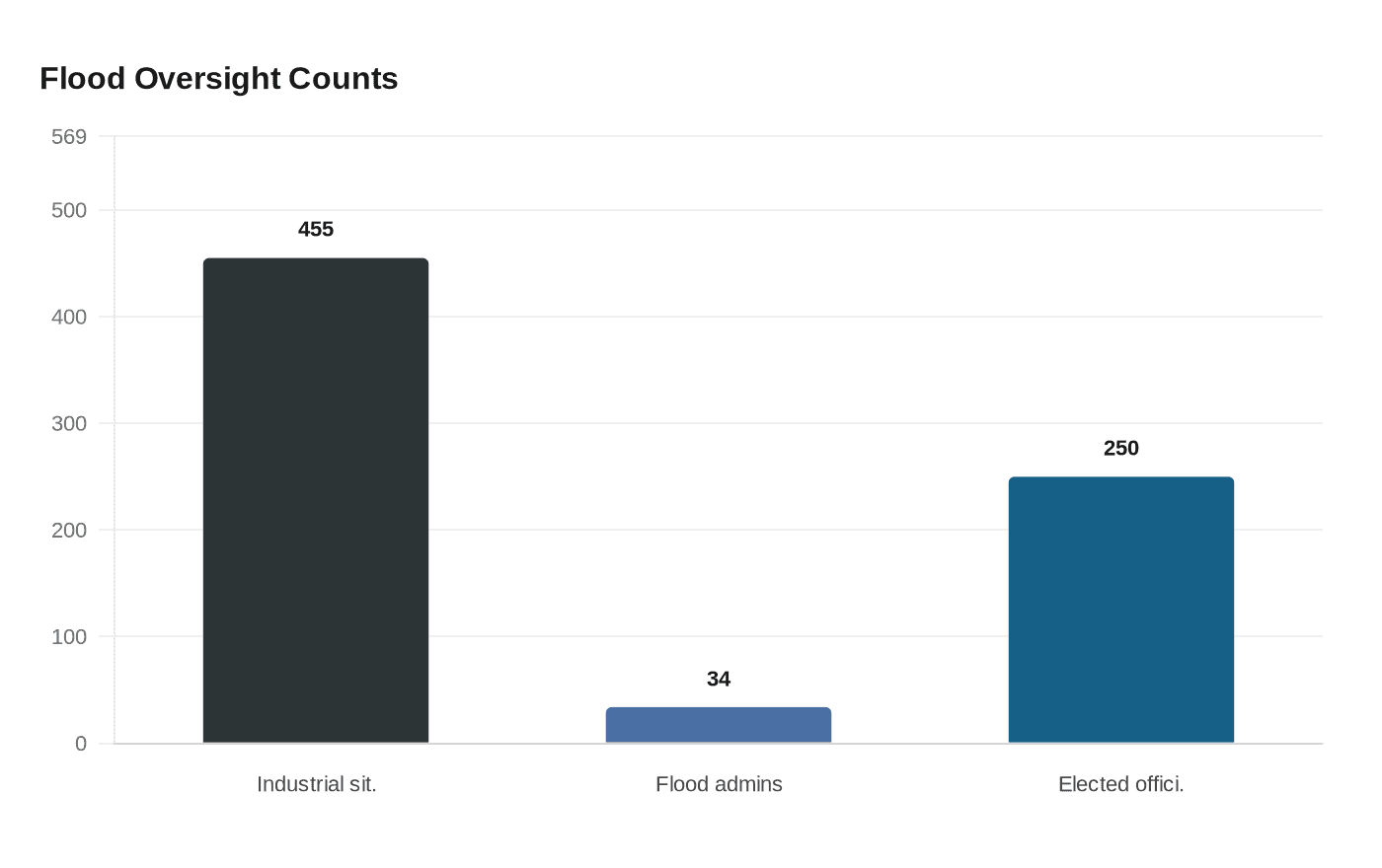
County flood maps remain complex to navigate. Harris County Flood Control District says 34 floodplain administrators work across separate entities of government, and nearly 250 elected officials are involved in drainage and flooding issues. Residents are being pushed toward the draft maps now, but official flood insurance determinations still come from FEMA’s effective maps and the Flood Map Service Center.
Know something we missed? Have a correction or additional information?
Submit a Tip