Harris County under flood watch as heavy rain threatens flash flooding
Heavy rain was expected to soak Harris County, with 2 to 4 inches likely and isolated totals above 6 inches, raising the risk of stranded cars and street flooding.
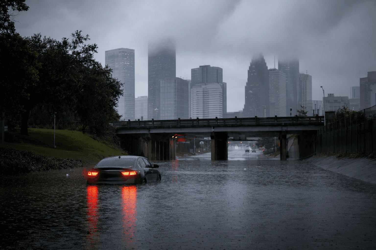
Street flooding and stranded vehicles were the first real risks for Harris County as a Flood Watch covered much of Southeast Texas, including the county, from 3 a.m. Friday to 4 a.m. Saturday. The National Weather Service said showers and storms were expected through Friday night, with the heaviest coverage during the day Friday into early Friday evening, when low-lying roads and neighborhood streets were most likely to take on water before homes were hit.
The forecast called for most areas to pick up 2 to 4 inches of rain, with isolated higher amounts of 6 inches or more possible. The weather service also placed a Slight Risk of excessive rainfall over most of the area, which meant minor street flooding was the most likely outcome but a few flash flooding events could develop if heavy rain repeatedly crossed the same neighborhoods. In a county threaded by bayous, creeks and flood-prone roads, that kind of setup can turn a routine commute into a stalled-car problem in a matter of minutes.
ReadyHarris urged residents to stay weather aware, keep multiple ways to receive alerts and be ready to act if conditions worsened. County officials pointed drivers to Houston TranStar’s live traffic map before getting on the road, along with wireless emergency alerts and the Harris County Flood Control District’s Flood Warning System for real-time water conditions.

That flood warning system draws on gage stations placed across Harris County bayous and tributaries to show rainfall totals, channel status and inundation maps. TranStar and the Texas Department of Transportation developed the roadway flood warning system in 2018 after Hurricane Harvey, using rainfall, stream elevation and traffic data together to flag where roadway flooding was most likely.
The broader backdrop remains hard to ignore. The Harris County Flood Control District says a major flood occurs somewhere in the county about every two years, and the district itself was created by the Texas Legislature in 1937 to confront the region’s flood problems. In a county with extensive drainage corridors and a long history of water over roads, even a few inches of rain can force quick decisions on Friday morning commutes and Friday evening travel.
This article was produced by Prism’s automated news system from verified source data, official records, and press releases, then run through automated quality and moderation checks before publishing. The system is built and supervised by the people who set the standards it runs under. Read our full AI policy.
Did this article answer your question?