Harris County under severe thunderstorm warning, flood watch through Saturday
Storms were lining up over Harris County as a flood watch took hold, with the highest risk Friday afternoon and evening for wind, hail and street flooding.
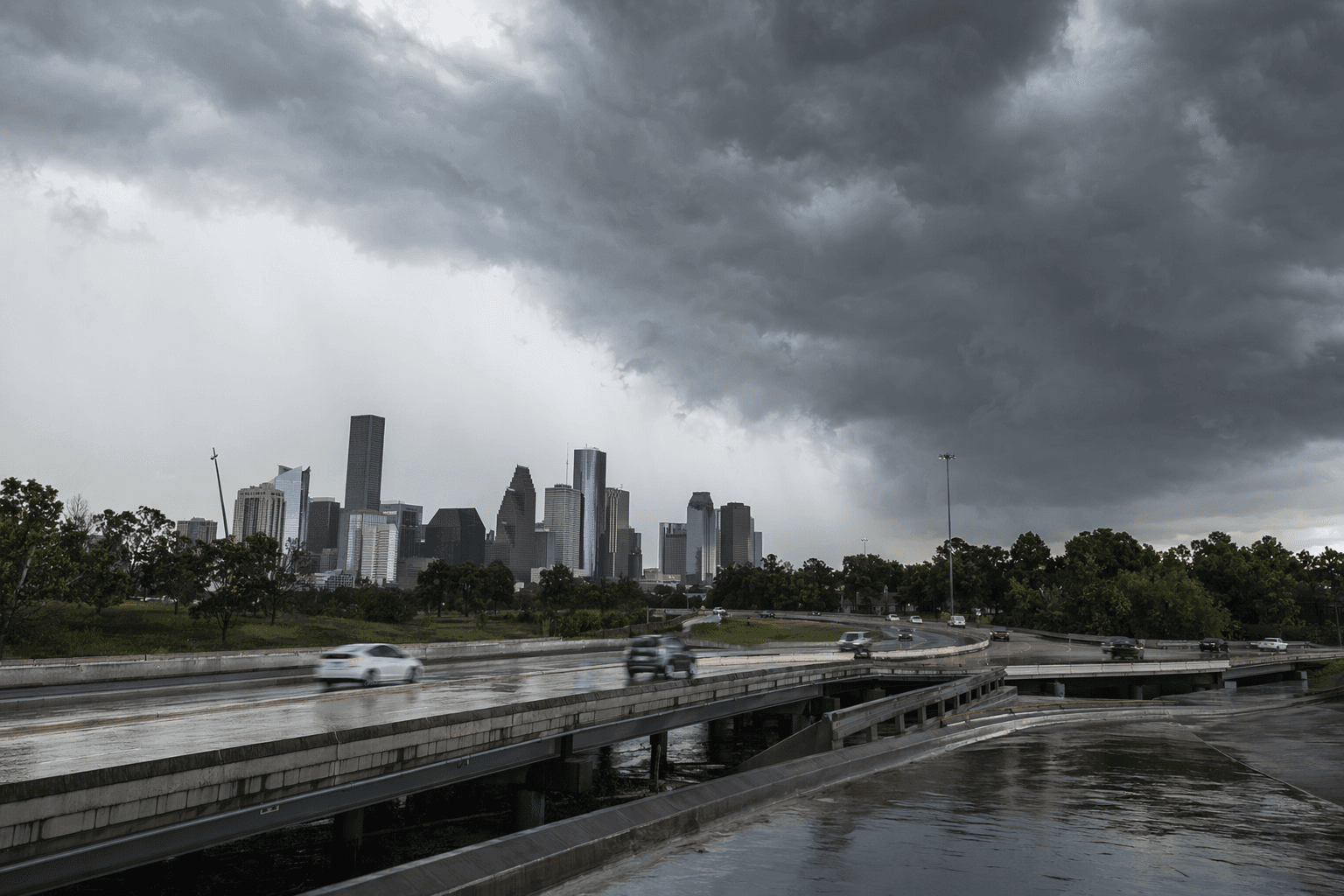
Harris County entered Friday under a severe thunderstorm warning and a flood watch that stretched from 3 a.m. Friday to 4 a.m. Saturday, putting much of southeast Texas on alert for damaging wind, hail and fast-rising water. The Harris County Office of Homeland Security & Emergency Management told residents to stay weather aware as storms approached.
The National Weather Service in Houston/Galveston said the most active window for showers and storms was expected during the day Friday into early Friday evening, with periods of rain continuing through Friday night. Most areas were expected to see 2 to 4 inches, but isolated spots could take 6 inches or more, enough to turn neighborhood streets into trouble spots and make flash flooding possible if heavy rain repeatedly moved over the same area.
Minor street flooding was the most likely impact, but the setup also carried more disruptive risks for parts of the county. Forecasters said an isolated strong to severe storm was possible south of I-10, where damaging wind gusts, large hail and even an isolated tornado could not be ruled out. For people living and driving along the I-10 corridor, that meant the evening commute could deteriorate quickly if storms strengthened and rain rates spiked.
The warning also carried a coastal impact. A Gale Warning was in effect for bays and coastal waters Friday through Saturday morning, with north winds gusting up to 40 knots. Seas were expected to build to 6 to 9 feet nearshore and 9 to 13 feet offshore, a sharp reminder that the storm system was affecting more than just streets and bayous.

The practical decisions for Harris County residents were immediate: move cars out of low spots before rain bands intensify, delay nonessential travel if roads are already ponding, and make sure phones and backup batteries are charged in case outages spread overnight. Thunderstorm hazards can arrive in bursts, and the combination of wind, hail and flooding can leave neighborhoods dark, roads blocked and morning commutes slowed long after the strongest cells pass.
The National Weather Service Houston/Galveston forecast page was last updated at 3:56 a.m. CDT Friday, May 1, 2026, and its severe-weather quick page listed active hazard products including severe thunderstorm warnings, tornado warnings and flash flood warnings for the region. In a spring pattern that has repeatedly forced ReadyHarris alerts for damaging winds, hail, tornado risk and localized flooding, Friday’s threat fit a familiar but still dangerous Houston-area script.
Know something we missed? Have a correction or additional information?
Submit a Tip