White Oak Bayou flood reduction project completed in northeast Harris County
Residents along Tidwell Road, the Sam Houston Tollway corridor and in Jersey Village will see lower flood risk after the White Oak Bayou project finished April 8, 2026.
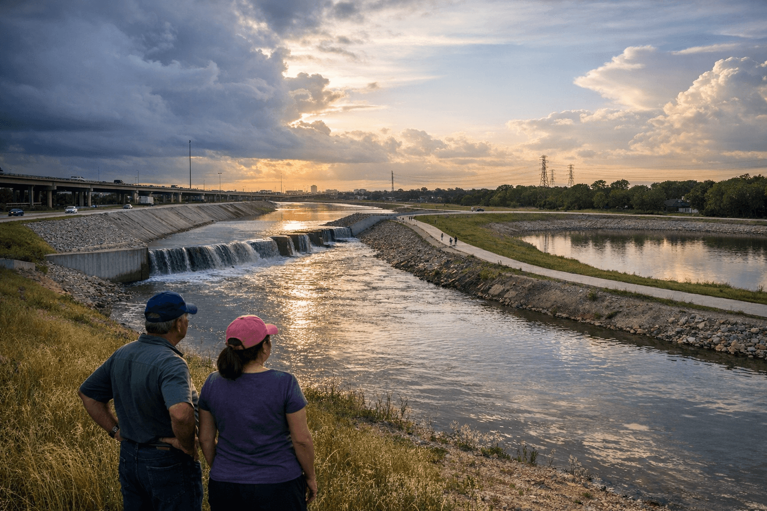
Water that once topped banks near Tidwell Road and sent emergency crews into neighborhoods in northwest Houston is now held in new detention basins and faster-moving channel sections, officials said after a ribbon-cutting marking the project's completion April 8, 2026. The work targets communities across the White Oak Bayou watershed, including parts of the City of Jersey Village, stretches northwest of FM 1960 and the corridor that feeds southeast to Buffalo Bayou.
Federal, county and local leaders attended the ceremony: the U.S. Army Corps of Engineers Galveston District and the Harris County Flood Control District led construction, joined by Commissioner Rodney Ellis, Houston City Council Member Amy Peck and partners including the Houston Parks Board. USACE published the completion release April 8 noting the project strengthens regional resilience by combining conveyance, detention and recreation.
What was built: 15.3 miles of grass-lined channel conveyance improvements, four detention-basin complexes covering roughly 352 acres that store about 2,940 acre-feet of stormwater, a bypass channel near Jersey Village and about 12 miles of hike-and-bike trail and linear park elements. The project’s reservoirs, USACE noted, “will hold enough water to fill nearly 1,500 Olympic swimming pools,” a detention capacity equivalent to nearly one billion gallons.
Those engineering numbers translate into measurable exposure reductions for homes and businesses under the federal project’s planning assumptions: using pre-Atlas 14 precipitation estimates, the project reduced the number of structures subject to a 10-year flood from 1,300 to 50, to a 25-year flood from 2,700 to 900, and to a 100-year flood from 6,100 to 4,600. Those gains are concentrated in the 110-square-mile White Oak Bayou watershed that drains into Buffalo Bayou and ultimately the Houston Ship Channel.
The project’s supporters framed the work as protection for neighborhoods and commerce: by increasing conveyance and lowering flood elevations upstream, the combined features reduce flood risk to transportation corridors and infrastructure that feed the Houston Ship Channel, which USACE tied to national economic resilience and called “multi-purpose infrastructure,” in the release.
Costs and context: the program began decades ago and carried a first-cost estimate of about $124 million, with HCFCD and the Corps listed as funders in the partnership agreement; many individual channel segments and detention basins had been built in prior phases, including a completed diversion channel in Jersey Village in 2010. Continued maintenance and additional upstream and downstream projects remain necessary to preserve the reductions achieved, county planners have said as they integrate the federal project with local efforts such as the I-10 White Oak elevation work.
The finished channel, basins and trails leave a visible footprint across northeast Harris County: new linear parks and basins at Fairbanks North Houston Road and conveyance improvements from Cole Creek toward FM 1960 are now part of the county’s flood toolbox, and the delivered reductions in exposed structures give planners concrete benchmarks to measure whether the years of public spending produced the promised protection.
This article was produced by Prism’s automated news system from verified source data, official records, and press releases, then run through automated quality and moderation checks before publishing. The system is built and supervised by the people who set the standards it runs under. Read our full AI policy.
Did this article answer your question?