Hidalgo County wildfire plan maps risk and protects rural communities
Hidalgo County’s wildfire plan is a practical map for rural life: it shows who sets the rules, where residents check current restrictions, and why the county keeps planning ahead.
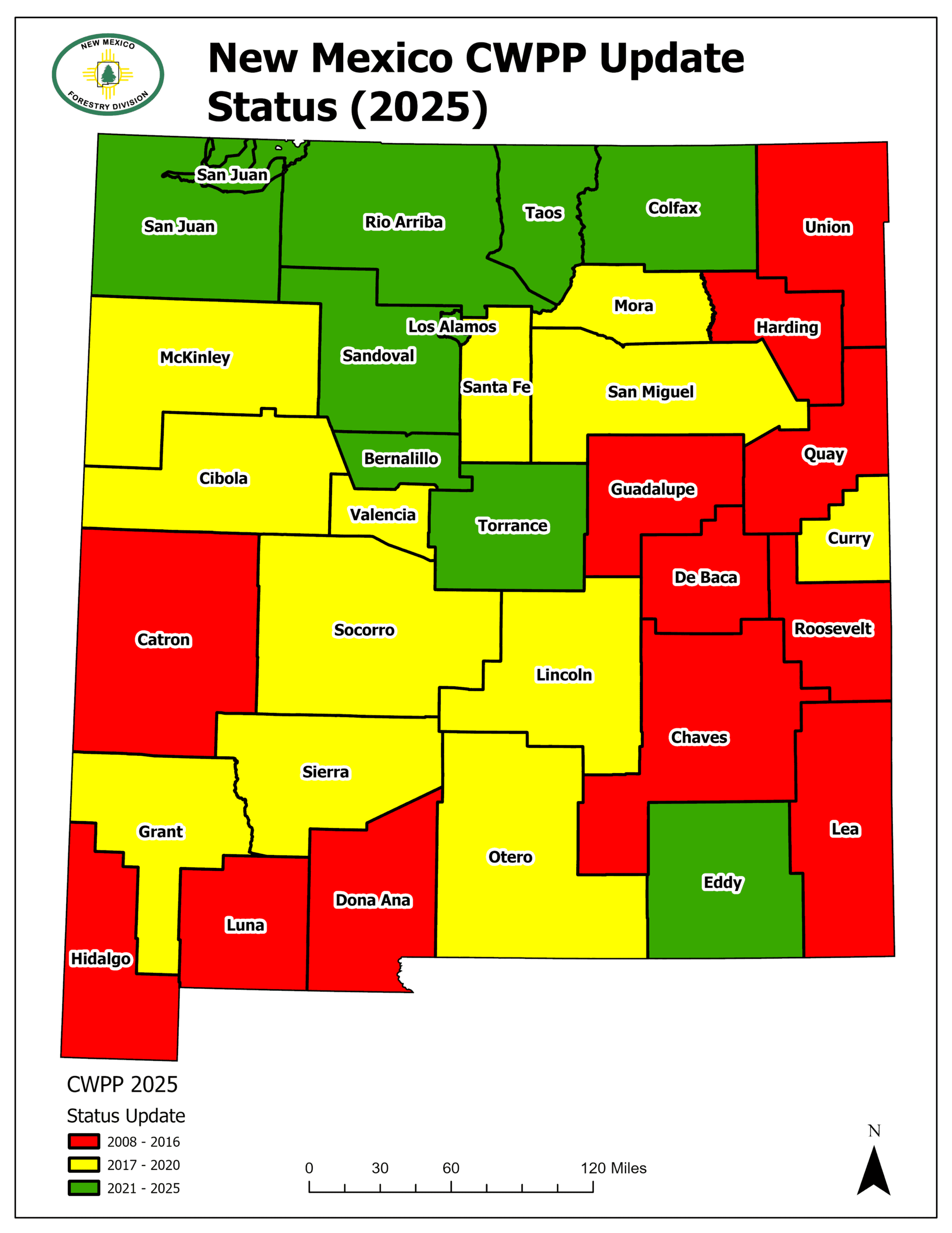
Hidalgo County’s 10-15-2009 Community Wildfire Protection Plan draft puts the county’s wildfire structure on paper before a fire starts, spelling out who has authority when rules change and what a rancher, homeowner, or traveler needs to know before working or moving through the bootheel. The county, state, and federal partners are all named in the planning process.
What the county wildfire plan is for
A Community Wildfire Protection Plan helps a county identify where homes, roads, community facilities, and other assets face the greatest exposure. It also tells local officials where fuel reduction or treatment should go first and how responders can coordinate before a fire reaches a neighborhood or ranch road.
In Hidalgo County, distance shapes every decision. Communities are small and spread out, so first-attack choices, evacuation routes, and communications can all be affected by geography. CWPPs are a way for communities to take proactive steps to protect themselves from dangerous wildfire. Fire Adapted New Mexico says the plans have become the primary mechanism for evaluating wildfire risk because they focus on community involvement and local resources.
Who built Hidalgo County’s plan
The 2009 draft was sponsored by the Hidalgo County Board of Commissioners, the Hidalgo County Fire Districts, the Hidalgo County Fire Marshal, and the Forestry Division of the New Mexico Energy, Minerals and Natural Resources Department, with additional support from the Bureau of Land Management.
The draft places Hidalgo County’s formal planning effort at a point when New Mexico was already building a broader CWPP framework. The BLM’s involvement reflects a county where fire risk can affect land that borders or connects with federal ground, and where mitigation planning has to consider how fire behaves across jurisdiction lines.
How restrictions work now
The county plan is the long-range piece. Fire restrictions are the day-to-day rulebook. Current fire restrictions are posted by EMNRD and by BLM for federal land in New Mexico. Residents should check those pages before burning, lighting campfires, or doing any activity limited by dry conditions.
The plan sets responsibility and priorities; the restrictions pages tell residents when fire-starting activities are limited.
What this means for ranchers, remote homeowners, and travelers
For ranchers, the plan helps show why fuel reduction, access routes, and communications matter so much. A ranch operation may depend on long roads, open land, and equipment moved across large distances, all of which can become harder to manage when fire danger rises. The county plan is built to help responders and local leaders think ahead about those conditions.
For homeowners in remote areas, the questions are simple and urgent: how close is the nearest ignition risk, which road is safest out, and how will responders reach the property if a fire starts nearby. The CWPP is designed to identify those vulnerabilities and point mitigation toward the places that matter most.
Travelers also need to pay attention during high-risk periods. In a county where state and federal land restrictions can change with conditions, a trip through the bootheel may mean encountering rules that limit burning or other fire-starting activity nearby. Checking the EMNRD and BLM restrictions pages before moving equipment, camping, or working outdoors is part of staying clear of a fast-changing fire environment.
Why the statewide numbers matter
Hidalgo County’s draft is part of a much larger New Mexico pattern. EMNRD’s 2023 Communities at Risk Assessment Plan lists 905 communities at risk and 65 CWPPs completed. EMNRD’s 2025 assessment shows all 33 New Mexico counties now have CWPPs or county-specific CWPPs completed.
Fire Adapted New Mexico says the state and its collaborative partners have spent about 15 years identifying wildfire-risk areas across New Mexico.
Why the plan still matters after a fire starts
The Eicks Fire in Hidalgo County in 2021 was tracked in a May 26, 2021 NM Fire Info update as it unfolded. A New Mexico firefighter was badly injured while battling a fire in Hidalgo County.
Funding and updated plans keep the system alive
New Mexico Counties’ 2026-2027 wildfire risk reduction grant program packet lists CWPP updates as eligible for up to $30,000 per project. The same packet ties the program to the National Fire Plan and the Department of the Interior’s Bureau of Land Management.
Other counties show how these plans evolve. Sierra County’s CWPP was originally accepted in June 2005 and later updated in 2012 and 2019. Bernalillo County’s CWPP was updated in June 2022.
This article was produced by Prism’s automated news system from verified source data, official records, and press releases, then run through automated quality and moderation checks before publishing. The system is built and supervised by the people who set the standards it runs under. Read our full AI policy.
Did this article answer your question?