Aerial photos show flooding damage across Millersburg after heavy rain
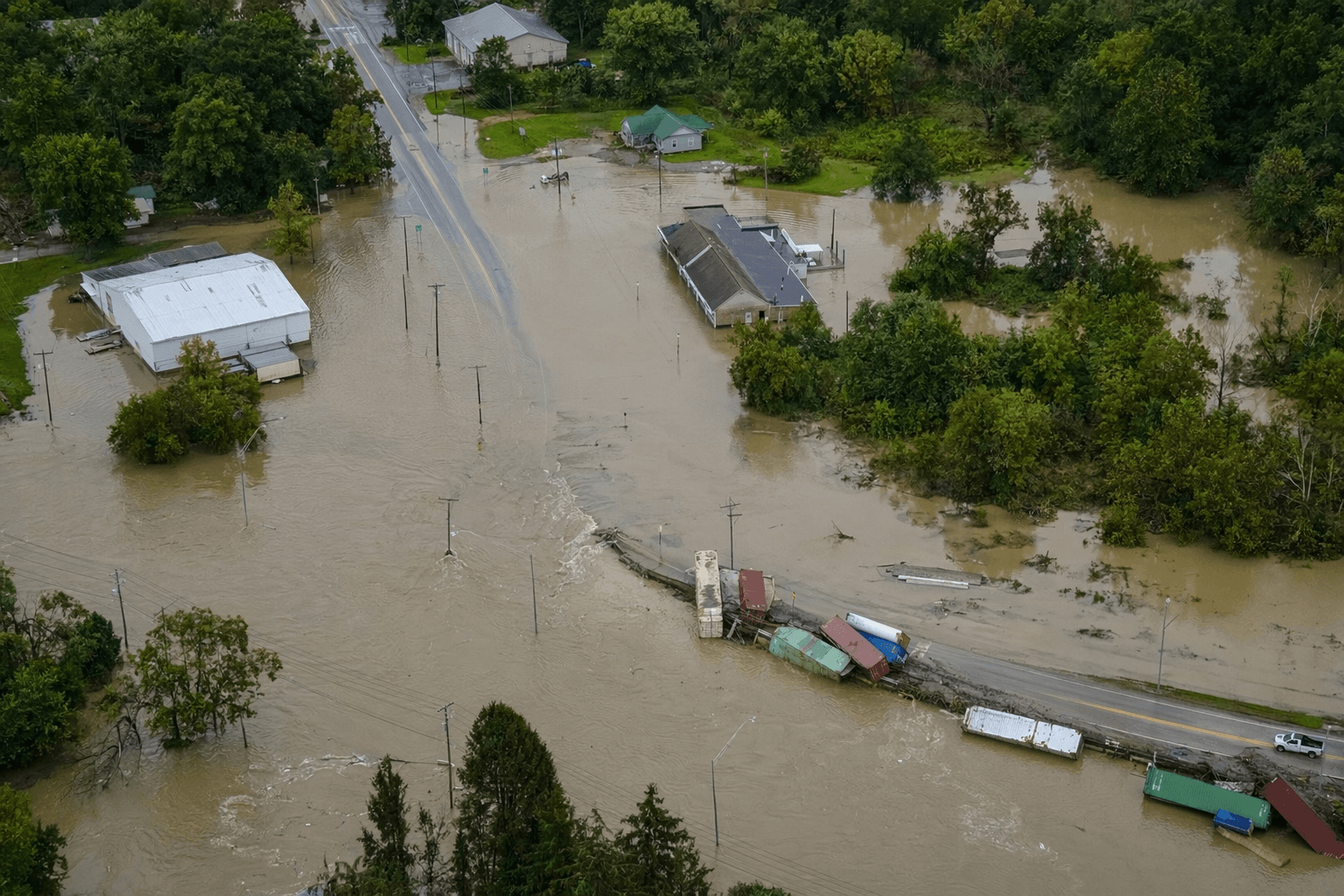
Aerial photos showed floodwater over State Route 39 and South Washington Street, while Township Road 129 saw water about 2 feet deep and shipping containers move.
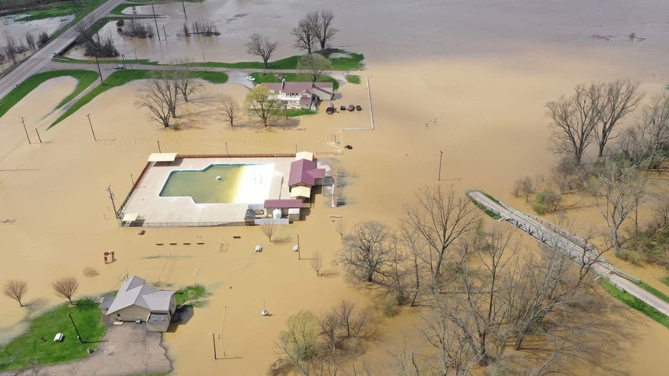
Aerial photographs from Dobbins Aerial Photography showed floodwater spread across Millersburg, with State Route 39 and South Washington Street among the hardest-hit spots after heavy rain pushed water into low-lying parts of the village. Millersburg police warned residents to use caution and avoid affected areas, a reminder that flooded roads in the county seat can turn everyday travel into a hazard in minutes.
The disruption stretched far beyond one block. News 5 Cleveland listed closures and high-water areas across Holmes County near Millersburg, including State Route 520 and State Route 62 at their intersection, State Route 520 from Glenmont to Killbuck, State Route 60 north and south of Killbuck, State Route 83 north of Holmesville near mile marker 16, County Roads 621 and 53, Township Roads 305 and 346, and high water on County Roads 165, 172, 114 and 88. On Township Road 129 near Millersburg, floodwaters reached about 2 feet deep and were strong enough to move shipping containers.
Holmes County Sheriff Timothy W. Zimmerly declared a Level 2 Road Emergency, signaling that unnecessary travel was strongly discouraged as water covered roads and made some routes unsafe. The National Weather Service in Cleveland issued flash flood warnings for Holmes County on the evening of Friday, April 3, and later extended them after the storm system dumped roughly 2.5 to 4.5 inches of rain across the county.

Killbuck Creek added another layer of risk after rising above its 15.0-foot flood stage. Forecasters warned it could threaten Water Street in Killbuck and State Route 60 south if it climbed higher, underscoring how quickly a storm system can strain the county’s low-lying road network.

For Millersburg, the damage was more than a striking aerial view. It meant detours around State Route 39 and South Washington Street, slower access for emergency vehicles, and added delays for errands, deliveries and commutes across the village and surrounding communities. The photos made the scale clear from above, but the impact was already visible at street level across Holmes County.
This article was produced by Prism’s automated news system from verified source data, official records, and press releases, then run through automated quality and moderation checks before publishing. The system is built and supervised by the people who set the standards it runs under. Read our full AI policy.
Did this article answer your question?