Holmes County Rails-to-Trails Offers 25-Mile Multi-Use Route Linking Villages
Holmes County's rails-to-trails provides a roughly 25-mile paved multi-use corridor linking villages, boosting local recreation and tourism in Amish Country.
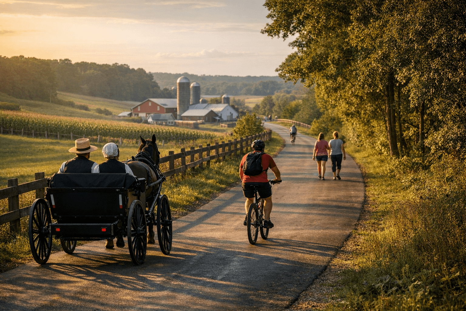
The Holmes County Rails-to-Trails creates a continuous, roughly 25-mile paved route that links Millersburg, the Holmesville area, Glenmont and stretches toward Killbuck and Brinkhaven. The multi-use trail accommodates bicyclists, walkers, runners, horseback riders and, in some rural segments, horse-drawn buggies, giving residents a safe, scenic corridor for everyday recreation and for visitors exploring Amish Country.
The trail is built from multiple connected segments, with TrailLink listing the Holmes County Trail at approximately 25–27 miles and many stretches surfaced in asphalt. Hipp Station in Millersburg is a common trailhead and parking point, while other village trailheads allow shorter rides and easier access to downtown Millersburg and nearby attractions. The route links directly to the Amish Country Byway and provides side-trip opportunities for dining, shopping in Berlin and Walnut Creek, visits to the Holmes County Victorian House Museum and wildlife viewing around Killbuck Marsh.
Local economic implications are tangible. The trail functions as infrastructure for tourism-driven businesses such as lodging, restaurants and shops that depend on both day visitors and longer stays. It also supports organized events - community rides and races - that bring visitors into Holmes County and generate activity for Main Street businesses. For everyday residents, the trail expands safe options for fitness and nonmotorized transportation, strengthening quality-of-life amenities that can influence household decisions about where to live.
From a policy perspective, the trail highlights priorities for local government and stakeholders: maintaining paved surfaces, coordinating parking and trailheads like Hipp Station, clarifying where horse and buggy traffic shares the route, and ensuring signage for safe yielding and mixed use. Winter use includes cross-country skiing where conditions permit, which spreads recreational demand across seasons but also raises maintenance and liability considerations that officials must weigh.
Practical notes for users: the trail supports a range of activities and is shared with Amish buggies in some rural stretches, so users should be prepared to yield and share space. Maps, parking locations and condition updates are available from local tourism resources and trail mapping services for trip planning.
As Holmes County positions itself as a destination in Ohio’s Amish Country, the rails-to-trails corridor serves both as a community amenity and an economic connector between villages and attractions. Continued attention to maintenance, signage and coordinated marketing can help turn the 25-mile route into a longer-term engine for recreation, small-business revenue and local mobility.
This article was produced by Prism’s automated news system from verified source data, official records, and press releases, then run through automated quality and moderation checks before publishing. The system is built and supervised by the people who set the standards it runs under. Read our full AI policy.
Did this article answer your question?