Holmes County tourism bureau warns drivers to share roads with buggies
Holmes County drivers face buggies, blind hills, and GPS traps. The safest move is simple: slow down, carry a map, and treat every bend as a shared lane.
Holmes County is not a place to trust muscle memory or a navigation app alone. The county tourism bureau says horse-and-buggy traffic is the most common roadway encounter, and it warns that blind hills and curves can put slow-moving vehicles, bikes, horses, and cars on the same stretch of road with little warning. In this county, safe driving starts with the assumption that the next bend may already be occupied.
Know what you are driving through
Holmes County was created in 1824, and its road network still reflects the rural landscape that drew settlers here. The county spans 422.6 square miles of land area, with working farmland, tight curves, and long sightlines interrupted by hills that hide whatever is coming next. That same geography helps explain why a visitor can be on a paved state route one minute and on a gravel township road the next.
The county’s population also helps explain the pressure on its roads. Holmes County had 44,223 residents in the 2020 Census and an estimated 44,970 in 2025, numbers that sit alongside steady tourist traffic and a large Amish settlement. The Holmes Amish settlement numbered 37,770 people in 2021 and is described as the second-largest Amish settlement in the world after Lancaster County, Pennsylvania. That mix of residents, visitors, and working traffic is why road etiquette here is not a courtesy lesson. It is a basic safety requirement.
Expect buggies, bicycles, horses, and road apples
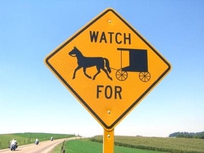
The Holmes County Chamber of Commerce & Tourism Bureau says visitors should plan to share the road with walking traffic, bicycles, e-bikes, horseback riders, and horse-and-buggy travel. The bureau identifies the horse and buggy as the most common roadway encounter, which makes passing behavior especially important. The rule is simple: do not force a pass, and do not try to squeeze by where a hill, curve, or blind rise leaves you without a clear view.
The tourism bureau also says road apples are part of the experience, a reminder that horse traffic here is not a novelty. It is routine. Drivers who come from suburban roads often misread the speed of a buggy, but a buggy is not a slow car. It is a completely different vehicle class on a road system that still serves farm equipment, cyclists, and pedestrians.
The Holmes County Chamber of Commerce says buggies are typically marked at night with reflective tape and slow-moving vehicle triangles. Those markings matter after dark, but they do not replace caution. On the county’s smaller roads, low light and rolling terrain can make a buggy visible only at the last moment, especially around the hills and bends the tourism bureau specifically warns about.
Use the road system the way locals do
The 2026 Holmes County visitor guide breaks the county’s road network into practical categories. State routes are paved and marked for two-way traffic, county roads are generally chip-and-seal, and township roads may be gravel. That distinction is more than a map detail. It affects braking distance, dust, tire grip, and how quickly a car can stop if a buggy or bicycle appears around a curve.
The same guide points out a navigation problem that frustrates many first-time drivers: GPS can misread abbreviated route names. When a system does not recognize SR, CR, or TR, the guide suggests using Highway instead of Road. That advice is especially useful in a county where a business with a Millersburg address may actually be in Berlin, and a Sugarcreek address may be closer to Walnut Creek. The postal label and the road location are not always the same thing.
Those quirks explain why the official visitors guide still matters. In Holmes County, navigation is not only about the destination. It is about understanding how local roads are named, how they are surfaced, and how route numbers map onto real travel time.
Do not count on a ride app to save you
The tourism bureau says Holmes County does not have regular public transportation, and app-based taxi service is scarce. It also says phone service can still drop in some hills and valleys, which means a map should not be an afterthought. Carry a county map or the official visitors guide before you leave town, especially if you are heading into a road network where GPS may lose the correct road name just as cell service fades.
Motorcyclists face the same reality. The bureau says motorcycles are welcome, but the roads are hilly and curvy and riders should expect buggies, tractors, and bicycles around the next bend. That combination makes defensive driving essential. Whether you are in a car or on two wheels, the county’s travel pattern is slower, narrower, and more variable than most drivers are used to.
For delivery drivers and newcomers, the rule is to plan routes conservatively and allow more time than an app suggests. A road that looks direct on a screen may still be difficult to pass on, difficult to turn around on, or impossible to navigate quickly once a buggy or farm vehicle is in front of you.
Why the safety warnings keep getting revisited
The Ohio Department of Transportation says the Amish Buggy Safety Action Plan was completed in 2000, but later work became necessary because Amish populations had migrated beyond the earlier study limits. To update its understanding of the roads, ODOT says it conducted 417 traffic counts across 11 districts between November 2018 and August 2019 as part of its buggy-count study. That broader traffic picture matters in Holmes County, where semis, trucks, tractors, cars, horse and buggies, e-bikes, unpowered bikes, schoolchildren, and farm equipment all share the same corridors.
ODOT’s background explains why this remains a live transportation issue rather than a one-time educational push. The roads are not designed around a single mode of travel, and the mix of users changes by season, by time of day, and by location. In a place where hills and twisting roads already make driving a challenge, the margin for error stays thin.
Where to orient yourself before you roll out
The Holmes County Chamber of Commerce has built more than a brochure approach to navigation. It offers an interactive wander map, and the county’s visitor infrastructure includes the Holmes County Chamber of Commerce & Tourism Bureau and Behalt, the Amish & Mennonite Heritage Center. The county’s own road resources also include road-record books and a road-name cross-reference table, a sign of how much local travel still depends on place-specific knowledge rather than app-based routing alone.
The county’s history page ties today’s road landscape to earlier settlement patterns, including the Greenville Treaty Line of 1795 and frontier conflict before the county’s 1824 creation. That history is not decorative. It helps explain why the roads curve the way they do, why farmlands sit close to travel routes, and why the transportation culture here still centers on coexistence.
For anyone driving, cycling, riding, or delivering in Holmes County, the practical rule is unchanged: slow down before the blind hill, assume a buggy may be around the curve, and keep a map within reach when the signal drops. In this county, the safest route is the one that leaves room for everyone else on the road.
This article was produced by Prism’s automated news system from verified source data, official records, and press releases, then run through automated quality and moderation checks before publishing. The system is built and supervised by the people who set the standards it runs under. Read our full AI policy.
Did this article answer your question?