Geologists trench newly identified Humboldt County fault for quake clues
A trench in Humboldt County is exposing layers that could show when a newly identified thrust fault last broke. The findings could sharpen quake hazard planning from Eureka to the Samoa Peninsula.
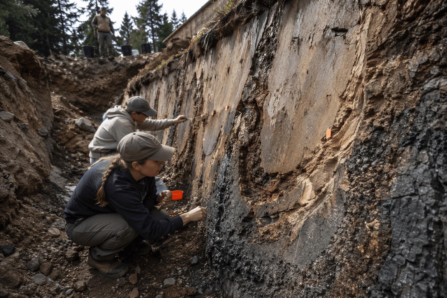
Geologists opened a trench this week on a newly identified thrust fault in Humboldt County, a field study that could help determine how often the ground beneath the Humboldt Bay region has ruptured and how large those earthquakes may be.
The work matters because Humboldt County sits in one of California’s most complicated seismic settings. North of Cape Mendocino, the Gorda plate is being forced beneath North America, compressing the crust and helping drive an active fold-and-thrust belt around Humboldt Bay. County planning documents identify the Little Salmon fault and the Mad River fault zone as active thrust faults capable of generating large-magnitude earthquakes, with the Samoa Peninsula, Eureka and surrounding communities sitting inside the region most exposed to that hazard.
Paleoseismology, the science behind the trenching, looks for physical evidence of old earthquakes in the ground. By cutting across a fault and examining displaced layers of sediment, geologists can reconstruct a timeline of past ruptures and estimate whether a fault has moved repeatedly over centuries or millennia. In Humboldt County, that kind of evidence can be preserved in thick Pleistocene deposits and in late Holocene bay muds and estuarine sediments laid down around Humboldt Bay.
Mark Hemphill-Haley of Cal Poly Humboldt said he is involved in a U.S. Geological Survey NEHRP-funded project to evaluate the surface rupture history of the Little Salmon fault. His work underscores how closely researchers are now examining the offshore-onshore seismic boundary that runs through this part of the North Coast, where active faults are part of the southernmost onshore end of the Cascadia subduction zone.
The trenching also lands in a county that has been living with renewed earthquake awareness since the Dec. 20, 2022 sequence, which was followed by more than 80 aftershocks of magnitude 2.5 or greater over the next month. That swarm reminded residents from Eureka to the Samoa Peninsula that Humboldt’s earthquake risk is not theoretical, even when the fault itself is hidden beneath layers of mud and older sediment.
The trench will not predict the next earthquake. What it can do is tighten the history that hazard maps, emergency planning and building decisions rely on, turning a newly recognized fault from a line on paper into a clearer picture of how the ground beneath Humboldt County has moved before, and may move again.
This article was produced by Prism’s automated news system from verified source data, official records, and press releases, then run through automated quality and moderation checks before publishing. The system is built and supervised by the people who set the standards it runs under. Read our full AI policy.
Know something we missed? Have a correction or additional information?
Submit a Tip
