Iron County bridges tell the story of road building history
Iron County’s surviving bridges show how highways reshaped downtown Iron River, rural township roads, and county maintenance priorities. A few spans still carry traffic; others preserve road-building history in place.

Iron County’s bridge inventory reads like a map of how travel shifted from local dirt-and-concrete routes to trunkline highways and, in some places, back again to preservation. The surviving spans in Iron River, Bates Township, Amasa, and along M-69 show where the county built first, where state highways later pulled traffic away, and which pieces of that older road network still matter to drivers, taxpayers, and planners today.
A county inventory that tells a road network story
The bridge record for Iron County is not just a list of structures. It captures three distinct moments in transportation history: rural county-road construction, trunkline-era engineering, and later rehab efforts meant to keep historic bridges in service without erasing their original character. The most revealing part is that these bridges are scattered across the county, which means the story is not confined to one town or one corridor. It stretches from Iron River to Bates Township and Amasa, showing how the county’s built landscape changed as traffic patterns changed.
That matters now because bridges are among the clearest public records of what a community decided to build, preserve, bypass, or replace. In Iron County, the remaining spans show where earlier roads once carried the main flow of movement through town centers, over creeks, and across river crossings that no longer function the same way.
Genesee Street Bridge and the old main line through Iron River
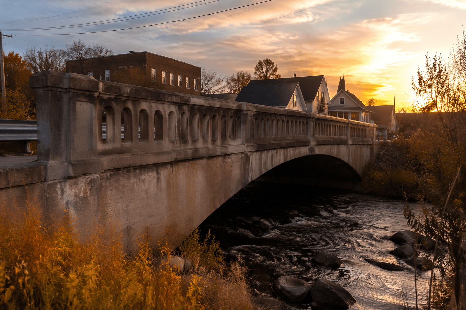
The Genesee Street Bridge, also known as the US 2-Iron River Bridge, is the clearest example of a downtown crossing that once anchored everyday travel. Built in 1917, it is a concrete closed-spandrel deck arch measuring 90 feet long with a 45-foot roadway. For decades, it carried the main route through Iron River until US-2 was realigned north in 1998, shifting through traffic away from the bridge and the downtown crossing it served.
That realignment is the public planning story in miniature. When US-2 moved, it did not just change a line on a map. It changed which streets bore the pressure of through traffic, which parts of downtown saw more local use than highway use, and how the bridge functioned in the city’s daily life. The National Register listing in 1999 recognized the bridge’s value in engineering and transportation history, and that recognition reflects more than age. It marks the bridge as a preserved reminder of when the river divided the town and the highway ran directly through the center of community life.
For Iron River, this is not a frozen artifact. It is a still-visible piece of the old street and highway pattern, and it remains useful as a reference point for how downtown traffic once worked before the route shifted north.
Chicagon Mine Road Bridge and the county-road era
If the Genesee Street Bridge represents the highway age, the Chicagon Mine Road Bridge represents an earlier county-road era. Located in Bates Township over Chicagon Creek, it was built in 1910 and is identified as a 25-foot concrete slab span, probably built for the Iron County Road Commission. The National Register record places it firmly in the county’s bridge history, and HistoricBridges describes it as the earliest dateable concrete slab bridge found in Michigan.
That detail gives the bridge unusual significance. It preserves an early stage in concrete bridge construction, before statewide standardization made these structures more uniform. In practical terms, it shows how Iron County was experimenting with materials and techniques at a time when roads were still being formalized into a countywide system. The bridge is not only old; it documents a stage of public works development that is easy to overlook once later highway standards take over.
For local planning, that makes the bridge a useful benchmark. It is a reminder that some of the county’s oldest transportation infrastructure survives in out-of-the-way places, not just in downtowns. It also shows how a road commission-era bridge could still stand as part of the landscape long after the traffic patterns that justified it first changed.
M-69 and the preservation problem
The M-69 Paint River Bridge adds a different layer: a major crossing that was not only preserved, but carefully rehabilitated. Built in 1924, it is a concrete open-spandrel deck arch with a 131-foot main span and a total structure length of 261.8 feet. In 2001, it was rehabilitated with replacement elements closely replicated so the bridge would keep its original appearance.
That approach shows the balancing act counties and state highway agencies face with historic structures. A bridge can remain important to traffic and still require work that is expensive, technical, and politically visible. The M-69 bridge shows how preservation can be part of infrastructure policy rather than separate from it. Safety, load capacity, and appearance all have to be considered together, especially when a bridge still serves a road people actually use.
The bridge also helps explain why Iron County’s bridge story is not just about the past. Rehabilitation is a present-day decision about where to spend public money and how to keep a crossing functional without stripping away its original character. In that sense, the M-69 bridge is a live example of preservation-minded infrastructure management.
Amasa and the old trunkline footprint
The county listing also includes the Old US-141 Bridge in Amasa, another surviving span that helps trace the old trunkline network through Iron County. Even without treating it as a postcard relic, its presence in the inventory matters because it points to a route that was once part of the active highway system and is now part of the county’s historical landscape.
Taken together with the Iron River and Bates Township bridges, it shows how the old road system did not disappear when newer alignments and numbered routes took over. Some spans were bypassed, some were retained, and some were rehabilitated so they could keep serving a road network that taxpayers still help maintain.
Why these bridges still matter to residents and planners
The county’s surviving bridges show where transportation decisions left a lasting mark. US-2 was shifted north in 1998, changing Iron River’s traffic pattern. The M-69 bridge was rehabilitated in 2001, showing that preservation and safety can be managed together. The Chicagon Mine Road Bridge survives as an early concrete example in a rural township, and the Old US-141 Bridge in Amasa ties the county to a former trunkline corridor that no longer defines travel the way it once did.
That is the present-day stake in Iron County. Bridge preservation is not only about honoring old engineering. It is about deciding which structures remain in service, which ones need costly upkeep, and which ones still help local roads connect people to downtowns, townships, and county routes. In Iron County, the bridges themselves are the evidence.
This article was produced by Prism’s automated news system from verified source data, official records, and press releases, then run through automated quality and moderation checks before publishing. The system is built and supervised by the people who set the standards it runs under. Read our full AI policy.
Did this article answer your question?