Iron County brochure spotlights nine scenic waterfalls for day trips
Nine named stops, one workable loop: Iron County’s waterfall brochure pairs spring runoff timing with a 54-minute, easy-to-difficult day-trip plan.
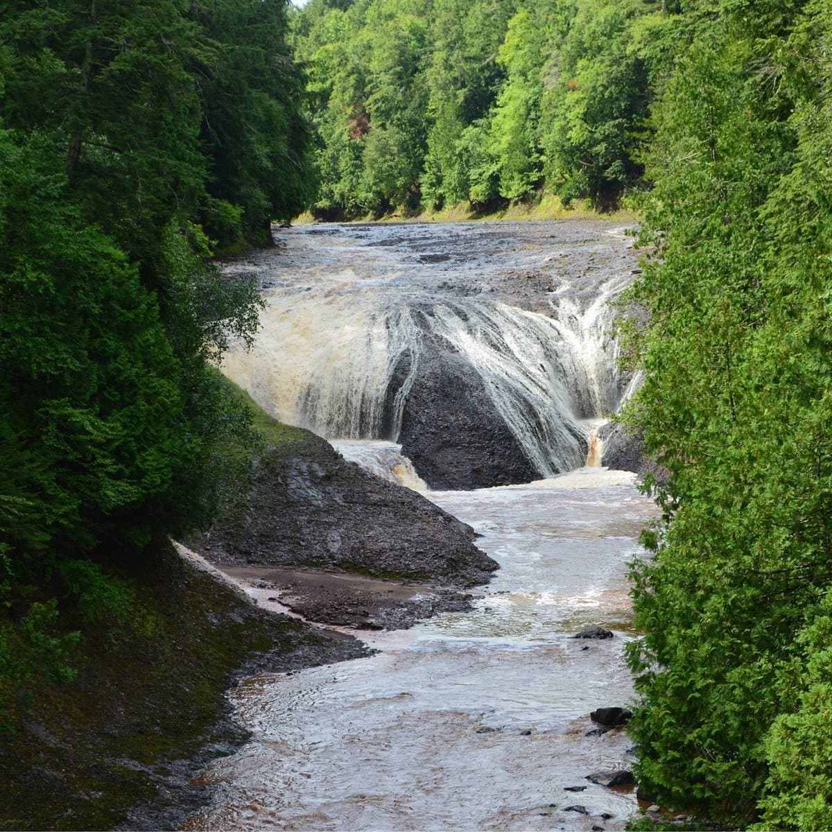
Iron County’s waterfall brochure turns a loose scenic detour into a practical weekend route: nine named stops, a 54-minute travel note, and an accessibility range from Easy to Difficult. Spring gives the strongest water, when snowmelt and April showers swell the rivers and streams, but the same loop works from spring through fall, especially if you want to pair it with Crystal Falls, the Paint River, and the county’s broader outdoor network of forest land, lakes, and trails.
The county is built for that kind of trip. Iron County sits amid 400,000 acres of public forestland in the Ottawa National Forest, and county materials point to more than 250 lakes, 200 miles of rivers, and Blue Ribbon Trout Streams as part of the same outdoor system. If you are planning a waterfall day, the useful move is to match the stop to the route: some are short walks, some are drive-up looks, and a few belong in a longer outing when road conditions and daylight are on your side.
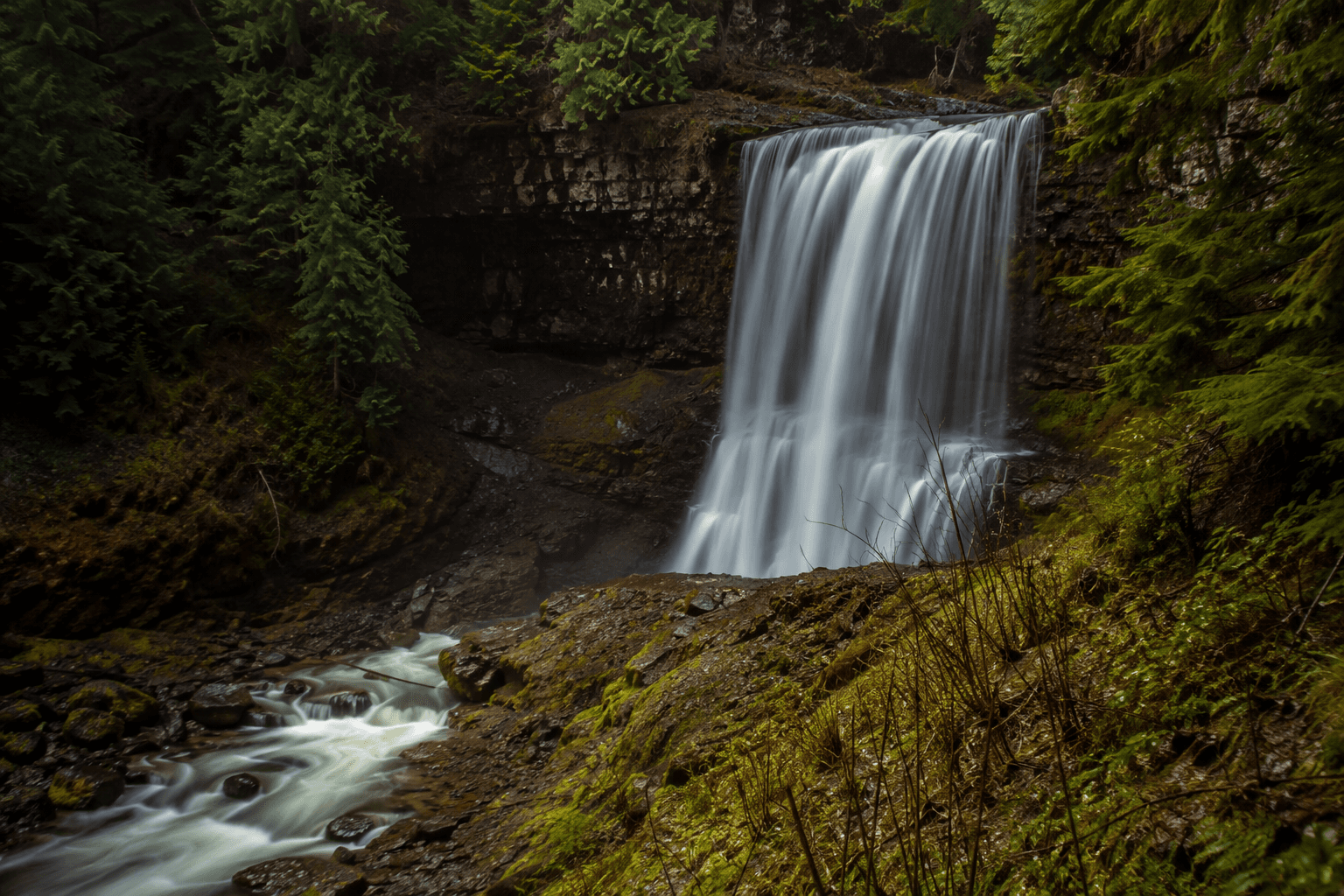
Agate Falls
Agate Falls is one of the easiest ways into the brochure’s western Upper Peninsula loop because the access is built for a short family walk rather than a full hike. Trail notes describe a 0.3-mile universally accessible walk to a viewing platform, with a parking area and picnic area, and the falls drop nearly 40 feet over the middle branch of the Ontonagon River. If you want the safest, most legal approach, this is the model stop: park in the designated area, follow the improved trail, and take in the view from the platform.
Bond Falls
Bond Falls fits the same low-stress category, which is why it is a natural companion to Agate on a day trip. Trail information points to a paved surface and three designated van-accessible spaces in the trailhead lot, making it a short family walk rather than a rough-road adventure. The brochure places it in the larger Iron County waterfall set, but in practical terms it works best as an easy, scenic stop when you want a clean access point and a trail you can walk without special gear.
Canyon Falls
Canyon Falls is the stop to save for a longer outing, not a quick pull-off. Trail listings describe a 0.75-mile moderate walk, with parking handled through multiple pull-offs along a rough road, and road conditions are best when it is dry. That extra effort matches the setting: Canyon Falls is known as the Grand Canyon of Michigan, where the Sturgeon River drops through a gorge rather than simply crossing a roadside ledge.
Chicaugon Falls
Chicaugon Falls keeps the Crystal Falls connection front and center, but it asks more of your route planning than a paved overlook does. Trail notes put the hike at about 0.75 miles, rated moderate, and describe the access road as rough enough that drivers often rely on pull-offs before the road becomes impassable for their vehicle. The waterfall itself is described as a 23-foot tiered fall on Chicagon Slough, so this is a worthwhile half-day stop when you want a short walk with a real trail payoff.
Duppy Falls
Duppy Falls is one of the brochure’s quieter names, but it still matters because it sits inside the same nine-stop planning frame as the better-known sites. The county’s Easy-Difficult range gives you the clue: this is not a separate expedition so much as one more waypoint to layer into the route if you are already out on the western Upper Peninsula circuit. In spring, that matters even more, because the runoff window is when the falls carry the most water and the day-trip list has the most visual payoff.
Horse Race Rapids
Horse Race Rapids is the cleanest driving instruction on the list, and that makes it a useful anchor for readers who want something they can find without guesswork. From Crystal Falls, head south on U.S. 2 for about 6 miles, turn left on County Airport Road, then continue straight onto Horserace Rapids Road to a trail that leads down to the Paint River. It is a short family walk with easy driving access, and the county’s own advice is to trust the sound of the water as you get close.
Jumbo Falls
Jumbo Falls belongs in the same broader loop as Agate and Bond, which is exactly how Iron County’s brochure wants the trip organized. The point of the county’s 54-minute note is not to turn every stop into a separate expedition, but to let you stack a few named waterfalls or rapids into one practical drive. On a day when you already have room for multiple stops, Jumbo Falls is the kind of name that helps fill out the route between the more clearly mapped trailheads.
Mex-i-min-e Falls
Mex-i-min-e Falls is another brochure-listed stop that shows how Iron County packages waterfall travel as a route rather than a single destination. The county’s outdoor materials stress that the region has the water and public land to support that approach, from the Ottawa National Forest to the miles of rivers and Blue Ribbon Trout Streams that cut through the county. That makes Mex-i-min-e Falls best suited to a longer loop when you are already committed to a scenic drive and have time to move from one named stop to the next.
Tibbetts Falls
Tibbetts Falls closes out the brochure’s nine-stop set and fits the same day-trip logic as the rest of the list. The county’s waterfall materials do not treat the stops as isolated attractions; they present them as part of a western Upper Peninsula network that can pair with historic routes like the 36-mile Heritage Trail and nearby heritage towns such as Alpha, which has several buildings on the National Register of Historic Places. If you want one Iron County outing that combines water, roads, and a sense of place, Tibbetts Falls belongs in that larger circuit.
This article was produced by Prism’s automated news system from verified source data, official records, and press releases, then run through automated quality and moderation checks before publishing. The system is built and supervised by the people who set the standards it runs under. Read our full AI policy.
Did this article answer your question?