Iron County's Top Outdoor Recreation Spots, From Parks to Lakes
Iron County has 300+ lakes and 250+ miles of groomed snowmobile trail; here's the practical guide to reaching every major spot safely this season.
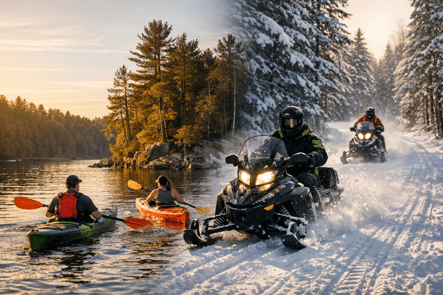
Two snowmobile clubs groom more than 250 miles of Iron County trail every winter, over 300 lakes sit within reach of virtually every resident, and the Brule River Trail through Pentoga Park runs mostly empty on weekdays. This county's outdoor infrastructure is genuinely exceptional, and genuinely underused by people who know it's there but don't know the access points, the rules that get visitors cited, or the seasonal hazards that turn a good day sideways. Here, by priority, are the seven spots that matter most.
1. Pentoga Park (George Young Complex)
Park at the Brule Lake picnic grounds off County Road 424; that's the correct trailhead, not the first pullout you'll pass, and confusing the two puts you a half-mile off-route before you start. No permit is required, but download a trail map before you go because cell signal is unreliable past the first mile. The signature route is the 5-mile Brule River Trail, which launches from the registration booth, crosses CR 424, and runs to the Brule River; the 1-mile Indian Ceremonial Bowl Trail offers a shorter loop with a stop near the Ojibwa burial structures at the south end of Chicagon Lake. Spring breakup is the biggest seasonal hazard: wet sections near the Brule River can be impassable through late April, and the county road commission posts closures with little warning.
The rule locals most often get wrong: driving to the first pullout instead of the designated Brule Lake picnic area lot.
Surprising stat: Pentoga Park anchors the southern end of the 36-mile Iron County Heritage Trail, a paved loop connecting 14 historic and recreation sites that begins in Iron River.
If you only have 2 hours: Walk the Indian Ceremonial Bowl Trail (1 mile) and take in the burial structures near Chicagon Lake's south shore. Half-day: Hike the Brule River Trail's full 5-mile out-and-back, packing water and blaze orange during hunting season. Full day: Bike the Heritage Trail from Iron River to Pentoga Park, hitting all 14 sites on the paved loop.
2. Runkle Lake Park (Crystal Falls)
Street parking is available directly adjacent to the park in Crystal Falls; no fee or pass is required for day use. The park includes a small beach, playground, and a boat launch ramp suitable for small motorized and non-motorized craft. There is no lifeguard on duty, which is the critical detail families with young children consistently miss in the summer rush.
The rule locals most often get wrong: launching a motorized boat without a displayed Michigan DNR registration, which is legally required on any public water.
Surprising stat: Runkle Lake Park doubles as one of Crystal Falls' primary community event venues year-round; before driving down for a quiet beach afternoon, check the Iron County Chamber events calendar to avoid sharing the sand with a few hundred people at a festival.
If you only have 2 hours: Swim, use the playground, and walk the lake perimeter from the beach. Half-day: Launch a canoe or kayak, explore the lake, then stay for a picnic at the waterside tables.
3. Chicaugon Lake
Multiple Michigan DNR public boat launches ring the lake; launch fees are waived with a valid Michigan Recreation Passport, which is included with annual vehicle registration. Cell signal is marginal to nonexistent along the eastern shoreline, so pre-load a GPS map before heading out. During ice fishing season, typically December through February, always verify ice thickness locally before driving onto the surface: Chicaugon's maximum depth of 115 feet means ice thickness varies significantly from shore to mid-lake.
The rule locals most often get wrong: targeting only walleye and ignoring the lake's northern pike and largemouth bass, both of which have separate DNR size and bag limits that visiting anglers routinely overlook.
Surprising stat: Chicaugon Lake covers 1,100 acres and drops to 115 feet at its deepest, sustaining a self-reproducing walleye population that the Michigan DNR actively monitors through annual population studies. DNR fisheries crews including Technician Supervisor Mark Mylcheest have conducted multi-day electrofishing and fyke-net surveys here, making it one of the most closely watched fisheries in the county.
If you only have 2 hours: Launch at the nearest public ramp and fish the walleye-productive shallows along the western shoreline at dawn or dusk. Half-day: Fish the morning bite, then walk the 2 miles of beachfront at the George Young Complex on the lake's edge. Full day: Fish, paddle, and in winter use 1,100 acres of open ice for a cross-country ski session when conditions are confirmed safe.
4. Iron County Snowmobile Trail Network
Trailhead signage marks major entry points in Iron River, Crystal Falls, Amasa, and Sidnaw. Riders must carry a current Michigan snowmobile registration and a trail permit, available online through the Michigan DNR or at local outfitters; this is the step out-of-county visitors most often skip. Fuel stops are spaced along the network, but Trail 15 into the northern woods has long gaps; carry extra fuel. The Iron Range Trail Club (906-265-7152) grooms approximately 150 miles of trail; the Chippewa Sno-kats Snowmobile Club (906-875-3117) handles roughly 100 miles. Call either club for current conditions before you go.
The rule locals most often get wrong: leaving the marked route onto private land. A substantial portion of Iron County's trail system crosses private property under informal landowner agreements that riders violate the moment they go off-trail.
Surprising stat: Iron County's two trail clubs together groom and maintain more than 250 miles of trail locally, part of a regional network exceeding 300 miles that threads across the western Upper Peninsula, connecting riders from as far as Kenton and Sidnaw.
The biggest late-season hazard is slush beneath the snowpack. Above-freezing daytime temperatures in late February and March convert packed trail surfaces into hidden wet traps that can high-center a machine in minutes.
If you only have 2 hours: Ride Trail 15 north from Iron River for a 10-15 mile out-and-back into the northwoods. Half-day: Loop from Crystal Falls through Amasa via Trail 111, hitting fuel stops along the way. Full day: Complete the full Iron Range Trail Club loop connecting Iron River, Crystal Falls, Amasa, and Sidnaw.
5. Local Forest Campgrounds and Dispersed Camping Areas
Ottawa National Forest and Michigan state-managed forest lands frame Iron County on multiple sides, creating access to remote camping with no real drive required. Developed campgrounds charge nightly fees and accept reservations through Recreation.gov. Dispersed sites are free and require no permit, but Michigan's 200-foot buffer rule mandates that you camp at least 200 feet from any water, trail, or road. Cell signal is absent across most backcountry zones; file a trip plan with someone before you go.
The rule locals most often get wrong: setting up a dispersed camp directly at a lakeside clearing, unaware that the 200-foot buffer is an actively enforced regulation and not a guideline.
Surprising stat: With 300-plus lakes and extensive forest road access, Iron County offers more waterside dispersed camping options than nearly any comparable county in Michigan, most of which see fewer visitors per year than a single summer weekend at a downstate state park.
The most common seasonal hazard is fire. July and August dry periods frequently trigger fire bans across Ottawa National Forest units; check current restrictions at the local ranger station or forest service website before lighting anything, including a camp stove.
Half-day: Drive to a developed Ottawa National Forest campground, set up a site, and do a short evening hike before dark. Full day: Paddle or portage to a dispersed site on one of the county's lesser-known lakes and spend the night.
6. Ice Safety and Lake Access Education Resources
Demonstrations are offered periodically by Iron County fire and rescue departments and volunteer organizations; check the Iron County Library event calendar and municipal websites for scheduled sessions, which are typically free but capacity-limited. Bring your own ice picks if you have them.
The rule locals most often get wrong: heading onto the ice alone and without self-rescue gear. The three recommended tools (ice picks, a throw rope, and a flotation device) are widely known and almost never carried.
Surprising stat: With more than 300 lakes within or adjacent to Iron County, ice safety is not a niche recreational topic; it is a core winter life skill for essentially every household in the county.
The highest-risk windows are early December, when ice forms quickly and unevenly, and late March, when a 48-hour warm spell can drop 6 inches of solid ice to 2 inches without any visible surface change. Locals who have fished the same lake for 20 years have broken through during these transition windows.
If you only have 2 hours: Attend a scheduled ice safety demonstration; the hands-on self-rescue drill, which simulates breaking through and pulling yourself out, is the technique that actually changes behavior in an emergency.
7. Hiking and Wildlife Watching on County-Managed Trails and Small Preserves
County-managed trails and small natural preserves are accessible from road-edge pullouts throughout Iron County, most without formal trailhead infrastructure. No fee or pass is required. The Michigan DNR and Iron County Recreation pages offer downloadable maps; print one before you go because cell signal is limited across most of these areas.
The rule locals most often get wrong: arriving mid-morning. The productive wildlife window is 6 to 8 a.m., particularly during May and September migration peaks, when warbler and raptor activity can be dramatic and is almost entirely finished by 10 a.m.
Surprising stat: Spring and fall migration routes across the Upper Peninsula funnel tens of thousands of birds through Iron County's forests and wetlands each year, quietly making the county one of the better birding destinations in the region. It rarely appears on birding lists because it lacks a formal visitor infrastructure, not because the birds aren't there.
Fall color peaks late September through mid-October but runs directly concurrent with archery and early firearm hunting seasons. Wearing blaze orange on any trail that crosses managed forest is not optional during those weeks.
If you only have 2 hours: Reach a county trailhead at first light during May or September and walk slowly; bird activity drops sharply after 9 a.m. Half-day: Pair a morning wildlife walk with a fall color drive along sections of the Iron County Heritage Trail. Full day: Walk multiple preserves across the county during peak color week in late September, when the hardwood ridges produce some of the most photographed scenes in the western Upper Peninsula.
The infrastructure here supports serious outdoor use year-round, and the county's two trail clubs, the Michigan DNR, and local fire and rescue departments have collectively created a safety and stewardship network that rewards preparation. Register at trailheads where sign-in options exist, let someone know your itinerary, and respect posted closures during spring breakup. These places stay available because people treat them carefully.
This article was produced by Prism’s automated news system from verified source data, official records, and press releases, then run through automated quality and moderation checks before publishing. The system is built and supervised by the people who set the standards it runs under. Read our full AI policy.
Did this article answer your question?


