Coupeville walking tour reveals Ebey’s Landing history and heritage
A 1.9-mile walk from Town Wharf turns Coupeville into an open-air lesson in Island County history, from Captain Thomas Coupe to Ebey’s Landing.
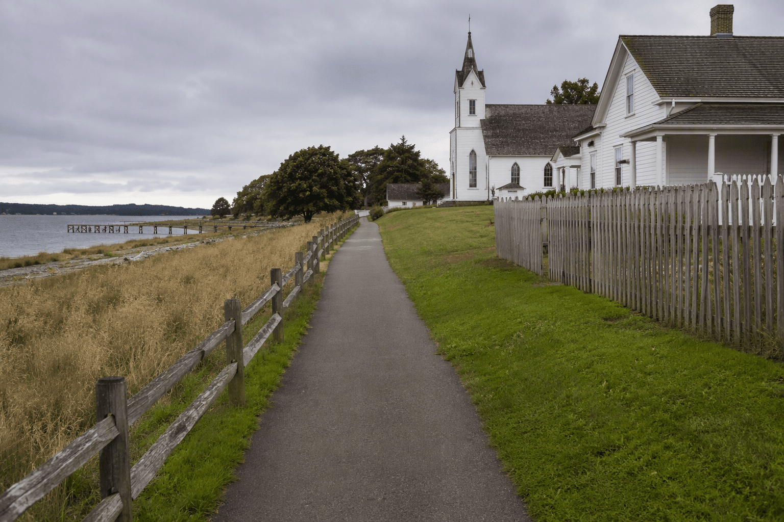
Couveville’s best history lesson begins at the foot of the Town Wharf, where Front Street meets Alexander Street and a self-guided route points you through a town that still looks, in many places, much as it did more than a century ago. The National Park Service brochure maps the full walk at about 1.9 miles and allows for shorter versions, which makes it useful whether you want a quick heritage stop or a slower look at the waterfront, the streets behind it, and the larger preserved landscape around Penn Cove.
Why Coupeville matters in Island County
Coupeville is not just one of Washington’s oldest towns. It is the only town inside Ebey’s Landing National Historical Reserve, a distinction that gives the walk a broader meaning for Island County residents and visitors alike. Founded in 1852 by Captain Thomas Coupe, the town also serves as the seat of Island County, so the buildings along the route are tied to both everyday civic life and the county’s earliest settlement story.
In a place where tourists come for views, the walking tour shows that preservation is not simply about keeping old houses standing. It also means maintaining a working main street, a public waterfront, and a recognizable town center that still helps define how central Whidbey functions today.
Start at the Town Wharf
The route begins at the information kiosk at the foot of the Town Wharf, at Front and Alexander streets, and runs through roughly 24 blocks.
The setting around the wharf gives the tour its first clue about Coupeville’s past. Penn Cove and the waterfront helped shape the town’s economy, and the streets behind the shoreline still reflect that older connection between shipping, commerce, and community life. Many of the town’s buildings remain much as they were over a century ago, so the walk feels less like a preserved display case than a living town.
What to stop for along the way
A short walk can still cover a lot of ground if you know what to look for. The named sites in the tour materials make the history concrete, not abstract, and they reveal how many parts of town life once fit within a small footprint.
- The Island County Bank points to the commercial side of Coupeville, when local business and finance were concentrated close to the waterfront and the county center.
- The Methodist Manse reflects the town’s religious life and the role churches played in shaping community routines on central Whidbey.
- The Captain Coupe House and Barn connect the town directly to its founder, Captain Thomas Coupe, and to the domestic and agricultural life that sat alongside the waterfront economy.
- The courthouse vault is a reminder that Coupeville’s identity has long included government and records, not just shops and scenery, since this is also the county seat.
You do not need to cover every block to see the pattern: commerce, worship, home life, and county administration all grew within walking distance of one another.
A reserve shaped by law, land, and settlement
The bigger frame for the walk is Ebey’s Landing National Historical Reserve, which Congress established in 1978. The National Park Service lists it at about 17,572 acres and as the only National Historical Reserve in the National Park System, as well as one of the largest national historic districts in the nation. The Coupeville walk is one part of a much larger protected cultural landscape that includes town, farm, and forest land.
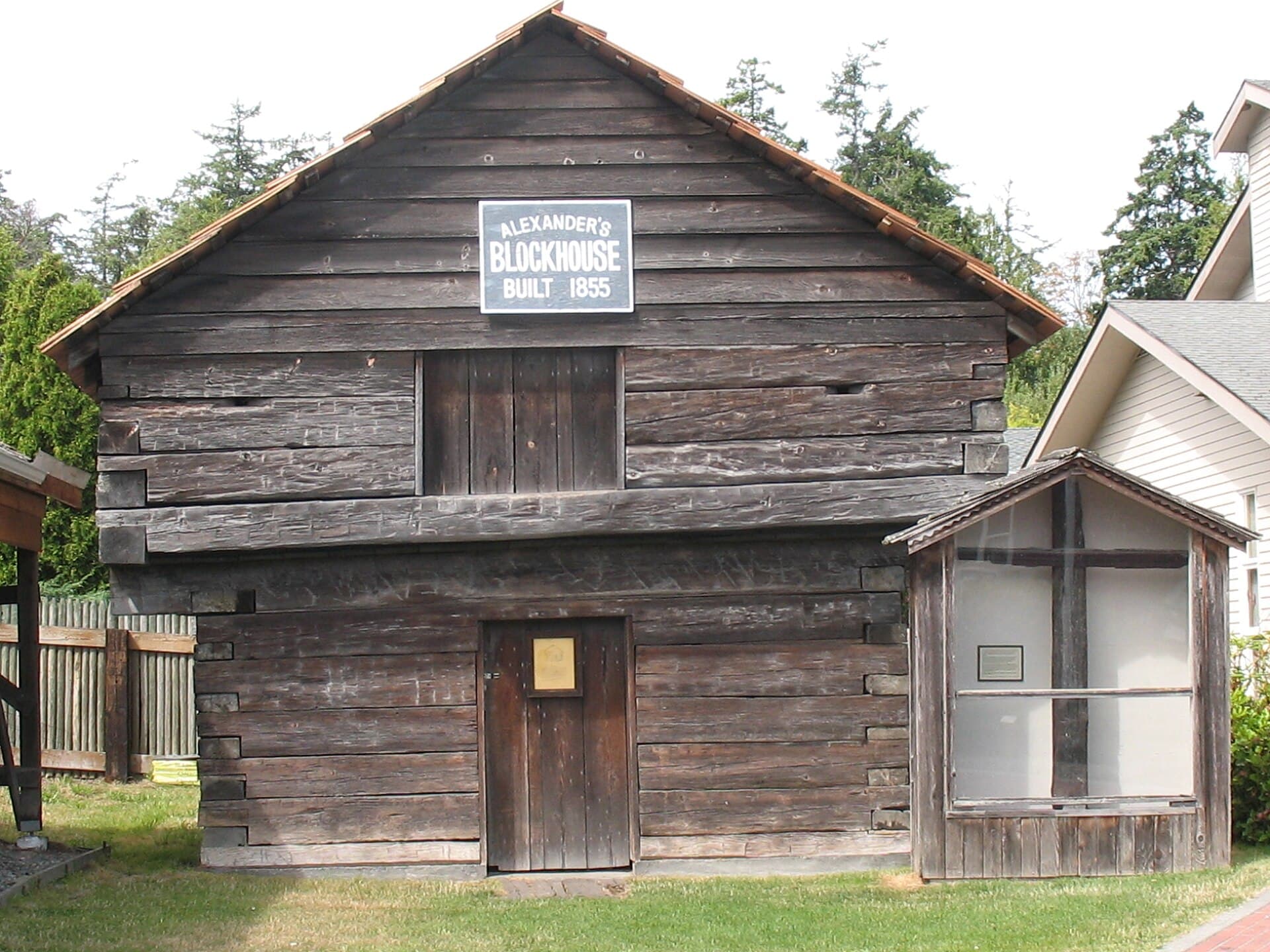
Those boundaries tie to the Central Whidbey Island Historic District, established in 1973. That district, in turn, was based on settlement patterns that followed the Public Lands Survey Act of 1850, also known as the Donation Land Claim Act. In plain terms, the townscape you see today is tied to a legal and land-ownership system that shaped who settled where, how property lines formed, and why the historic core looks the way it does now.
Preservation decisions affect how the town looks to visitors, how businesses sit alongside older structures, and how civic identity is carried forward in a place where the county government and the historic streets share the same small town center.
The deeper history beneath the streets
Long before European-American settlement, the Coupeville area was home to Coast Salish Lower Skagit villages. That history adds depth to the walk and keeps it from being mistaken for a story that begins with 19th-century town founders alone. The modern reserve sits on a landscape that had already been inhabited, used, and understood for generations before Coupeville was laid out as a town.
The route does not only interpret architecture or old street patterns. It also sits inside a much older human geography, where Indigenous history, early settlement, and later preservation all overlap in one small waterfront community.
How to use the tour well
Start at the Town Wharf kiosk. Choose the full 1.9-mile route if you want the widest view, or shorten it to focus on the core historic blocks around the waterfront and courthouse area. Either version gives you access to a town center that still functions as a working community.
This article was produced by Prism’s automated news system from verified source data, official records, and press releases, then run through automated quality and moderation checks before publishing. The system is built and supervised by the people who set the standards it runs under. Read our full AI policy.
Did this article answer your question?