Island County bike map helps riders pick routes by hills and traffic
Island County’s bike map lets you choose roads by hills, traffic and route type before you leave home. The county’s own layers help families, visitors and touring riders avoid unpleasant surprises.
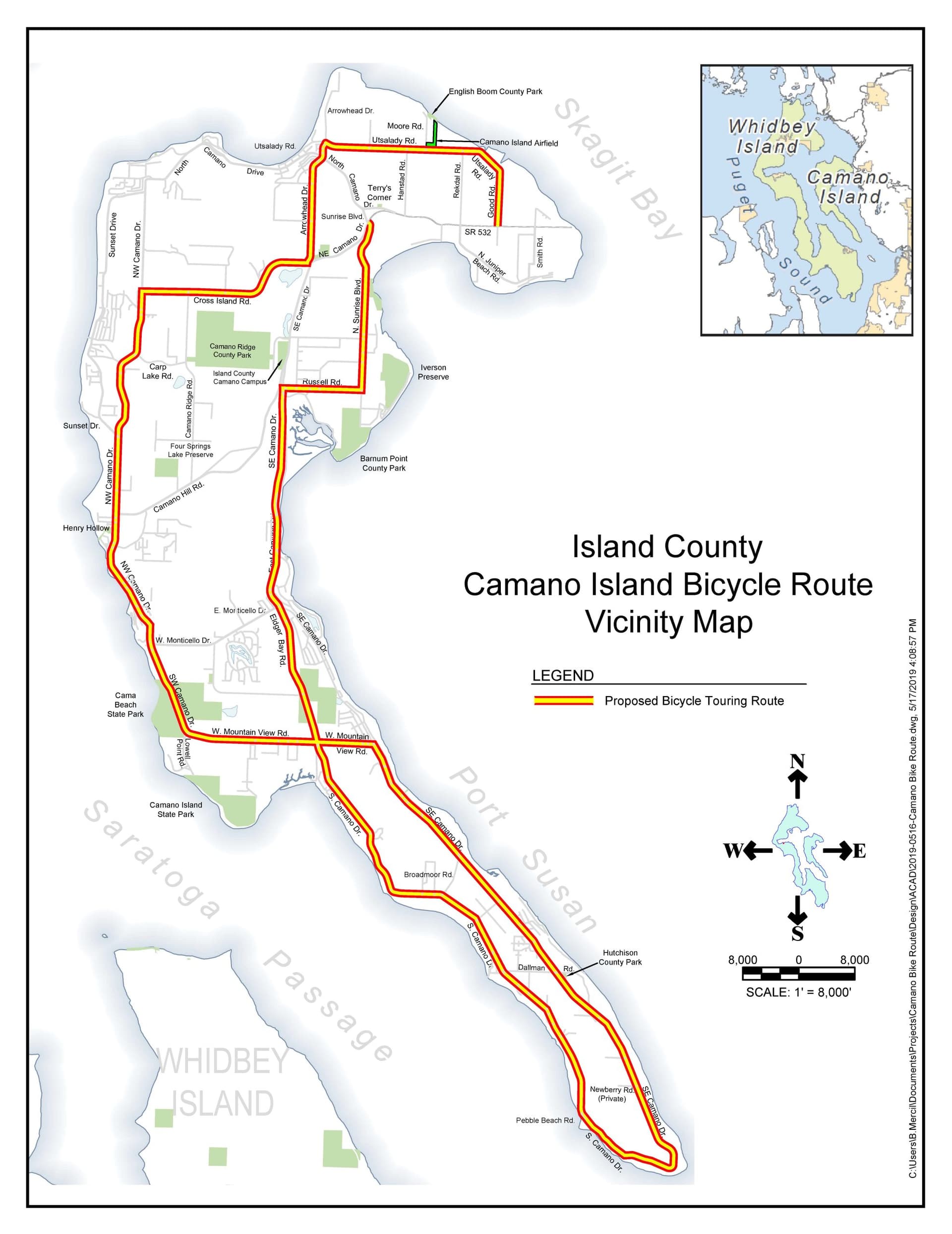
Island County’s bicycling page does something a generic cycling app often does not: it lets you weigh hills, traffic and road type before you commit to a route. On Whidbey Island, Camano Island and the connected roads in between, that matters because a short trip can feel easy or punishing depending on speed limits, average daily traffic and elevation.
How the county map works
The county’s official page, “Bicycling in Island County,” sits on the Public Works site and points riders to a web map. That map shows touring routes, U.S. bike routes, hills, speed limits and average daily traffic, or ADT. The companion PDF, branded “Island County Bicycle Tour Routes,” tells users to scan a code to view the web map and download a copy of the map.
Those layers make the county map more useful than a simple point-to-point directions app. A route that looks direct on a screen may include a steep grade, a faster arterial or traffic volumes that change the whole feel of the ride. The county is giving riders the information they need to judge comfort, not just distance.
For a family ride, look for quieter roads and lower speeds
A family trying to keep a weekend ride calm can use the map to avoid the roads that feel busiest and fastest. Speed limits and ADT are especially useful here, because they help separate a low-stress connector from a road that may be technically rideable but not pleasant for children or newer cyclists.
The county’s map also matters because it includes symbols and notes for paved non-motorized paths that run parallel to highways. That gives families another option when they want to stay close to a destination without riding directly in mixed traffic. On a county where roads can change quickly from neighborhood scale to highway scale, that kind of detail can decide whether a ride feels manageable.
For visitors, hills are the difference between a scenic loop and a grind
A visitor staying in Freeland, Coupeville, Oak Harbor or on Camano can use the county tools to avoid surprises before leaving a rental or hotel. The bike map’s hill grades show where the terrain will rise, and the web map adds that to the route picture along with speed limits and ADT.
That is useful in Island County because the landscape is not flat. A ride that appears short between a trailhead, park, ferry terminal or downtown business can become much harder once the grades are added in. The county’s map is built for exactly that kind of decision, helping riders choose a route that matches their legs as well as their destination.
For regular riders, the U.S. bike routes connect local roads to longer trips
The county’s inclusion of U.S. bike routes makes the map more than a local navigation aid. It helps riders understand how Island County fits into longer touring patterns across Washington and beyond, especially for people linking up routes between communities or planning a full-day ride.
Washington State Department of Transportation says the state has over 900 miles of U.S. Bicycle Routes. WSDOT describes those as interstate long-distance cycling routes that direct bicyclists along the shoulder of low-traffic roads and highways, with some bike lanes and a few off-road paths. In that context, Island County’s map is not just about getting across town; it is about showing how local roads connect to the larger regional network.
For riders who already know the island road grid, that can function like a planning layer. It helps explain why one road is better for touring while another may be better avoided during busy hours, even if both lead to the same destination.
The county’s speed work adds another layer of context
Island County also maintains a separate speed limit study page, which shows that roadway speed is not a side issue in local transportation planning. The county has treated speed data as something worth mapping on its own, separate from the bicycle page.
The county’s speed-limit maps have used a color key that runs from dark blue for 25 mph, green for 30 mph, turquoise for 35 mph, orange for 40 mph, red for 45 mph and purple for 50 mph. For cyclists, that kind of coding is practical. It lets a rider see at a glance where a route is likely to feel calmer and where traffic speeds may call for a different plan.
Why this matters in Island County
This map-based approach fits Island County’s geography. Whidbey Island and Camano Island are not places where every route feels the same once you are on it. One road may offer a paved non-motorized path alongside a highway; another may carry faster traffic; another may look simple but hide enough climb to change the whole ride.
WSDOT’s broader biking materials reinforce why that local detail matters. The agency says bicycling plays a key role in Washington’s transportation system, and it notes that Washington was named the nation’s No. 1 Bicycle Friendly State by the League of American Bicyclists for seven years in a row. Island County’s bike pages fit that statewide pattern by turning route choice into something more precise than guesswork.
For Island County riders, the result is a better decision before wheels hit pavement. The county is not only saying where bikes can go. It is showing which roads are slower, which are hillier, which are part of longer touring corridors and which offer alternatives beside busier highways.
This article was produced by Prism’s automated news system from verified source data, official records, and press releases, then run through automated quality and moderation checks before publishing. The system is built and supervised by the people who set the standards it runs under. Read our full AI policy.
Did this article answer your question?