Your Guide to Washington State Ferries Routes, Schedules, and Whidbey Island Destinations
Skip the two-boat wait at Mukilteo: the five ferry decisions that separate a smooth Whidbey day from a two-hour hold lane.
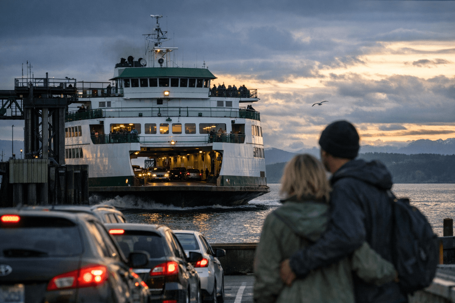
The holding lanes at Mukilteo fill fast on summer Saturdays, and by the time most visitors realize they've missed the obvious sailing, they're watching a third boat load ahead of them. Getting to Whidbey Island and back on your own terms comes down to five decisions made before you leave your driveway: which route to take, what time to arrive, whether your vehicle qualifies for low-tide travel, where to park, and what to do if your plans shift mid-day. Get those five right, and the ferry becomes the best part of the trip.
Two Routes, Two Very Different Experiences
Washington State Ferries operates both connections to Whidbey Island. The Mukilteo-Clinton route in the south is the busiest commuter crossing on the island; the roughly 3-mile crossing takes about 20 minutes and runs frequently throughout the day, served by vessels including the MV Kitsap and MV Tokitae. This is the default route for most visitors coming from Seattle or the I-5 corridor. The Port Townsend-Coupeville route, which crosses Admiralty Inlet to mid-island, is shorter in sailing distance but operates on a more limited schedule and carries a critical caveat: it is subject to scheduled cancellations and adjusted sailing times due to tidal currents.
The Port Townsend-Coupeville route is subject to scheduled cancellations or adjustments to sailing times due to tidal currents. At low tides, some loading ramps develop a steep slope that creates an extreme angle for certain vehicles, meaning trucks and vehicles with low ground clearance should wait for a higher tide to avoid damage. Washington State Ferries maintains a dedicated tidal cancellations page where upcoming affected sailings are listed by date, and checking it the morning of travel is not optional on this route; it's essential.
The Five Decisions That Actually Determine Your Wait
*1. Choose your sailing window.* On Mukilteo-Clinton, the worst vehicle backups build during Friday afternoon and evening outbound (toward Clinton) and Sunday afternoon inbound (toward Mukilteo). Weekday mornings before 7 a.m. and midday sailings on Tuesday through Thursday are consistently lighter. For Port Townsend-Coupeville, avoid scheduling a tight itinerary around a single sailing; build in a one-sailing buffer in case of a tidal cancellation.
*2. Check the schedule that morning, not the night before.* Washington State Ferries posts day-by-day sailings and alerts on the WSDOT ferry site, including a route-by-date view and live status maps. Seasonal schedule changes, vessel swaps, and tidal adjustments are all posted there first.
*3. Know your vehicle's clearance before boarding Port Townsend-Coupeville.* Trucks with a ground clearance of less than 14 inches should not travel on routes with low tide warnings. If you're towing a trailer, driving a lowered vehicle, or hauling anything close to the limit, cross-reference the tidal cancellations page before committing to that route.
*4. Plan your parking early.* At Mukilteo, the city has zoned parking for residential and commercial use, which limits what's available near the terminal. Free, 24-hour public street parking is available within one mile of the ferry terminal, but on summer weekends even that fills. The holding lanes themselves have no long-term parking option; the terminal area is capped at 4-hour limits. Walk-on passengers heading to Clinton pay no fare on the return direction and can use Island Transit buses once on Whidbey to avoid the parking problem entirely.
*5. Have a backup route.* If Port Townsend-Coupeville shows an operational alert, WSDOT's route-by-date tool suggests alternates. The practical fallback is Mukilteo-Clinton, adding about an hour of drive time depending on your destination; factor that into your day before you leave, not after you're already in the queue.
From the Terminal to Deception Pass
Arriving at Clinton puts you at the south end of Whidbey with roughly 50 miles of island ahead. Deception Pass State Park sits at the north tip, connected by Highway 20, and it is the single most-visited destination on the island. While summer is the most popular time to visit due to warm weather, it's also the most crowded, with parking and camping often filling up; campgrounds are usually fully booked every day from late June through Labor Day, with weekends booked as early as April.
For day visits, park rangers suggest arriving before 11 a.m. to secure parking, with the park opening at 6:30 a.m. in summer and 8 a.m. in winter. The earlier tip is worth taking seriously: on summer weekends, parking near the bridge fills by late morning, with the North Beach lot serving as overflow. Arriving before 9 a.m. on a weekend not only guarantees a spot; it gives you the bridge and tidepools almost to yourself, with morning light that photographers specifically target.
Deception Pass has extremely strong tidal currents; swimming in the pass itself is never safe. The park's trails, picnic areas, beaches, and coves are well-suited to families and photographers, but conditions change quickly. If you're kayaking, only paddle through the pass at slack tide and check NOAA tide charts before launching. To avoid summer crowds without sacrificing scenery, mid-September to October and April to May offer some of the best conditions for exploring outside of winter.
Ebey's Landing: The Central Whidbey Alternative
Arriving via Port Townsend-Coupeville puts you squarely in the middle of Whidbey and within minutes of Ebey's Landing National Historical Reserve, a landscape unlike anything else in the Pacific Northwest. The reserve is not a conventional park; nearly 85% of the land is privately owned, a conservation partnership that combines public bluff trails, working farms, and the historic seaport town of Coupeville.
There are two ways to access the Bluff Trail: from the Prairie Overlook trailhead by Sunnyside Cemetery, or from the seaside parking lot at the end of Ebey's Landing Road. Hikers who want a short beachside walk should begin at the parking lot, while those who want a longer hike should start from Prairie Overlook. The beach parking area is managed by Washington State Parks and requires a Discover Pass; parking above at the end of Cemetery Road does not require a pass.
Free public parking is available at the Island Transit Park and Ride on Main Street, or downtown Coupeville next to the Library on Alexander Street. Both are walkable to the trailhead and to Coupeville's waterfront, which is worth the extra 15 minutes. Both trail routes pass through private property, so respecting property lines and staying on designated trails is required. This matters to landowners who have chosen to participate in the reserve's voluntary conservation framework; treating that access as a given rather than a privilege is how it stays open.
The bluff trail rewards clear days and late afternoons with 180-degree views across the Strait of Juan de Fuca. Bring layers; coastal microclimates on Whidbey can shift from sun to fog to wind within an hour on the same trail.
Putting It Together: Protecting the Island While You Visit
The ferry schedule and these two destinations are not separate planning tasks; they're connected. A trip that times Deception Pass for an early Tuesday morning in May, uses the Mukilteo-Clinton crossing to avoid tidal uncertainty, and builds in a stop at Ebey's Landing on the way back through Coupeville is doing what locals do: reading the island's rhythms rather than fighting them.
Crowds at Deception Pass and overflowing trailhead parking at Ebey's Landing are real quality-of-life concerns for island residents, not just inconveniences for visitors. Choosing off-peak windows, packing out trash, using designated parking, and keeping distance from seabirds and marine mammals are the specific actions that keep both places accessible for the people who live here year-round. The WSDOT schedule pages and the Ebey's Landing Reserve's visitor information page remain the authoritative sources for real-time logistics; everything else is planning around the gaps.
This article was produced by Prism’s automated news system from verified source data, official records, and press releases, then run through automated quality and moderation checks before publishing. The system is built and supervised by the people who set the standards it runs under. Read our full AI policy.
Did this article answer your question?